Welcome to SENDITUR.COM · paths · routes · tourism

Castroviejo and Cave Serena
Duruelo de la Sierra, Soria![]()
![]()
![]()
![]()
![]() (1)
(1)
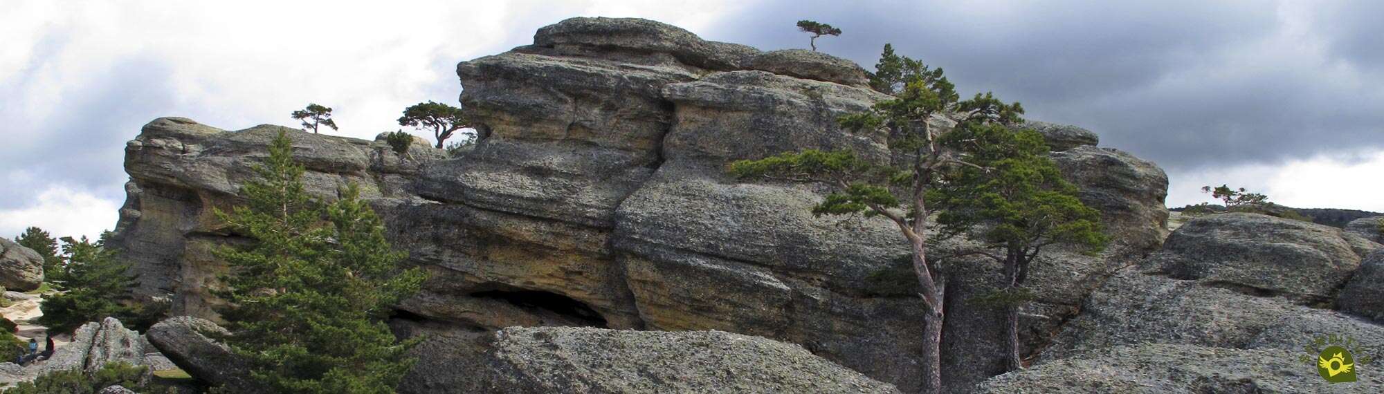
An enchanted place of incredible and fantastic forms
![]() Difficulty-Low
Difficulty-Low
![]() 0:30 h.
0:30 h.
![]() 2 km.
2 km.
Duruelo de la Sierra, Soria![]()
![]()
![]()
![]()
![]() (1)
(1)
An enchanted place of incredible and fantastic forms
![]() Difficulty-Low
Difficulty-Low
![]() 0:30 h.
0:30 h.
![]() 2 km.
2 km.
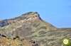
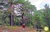
The hillsides of the mountains that make up the Sierra of Urbión hide spectacular places that seem to have been taken from science fiction films, together with small corners full of magic and serenity. Not too far from Duruelo de la Sierra, hidden by the thick forest that populates this area of Soria, under the protection of the Urbión Peaks, Castroviejo and Cave Serena await us, two of the unique spaces that we can find in this region.

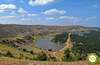
The 2 km route can well be doubled, partly thanks to the labyrinthine scenery we find in Castroviejo. Rocks with curious formations, shaped over the years by the expert hand of nature, canyons and cavities through which hardly a person passes, hardened and strong trees that are born from the same rock crowning in solitude the enormous formations that form this natural space of great value, both landscape and natural. The route transports us through this beautiful environment allowing us to wander around it, discovering every corner of it. We descend surprisingly with each step we take without imagining the spectacular panorama that awaits us on the edge of this place, where the Castroviejo Viewpoint awaits us, from which we can contemplate the entire length of the newly born Duero Valley and the different villages that make it up.

From here and returning to the parking area of Castroviejo, from where we started, we will set out for the next jewel, which we will visit, following the wide dirt track that continues along the road we arrived at. A quick and short descent will bring us to the beginning of a wide path that, on our right, ascends without delay to the nearby Serena Cave. There, a special corner full of beauty awaits us, surrounded by the peace and quiet provided by the sound of water falling from the top of the cave, the whimsical luminosity that gives it an almost magical air and the exuberant plant and animal life that surrounds it. A cave, a refuge for animals, that surprises as much as it does from the outside as once it is inside. After having enjoyed this whim of nature we can only say goodbye to it, not without sorrow, to return following our steps to the parking lot of Castroviejo, the starting point of our tour.

If we want to enlarge the route we have several possibilities that go from following the little more than 5 km of the GR 86 that separates Duruelo de la Sierra and Castroviejo through this path and return later by it, or make some of the routes that start from the same parking.
To get to Duruelo de la Sierra we have to follow the CL-117 road that from Salas de los Infantes crosses the Sierra of Urbión from one end to the other, rejoining the N-234 in the town of Abejar, the national road that connects Soria with Burgos. In this same section of the national road we will find several accesses that also communicate with the CL-117. At the same time, from the northern side of the mountain range, there are two roads, one coming from Neila and the other from La Rioja, passing through Montenegro de Cameros and Vinuesa. Once there, just at the entrance of Duruelo de la Sierra, as we arrive from Covaleda, we will find the asphalted road that, well signposted, gives access to Castroviejo. We will only have to cover the barely 7 km that in frank ascent, and without more detours, separates the town from this place. Once there, we will have a large car park where we can park our vehicle.
Simple walk in which it is important to be attentive to our dog, especially in the area of Castroviejo, because of the abrupt and labyrinthine terrain.
With several areas where we can have water and being a fairly short route, we should not have problems except in few days.
The local fauna, the cattle and some other pets, is generally all that we have to find in this itinerary.
 Distance. 2Km
This figure will increase as we walk through the Castroviejo labyrinth.
 Time. 0:30h
The final time must be marked without a doubt, not what it costs us to cover the distance between one point and another, but on the contrary, what we entertain ourselves in each place.
 Time of year
Except when the snow or ice prevents us from accessing, we can reach Castroviejo itself with our private vehicle throughout the year and enjoy the different singularities that each period brings to the already imposing place. While in winter conditions this area is difficult to access and is reserved for a more experienced public in these conditions.
 Required equipment
Always starting from good weather conditions, we are in front of a real walk that does not require big equipment or backpacks, but we cannot forget that we are at more than 1500 m of altitude and we go through a changing natural environment. Of course the camera will be a good companion. Consult our list of material and equipment for hiking. Read more.
 Difficulty. Low
Physical
Except for the short ramps that we will have to save along the route we will not find major obstacles that require a great physical condition to enjoy both places.
Severity of the environment
As long as we follow the main trails in Castroviejo and don't venture up onto the rocks or look for hiding places or passages between them, we don't face any complications except for a few slips in the gravel on the trail. Do not underestimate the area as the rocky cuts and hidden cavities can play a trick on you. In Serena Cave it is the humidity of the ground that can give us some kind of scare. It goes without saying that it is not very advisable to try to climb the rocky outcrop, or rather to do so in order to get a view of the cave from its edge.
Orientation
With well signposted routes and perfectly defined tracks and trails this section should not be a headache for almost anyone, except if we venture into the maze of rocks in which case we can get lost.
 |
 |
 |
 |
 |
| 1-Castroviejo | 0:00h | 1543m | 0Km | 30T 506499 4648484 |
| 2-Viewpoint of Castroviejo | 0:05h | 1515m | 0.3Km | 30T 506522 4648233 |
| 3-Serena Cave | 0:20h | 1540m | 1.3Km | 30T 505813 4648398 |
| 4-Castroviejo | 0:30h | 1543m | 2Km | 30T 506499 4648484 |
Coordinates UTM Datum WGS84

 Slope: 130m
 Slope +: 65m
 Slope -: 65m
 Maximum altitude: 1545m
 Minimum altitude: 1515m

This outline of the route is not to scale and does not contain all the information about the area, it is merely orientative.

![]()
This schematic with the path is approximate and has been created from the derived cartographic base © Instituto Geográfico Nacional "Cuadrante 278-4 y 316-2, 1:25.000"
Senditur has manipulated the tracks to correct the aberrant points that may exist, caused by problems with the reception of the GPS signal. In any case the tracks are always approximate. SENDITUR encourages you to use the new technologies within your reach, using them as support and consultation in your activity, not basing the realization and orientation of the same only and exclusively on them, since they may see their functioning altered by very diverse causes, not functioning correctly and their indications may not be precise.


Me encanto, no me esperaba algo así.

Rocks polished by natural elements that hold the memory of millions of years


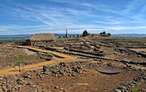
One of the first villas, from the late Roman period, excavated in the Peninsula
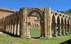

Place of burial of a holy body, Saint of the River, Saint of the Duero

Find out what to see in...
¿Did you know that...
Both Castroviejo and Cave Serena are movie locations, specifically they were the settings chosen to shoot some scenes of Roberto Lazaro's film, Legend of Fire, released in 2001.
Don't miss out...
The high medieval necropolis that you can find surrounding the church of Duruelo de la Sierra, known as the necropolis of San Miguel, one of those we can find in the region of Pinares.


From the commitment of SENDITUR with Nature and the respect to the balance of the environment, SENDITUR urges you to travel in a responsible way, with low environmental impact and respecting at all times the Natural, Cultural and Social environment wherever you go.

Besides sharing with all of us your experience on the route we would be grateful if you could write to us to inform us of any erroneous or outdated information you may have found, or simply to let us know what you think at Thank you.
This route has been carried out in the field by SENDITUR on 06-05-2017. The route may vary greatly depending on the time of year, weather conditions and terrain, as well as the actions of third parties and the evolution suffered in the natural environment where it is located. All opinions, advice and/or assessments made by SENDITUR in their descriptions are for guidance only and are subject to and/or refer to the specific conditions of the specific day of the route, referring to that specific day, taken from trained people, with the appropriate experience and with a high level of physical and technical preparation as a reference, as well as correctly equipped.
All the times are approximate and take an orientative character, the stops have not been taken into account, no matter how small they are. All the information related to the route, texts, images, videos, maps, diagrams, tracks, towns, and places of tourist interest are published as a guide, and may not coincide with the current state of each place. Before undertaking any activity, assess your technical knowledge, your physical condition, find out about the weather and the variations that the route may undergo, equip yourself correctly, be prudent and responsible at all times, and do not exceed your capabilities. SENDITUR is not responsible for any misuse or inappropriate use of the comprehensive guides of its routes and/or publications as well as its electronic guides, nor for any variations in their descriptions for the aforementioned reasons, and recommends that everyone be responsible and prudent in carrying out the activity. We also encourage you to read books and specialised guides to complement the information described above.
Continue watching …


.jpg "Go to Hermitage of San Saturio")