Welcome to SENDITUR.COM · paths · routes · tourism

![]() Difficulty-Low
Difficulty-Low
![]() 1:20 h.
1:20 h.
![]() 5.6 km.
5.6 km.
![]() Difficulty-Low
Difficulty-Low
![]() 1:20 h.
1:20 h.
![]() 5.6 km.
5.6 km.
The Gorge of Mataviejas is located in a unique natural space, serving as a link between the towns of Ura and Castroceniza in Burgos. Formed by the erosive action that the river Mataviejas has done for years in the rocky walls that form this gorge, today is home to many birds that find in their rocky walls an unbeatable place to live.

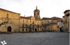
The route with only 5.6 km begins in Ura, located at the end of this rocky canyon, where the river escapes from it to go in search of the Arlanza where it dies. Ura has a jealous history dating back to the second Iron Age and not a few villages have passed through it, including the Romans who saw here an important and strategic enclave to settle. Already in the Middle Ages there was the monastery of San Mamés de Ura, of which little or nothing remains. Today, on our arrival in Ura, we are surprised by its Gothic church of San Martín. The route, a beautiful and simple hiking route, transports us through this peculiar gorge that follows the winding course of the river that gives it its name and that together with the erosive action of other elements has given shape to not a few curious geomorphological formations, chosen as home by different species of birds among which the griffon vultures stand out.

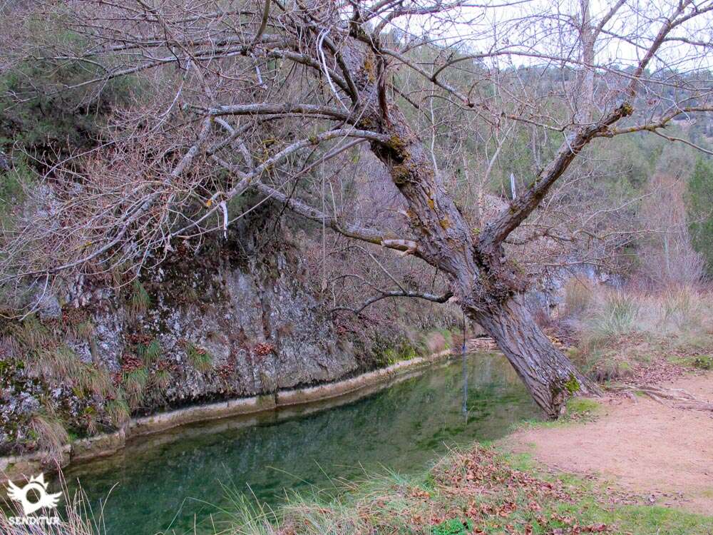
The river, our inseparable companion during the route, offers us some small backwater to approach, where with luck we will be able to listen and even observe others of the inhabitants of this privileged natural environment. The black-tailed redstart or the nightingale singer will liven up our journey inside the gorge as we approach Castroceniza with each step, whose church we can already sense before even going out to the wide valley where the river Mataviejas is introduced into the interior of the Gorge of Ura as it is also known. The 15th century church of Nuestra Señora de Castroceniza still preserves its late 13th century archery, which stands out next to the chapel and the altarpiece of Cristo del Miserere. The town of Castroceniza was the birthplace of the illustrious abbot of the nearby Monastery of Santo Domingo de Silos, Pedro Alonso, an example of the close relationship between the two towns in Burgos. Having climbed the course of the river up to Castroceniza, it is time, following our steps, to set course towards Ura, letting ourselves be carried by the flow of the water that brings us to this locality, the starting point and the end of the route.

Legend has it that during the time of the Cid Campeador the latter returned from one of his incursions when, after an obligatory stop at the Monastery of Silos, formerly known as San Sebastián, two strange old ladies with the look of sorceresses came out to meet the Cid army almost at night. They convinced Rodrigo with their arts to make night in a cozy place that they knew, what the Cid did not know was that these old women were really allies of the infidels and took care to deceive the Christians who passed by leading them to a Moorish ambush. In the calm of the twilight the camp of the troops of the Cid was attacked by surprise by a horde of infidels wielding their Saracen swords, the Christians fought in a singular battle against an army that doubled in number. When all seemed lost, from the narrow gorge a blinding light arose that illuminated the battlefield, fearful the Moors fled in terror, abandoning to their fate the two elderly women who left in a hurry, persecuted by El Cid and his men. Darkness loomed over the place again, preventing the sorceresses from seeing that they were going to precipitate directly to the river where they found their end, hence the name Mataviejas River.
To get to Ura we have to follow the BU-904 road that joins the towns of Lerma, in penalty A-1, and Covarrubias, being concretely to our passage by Puentedura where we will find the narrow road that from there takes us to the town of Ura. Another option is to take the gorge route in the opposite direction, in which case we will have to go to Castroceniza taking the BU-901 road that connects Covarrubias and Santo Domingo de Silos, being in this road where we can take the detour that leads to Castroceniza. Once in Ura and just before entering the town on our right crossing the river we have a large car park where we can leave our vehicle.
A good walk without great complications, as long as we don't let it separate too much from the route, where you can enjoy the natural environment that surrounds it.
The river is one of the protagonists of this route, finding us several points along it where our friend can drink and refresh with relative ease.
It is not strange to meet other pets that are doing the tour, to which we must add the quiet dogs that live in the two villages we visit, along with a large herd of cats, masters and lords of Castroceniza. We can not forget that in this gorge and in the rocky formations that border it inhabit a great number of different animal species to which it is necessary to respect.
The car park at the entrance to Ura (0h 00min) is the starting point of the Gorge of Mataviejas route.

As soon as we cross the river, we take the road that brought us here to follow its course and enter the locality.
.jpg "The two options are joined below")
We cross Ura following its main street that leads us without major complications to the outskirts of the town.

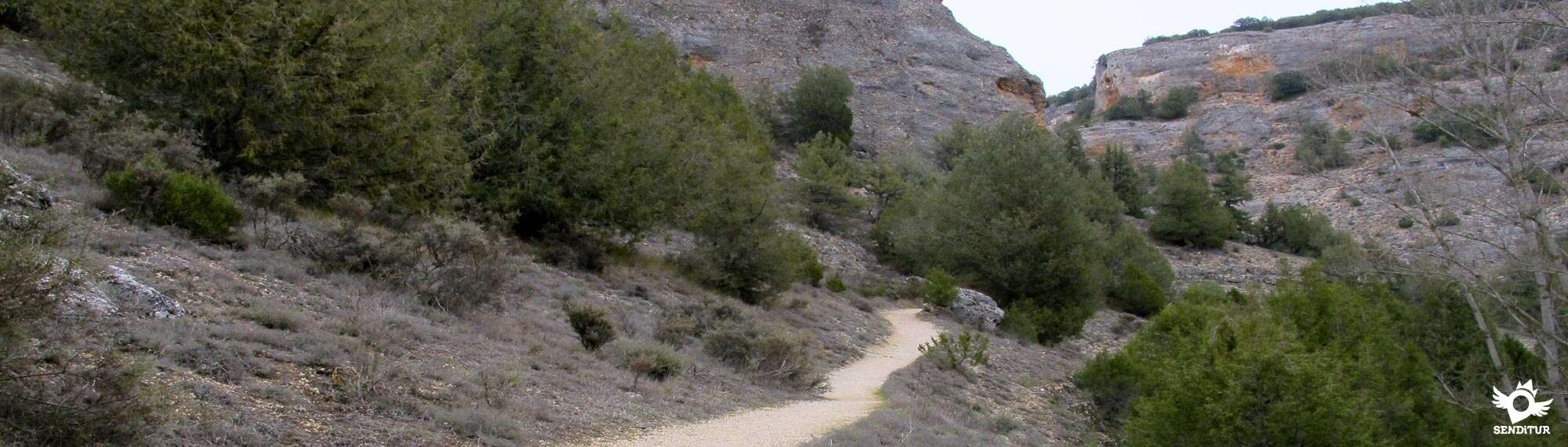
At the end of the village we find ourselves facing the slope of the mountain that forces us to choose between following on our left the path that would take us to Covarrubias or continuing on the right following the path that enters the gorge. The route leads us following the Mataviejas river through the canyon that has been formed over the years.

We advance leaving our back Ura, slowly entering the canyon. A narrow trail comes out to meet us inviting us to descend until a small backwater of the river hidden by the leafy vegetation that surrounds it.

If we decide to get close to this nearby corner, we can take the gorge path a little further on without having to return through the same place. The wide gorge is bounded by the whimsical course of the Mataviejas, while our path runs along the slope of the mountain at the foot of the rocky cliffs that rise above us.

The well marked path leaves no room for doubt as to the itinerary to follow, and there are few occasions when we have to meet other, less defined trails, which normally coincide with the small ravines that join the gorge we are crossing.

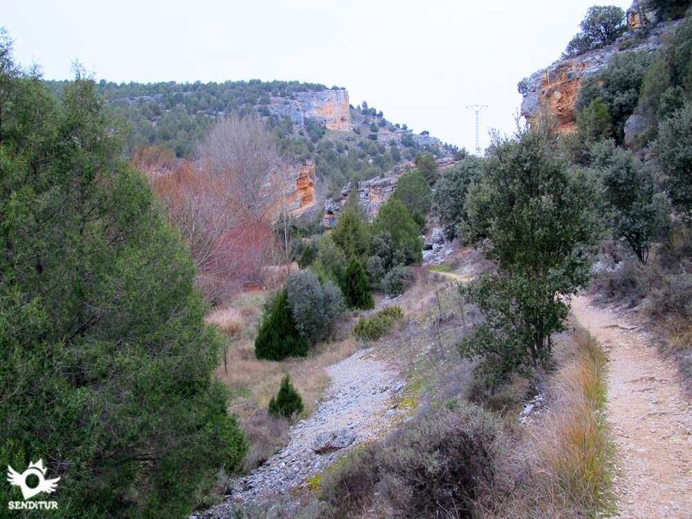
The canyon alternates wider sections with narrower ones that do not influence the simplicity and relative comfort of the route. Likewise, the path along which we progressed moves away and approaches the vertical walls that mark out the route, allowing us to contemplate calmly the curious formations that have been created in them while we sharpen our sight in search of the birds that live here.

The slope that we face in this route, which is not demanding at all, is almost concentrated in a small stretch in which the path seems to climb on the slope of the mountain, to quickly begin the descent.

This part of the route is the one that normally we will find something more decomposed but this should not suppose any problem. Step by step we get closer to the other end of the gorge and the valley begins to gain prominence and width, at the same time that the first houses of Castroceniza appear among the vegetation.

We still have a good stretch, practically flat, covering what used to be a flourishing valley populated with walnut trees, some of which still stand the test of time. This end of the gorge, less abrupt and wider than the other, brings us closer without further delay to the very gates of Castroceniza (0h 40min).

When we arrive at the locality we will have the option of visiting its church which contemplated us when we were approaching it.

Here we will begin the return following our steps until Ura (1h 20min), unless we encourage ourselves to extend the route or to return by some of the tracks that furrow the high part of the gorge.
 Distance. 5.6Km
Our route through the interior of the villages will mark the distance to be covered.
 Time. 1:20h
A calm route that even taking it with calm should not cost us much more time than the indicated one, of course it is always depending on the time that we dedicate to the stops that we will surely realize.
 Time of year
The gorge offers great attractions throughout the year, in summer the proximity of the river is an attraction for many locals who come to their corners, on the contrary the winter can offer a special postcard with the snow as protagonist. Spring and autumn bring their striking colours to an attractive route.
 Required equipment
Ornithology lovers will surely not leave their binoculars forgotten, as on this route they will surely be able to enjoy the birds that live here. The route invites us to equip ourselves with comfortable footwear to be possible hiking, also and especially in summer we can not miss in the backpack water and some food if we intend to spend a good time in one of the bends of the river. This area in winter is usually quite cold so it is important to be informed of the state of the route and adapt our clothes and material to the conditions we are going to find. Consult our list of material and equipment for hiking. Read more.
 Difficulty. Low
Physical
Neither the distance nor the slope to save should put us in difficulties, people less accustomed to walks through nature have the advantage, if given enough time, of being able to dose on the ramps that has the route so that they do not prevent them from making the entire route.
Severity of the environment
We are in a gorge and although the width of the gorge and the itinerary of the path do not expose us to great risks, as long as we do not abandon the marked route, we are not exempt from falling stones or possible slips. Ice in winter is a common feature of these lands, making the route more complicated if we come across the ice. The river normally flows far from the path and with enough width but in case of heavy rains both it and the ravines that converge in the gorge can descend quite loaded with water discouraging the route in these specific cases.
Orientation
With hardly any crossings to put us in trouble and with the pertinent signposting at the beginning of the route that adds to the well-defined path that accompanies us at all times, following the correct itinerary would not have to be a problem. However, in the event that we leave the signposted route or decide to return to another area, we will not find any marks that will help us in our return.
 |
 |
 |
 |
 |
| 1-Ura | 0:00h | 890m | 0Km | 30T 454132 4651543 |
| 2-Castroceniza | 0:40h | 920m | 2.8Km | 30T 455547 4649992 |
| 3-Ura | 1:20h | 890m | 5.6Km | 30T 454132 4651543 |
Coordinates UTM Datum WGS84

 Slope: 334m
 Slope +: 167m
 Slope -: 167m
 Maximum altitude: 1025m
 Minimum altitude: 890m

This sketch of the route is not made to scale nor does it contain all the information relating to the area, it is merely indicative.

![]()
This schematic with the path is approximate and has been created from the derived cartographic base © Instituto Geográfico Nacional "Cuadrante 276-4 1:25.000"
Senditur has manipulated the tracks to correct the aberrant points that may exist, caused by problems with the reception of the GPS signal. In any case the tracks are always approximate. SENDITUR encourages you to use the new technologies within your reach, using them as support and consultation in your activity, not basing the realization and orientation of the same only and exclusively on them, since they may see their functioning altered by very diverse causes, not functioning correctly and their indications may not be precise.


Un bonito y sencillo recorrido, muy recomendable.
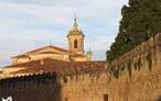
Benedictine monastery where the monks raise their prayers through Gregorian chant

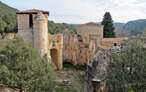
Defensive bastion between the mountain and the river
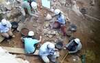
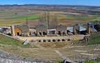
Great encyclopedia of the evolution of man, natural treasure kept in time

Rocks polished by natural elements that hold the memory of millions of years

Place of burial of a holy body, Saint of the River, Saint of the Duero

¿Did you know that...
In these lands was typical charcoal production, now in disuse but whose activity has remained active until relatively recently. From here came not few quantities of this material that were used in various activities because of its high quality, was even used to smoke the sausage among other foods.
Don't miss out...
The nearby Monastery of Arlanza founded by Count Fernán Gonzales became one of the most important monastic centres in Castile. Today, after a laborious restoration process, you can visit the different rooms that are still preserved, since after the disentailment of Mendizábal it fell into disgrace giving it different uses, and even became an improvised quarry from which noble stones could be extracted for different houses and palaces.


From the commitment of SENDITUR with Nature and the respect to the balance of the environment, SENDITUR urges you to travel in a responsible way, with low environmental impact and respecting at all times the Natural, Cultural and Social environment wherever you go.

Besides sharing with all of us your experience on the route we would be grateful if you could write to us to inform us of any erroneous or outdated information you may have found, or simply to let us know what you think at Thank you.
This route has been carried out in the field by SENDITUR on 08-05-2016. The route may vary greatly depending on the time of year, weather conditions and terrain, as well as the actions of third parties and the evolution suffered in the natural environment where it is located. All opinions, advice and/or assessments made by SENDITUR in their descriptions are for guidance only and are subject to and/or refer to the specific conditions of the specific day of the route, referring to that specific day, taken from trained people, with the appropriate experience and with a high level of physical and technical preparation as a reference, as well as correctly equipped.
All the times are approximate and take an orientative character, the stops have not been taken into account, no matter how small they are. All the information related to the route, texts, images, videos, maps, diagrams, tracks, towns, and places of tourist interest are published as a guide, and may not coincide with the current state of each place. Before undertaking any activity, assess your technical knowledge, your physical condition, find out about the weather and the variations that the route may undergo, equip yourself correctly, be prudent and responsible at all times, and do not exceed your capabilities. SENDITUR is not responsible for any misuse or inappropriate use of the comprehensive guides of its routes and/or publications as well as its electronic guides, nor for any variations in their descriptions for the aforementioned reasons, and recommends that everyone be responsible and prudent in carrying out the activity. We also encourage you to read books and specialised guides to complement the information described above.
Continue watching …