Welcome to SENDITUR.COM · paths · routes · tourism
Raso of the Vega of Baturio Paths of Valonsadero
Soria, Soria![]()
![]()
![]()
![]()
![]() (0)
(0)
Landscapes and history of a land with roots
![]() Difficulty-Low
Difficulty-Low
![]() 2:20 h.
2:20 h.
![]() 8 km.
8 km.
Soria, Soria![]()
![]()
![]()
![]()
![]() (0)
(0)
Landscapes and history of a land with roots
![]() Difficulty-Low
Difficulty-Low
![]() 2:20 h.
2:20 h.
![]() 8 km.
8 km.
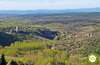
The province of Soria has remarkable natural sites of great beauty and environmental value. One of these sites is located at a short distance from the capital of Soria, which has made it an outstanding place for its inhabitants. Mount Valonsadero combines nature, culture and traditions in almost equal parts and is visited by a large number of people throughout the year who enjoy all that this place has to offer.

There are several trails that cross it and invite us to practice hiking in this place, one of them is the route of Raso of the Vega of Baturio that with its 8 km allows us to cover part of this natural complex. The circular route that characterizes all the hiking trails that we can do in Mount Valonsadero allows us to face them at our convenience, if always taking as a starting point the House of the Guard. From there we will immerse ourselves in the history of the people who passed through here, people who marked the uses that characterize these lands, pastures and grasslands, forests and rocks or the many cave paintings that we can contemplate mark the route that we are making.

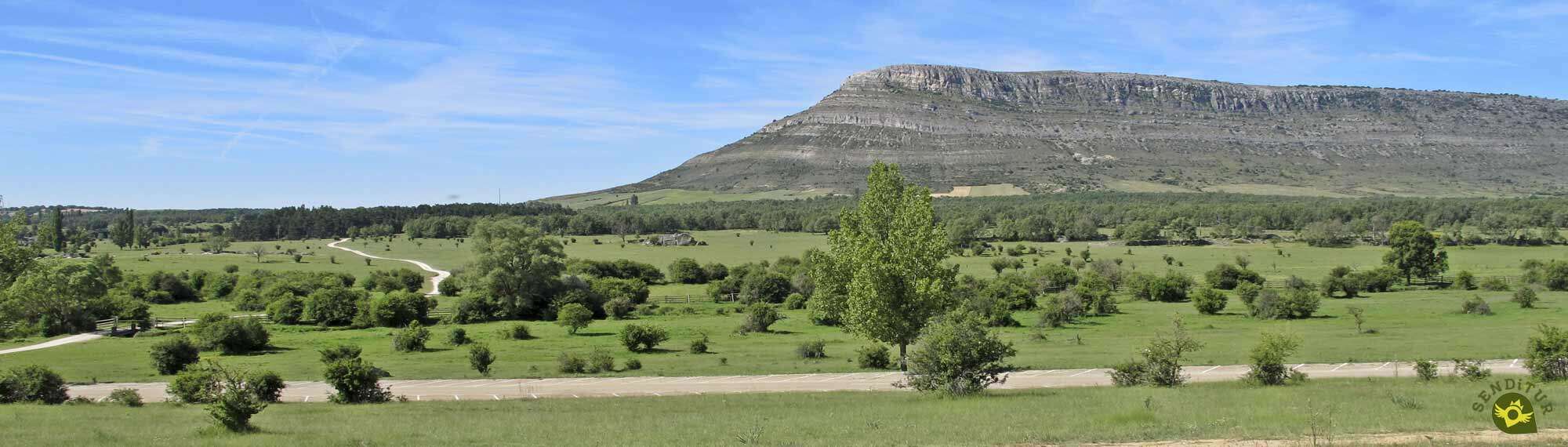
Corrals like the one of the Cañada Honda shelter the cattle that graze in these fields, without forgetting the different cave paintings that tell us about the rituals, customs and ways of life of the people that inhabited these lands in immemorial times. A route that takes us to the doors of the town of Pedrajas, which allows us to contemplate magnificent panoramic views from the top of El Riscal and transports us through the wide pasture of the Raso of the Vega to return us to the House of the Guard, entering before us in a leafy forest rebollos and quejigos.

All the paths that run through Valonsadero are circular and in some cases share part of their routes or cross each other. In this case there are several options that allow us to vary the route, extending its distance and demands by combining it with, for example, the route of the House of the City or that of Valonsadero, the latter being one of the longest hiking routes of all those we can do in this area.
The access to the complex of Mount Valonsadero will be found shortly after leaving the capital Soria following the national road that connects it with Burgos. It is on this road where the detour leading to the recreational area is located, next to the House of the Guard. Once there we will have several parking areas where we can park our vehicle, although this can be complicated on certain dates due to the large influx of people who come here.
A perfect route to introduce our friend to the world of hiking and prepare him and us for more challenging situations.
Don't forget the water, which you should always carry for him, as you will not pass by any points where he can drink, except at the beginning of the route.
It is very common for us to come across the cattle, the animals or the fauna that live in the area on the route, so we must be careful to avoid problems.
Our starting point is the car park next to the Guard House (0h 00min) in Valonsadero Mount.

We started the route by following for a moment the route of the road that brought us here. Just at the end of the limits of this recreational area begins the path that we must follow.

A path of not too much unevenness that quickly leads us to a new detour, thus avoiding us to keep gaining height with so much evidence.

Our path follows its course almost parallel to the route of the road we left behind before, while we follow the marks that indicate it.

After a while the road crosses our path again, at least for a moment, since on our right there is a detour that we must follow.

A new section of ascent next to one of the corrals that sits in Valonsadero. Once up our route looks for the limits of the vegetation leaving aside the path that would take us, like the road, to the same destination but with a little more distance.

We walk along the wall formed by the vegetation to start descending in search of our next destination, the corrals of Cañada Honda.

Once there we will only have to follow the wall that delimits them, to regain part of the lost height.

This short section ends when we come across a dirt track, and when we reach it, we can see on our left the continuation of our route.

We advance again bordering the thick vegetation that marks this part of the route clearly observing the dirt track that runs to our left, a track that leaves from the same corrals that we have just visited.

The marks of the route are mixed with the signs of the route of the cave paintings of Valonsadero and can make us doubt about the itinerary to follow.

An itinerary that, as could be predicted, leads us hopelessly to the encounter with the dirt track that runs to our left. A path that from this very moment will be in charge of guiding us.

There will not be too many crossroads to be found and in any case the marks and the state of the path itself leave no room for doubt.

After a while, our battered road ends when we reach the meeting point of a conditioned track that we will follow. A long stretch awaits us without further detours, at least for the time being.

A long way later, in front of us, there is what looks like the wall of a building, at the same time as we arrive at a new crossroads where the route turns radically, forcing us to say goodbye to the path by which we arrived here.

This new path ascends until we reach another junction where we will join the longest route of all those we can walk in Valonsadero.

Ahead of us lies another long stretch of rough road that marks the beginning of our return to the Guard House.

A path that on several occasions forks to give us different options to overcome the muddy areas that we may encounter.

Luckily, one of these forks has its own signposting, as its two options, unlike the previous ones, do not come together again a few metres further on.

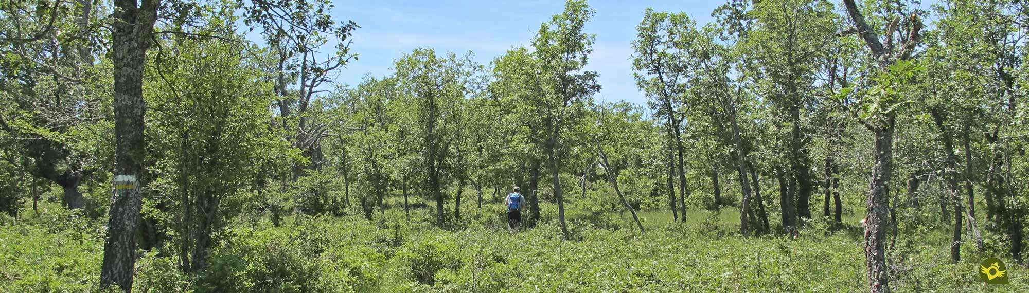
Our route begins to penetrate even more into the vegetation while the path becomes a marked trail.

After a while a fence cuts us off the pass, a fence that we will save thanks to the gate that prevents the cattle from passing.

Once again we will see ourselves walking through the wide plain that characterizes this trekking route, leaving aside the possible detours that we will find.

When we arrive at Raso of the Vega of Baturio we must be careful because the itinerary deviates without the marks that guide us being as clear or as visible as we are used to.

This section of the route will force us to be attentive in order to follow the marks that indicate it through the leafy vegetation that hides it.

Some marks that we will find in the trees or in some lonely post that fights to be seen.

The trail that we must follow is barely visible, forcing us to look for the best route to reach the next mark.

Luckily, little by little the trail begins to win the battle against the vegetation, making it easier for us to follow it.

After a long way, further on, our trail comes to an end when it meets the path we must follow.

A perfect path that, without further detours, will bring us closer, sooner than we imagine, to the well-known corral of the Cañada Honda from where, following our steps, we will return to the House of the Guard (2h 20min) from where we started.
 Distance. 8Km
The area offers multiplex alternatives to adapt the route to our preferences.
 Time. 2:20h
This figure can be increased with the stops we make to visit the different cave paintings we will pass by at the beginning of the tour.
 Time of year
This area suffers certain days of more or less extreme conditions both in summer and in winter, with strong days of heat or notable winter conditions, so it is important to know in advance the forecasts that allow us to decide and plan our visit.
 Required equipment
This is an itinerary that does not make too many demands and many people travel it incorrectly equipped. Even so, it is not superfluous to take into account that we are in the middle of nature, no matter how civilized it may seem. Water, appropriate footwear, would not be a bad idea if it were half a cane, and the necessary clothing depending on the weather should not be replaced by its counterpart considered street. Consult our list of material and equipment for hiking. Read more.
 Difficulty. Low
Physical
Without too much unevenness and with a medium distance the physical demand that we must face is not very remarkable, but as long as we have a minimum of physical condition.
Severity of the environment
As we mostly travel on paths, and as long as we do not abandon them, we will not go through complicated sections or areas. The sections of the trail, is the vegetation that we have to find the one that can generate more difficulties.
Orientation
The greatest complications are always to be found in the accumulation of marks corresponding to the different paths that cross Valonsadero and which can confuse us. Another point with certain complications is the section of the trail where the vegetation and the scarce signposting force us to be careful not to get lost.
 |
 |
 |
 |
 |
| 1-Guardian's House | 0:00h | 1035m | 0Km | 30T 537743 4628710 |
| 2-Guardian's House | 2:20h | 1035m | 8Km | 30T 537743 4628710 |
Coordinates UTM Datum WGS84

 Slope: 130m
 Slope +: 65m
 Slope -: 65m
 Maximum altitude: 525m
 Minimum altitude: 470m

This sketch of the route is not made to scale nor does it contain all the information relating to the area, it is merely indicative.

![]()
This schematic with the path is approximate and has been created from the derived cartographic base © Instituto Geográfico Nacional "Cuadrante 350-1 y 349-2, 25.000"
Senditur has manipulated the tracks to correct the aberrant points that may exist, caused by problems with the reception of the GPS signal. In any case the tracks are always approximate. SENDITUR encourages you to use the new technologies within your reach, using them as support and consultation in your activity, not basing the realization and orientation of the same only and exclusively on them, since they may see their functioning altered by very diverse causes, not functioning correctly and their indications may not be precise.


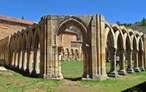

Place of burial of a holy body, Saint of the River, Saint of the Duero

One of the first villas, from the late Roman period, excavated in the Peninsula


Find out what to see in...
¿Did you know that...
On Mount Valonsadero, and more specifically in the area known as the Corrals of Cañada Honda, various festivals and social events are held throughout the year that bring together a large number of people, La Saca, San Juan or El Lavalenguas are some of them.
Don't miss out...
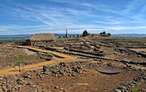
The cave paintings of Valonsadero, especially those you can find from the Cañada Honda corral. These have a relevant explanation and a small signposted route that allows us to visit them without having to face major detours in our journey.


From the commitment of SENDITUR with Nature and the respect to the balance of the environment, SENDITUR urges you to travel in a responsible way, with low environmental impact and respecting at all times the Natural, Cultural and Social environment wherever you go.

Besides sharing with all of us your experience on the route we would be grateful if you could write to us to inform us of any erroneous or outdated information you may have found, or simply to let us know what you think at Thank you.
This route has been carried out in the field by SENDITUR on 28-06-2018. The route may vary greatly depending on the time of year, weather conditions and terrain, as well as the actions of third parties and the evolution suffered in the natural environment where it is located. All opinions, advice and/or assessments made by SENDITUR in their descriptions are for guidance only and are subject to and/or refer to the specific conditions of the specific day of the route, referring to that specific day, taken from trained people, with the appropriate experience and with a high level of physical and technical preparation as a reference, as well as correctly equipped.
All the times are approximate and take an orientative character, the stops have not been taken into account, no matter how small they are. All the information related to the route, texts, images, videos, maps, diagrams, tracks, towns, and places of tourist interest are published as a guide, and may not coincide with the current state of each place. Before undertaking any activity, assess your technical knowledge, your physical condition, find out about the weather and the variations that the route may undergo, equip yourself correctly, be prudent and responsible at all times, and do not exceed your capabilities. SENDITUR is not responsible for any misuse or inappropriate use of the comprehensive guides of its routes and/or publications as well as its electronic guides, nor for any variations in their descriptions for the aforementioned reasons, and recommends that everyone be responsible and prudent in carrying out the activity. We also encourage you to read books and specialised guides to complement the information described above.
Continue watching …


.jpg "Go to Hermitage of San Baudelio")