Welcome to SENDITUR.COM · paths · routes · tourism
They are located in the western part of the provinces of Zamora and Salamanca, in the Arribes del Duero Natural Park, in the stretch known as the Arribas del Tormes, whose waters are dammed before being transferred to the Duero River. The Almendra dam, a peculiar work of hydroelectric engineering, is part of the Saltos del Duero system together with the infrastructures installed in Aldeadávila, Castro, Ricobayo, Saucelle and Villalcampo. The hydroelectric power station is located a few kilometres further west, in Villarino de los Aires; the settlement of the workers who participated in its construction gave rise to the towns of La Rachita and Santa Catalina.

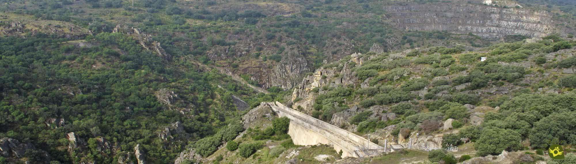
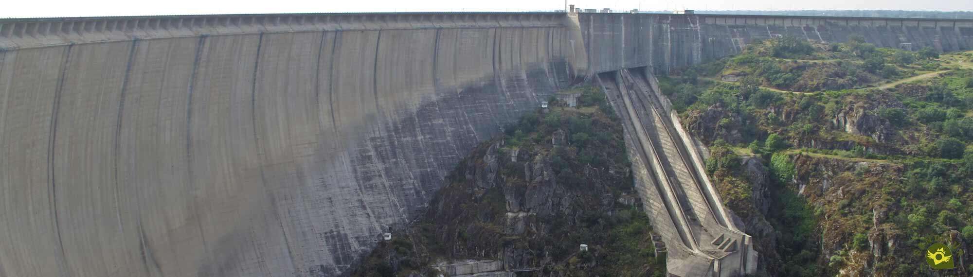
The Almendra reservoir is one of the largest in Spain. Its construction began on August 28, 1964 and in addition to being affected the municipalities of Almond, Carbellino, El Manzano, Ledesma, Monleras, Roelos de Sayago, Salce, Sardón de los Frailes, Villar del Buey and Villaseco de los Reyes, also meant the disappearance under its waters of the town of Argusino in Zamora. After six years of work the reservoir was opened in 1970. From the dam, a tunnel, dug into the rock, 7 metres wide and 15 kilometres long, is responsible for carrying the water to the underground power station in Villarino de los Aires where a complex engineering project allows the turbines to be reversed and the water to be pumped to the main reservoir, when the total need for electricity supply has been met.

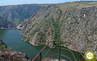
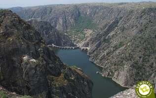
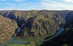
To look at the Almendra Reservoir from afar is to feel the mirage of approaching an immense and calm sea, such is the image given by its almost 8000 hectares of flooded surface, the waters of which are controlled and evacuated as necessary by the dam's retaining wall, which is more than three kilometres long, like an immense sea wall. On this wall, crossed by a road that joins the two banks, is the area of the machinery that carries out the opening and closing of the floodgates of this great reservoir. If on one side you can admire some peaceful waters on the other a vertigo fall of more or less 200 meters high makes the Almendra dam the highest in Spain.
In the distance the quarry, from which the material for the construction of the dam was obtained, shows the scars that this pharaonic work produced in its soil and also claims its prominence by letting us admire the lake of deep and crystalline waters formed inside the granite crater originated. Walking around the limits of the Almendra Reservoir through its paths and trails prepared for this purpose, bring hikers and nature lovers to impressive places, spectacular corners that the action of water has shaped to their liking with the passing of time.

Every year on the first Sunday of May a pilgrimage and a floral offering is held at the Santa Cruz hermitage, built on the banks of the reservoir between 1972 and 1995, as a souvenir of the town of Argusino.
The Almendra reservoir together with the La Serena reservoir in Badajoz and the Alcántara reservoir in Cáceres are the three largest of the more than 1200 reservoirs with a capacity of more than 50 hm3. Curiously, the road to the Almendra dam is the most frequented, in this part of Castilla y León, to get from the province of Salamanca to the province of Zamora, and vice versa.

There have been few times when the waters of the Almendra reservoir have let us see the treasures they hold, vestiges of other times that, just as in this sea, have remained submerged in the memory of the people who once inhabited it. The Pelazas bridge, on the mule track between Fermoselle and Zamora, the Villa bridge between Carbellino and the province of Salamanca, the paving of the Argusino main square...


MORE ROUTES AVAILABLE, DON'T MISS IT...


MORE PLACES AVAILABLE, DON'T MISS IT...


The Almendra reservoir and dam is located 5 km from the town of Almendra in Salamanca and 7 km from the town of Cibanal in Zamora. It can be reached from Cibanal, on the road from Zamora to Fermoselle, on the ZA-315 road, and from Almendra, on the road from Ledesma to Trabanca, on the SA-315 road.
This road crosses the Almendra Dam, and on its way there are several areas where we can park our vehicle to visit this engineering work.
SENDITUR is not responsible for any variation in the information described, as well as for the misuse of its guides and recommends that everyone be responsible and prudent in carrying out the activity. Likewise, we invite you to document yourself with books and specialized guides to complement the information described. From the commitment of SENDITUR with Nature and the respect to the balance of the environment, SENDITUR urges you to travel in a responsible way, with low environmental impact and respecting at all times the Natural, Cultural and Social environment wherever you go. For any suggestion, SENDITUR invites you to send an email to
72:00 h.321 km.
1:15 h.2.8 km.
1:00 h.3.8 km.

0:40 h.2 km.
96:00 h.351 km.

Continue watching …


.jpg "Go to Sanctuary of Our Lady of the Peña de Francia")
.jpg "Go to Arribes del Duero Natural Park")
.jpg "Go to Alba de Tormes")
.jpg "Go to Ledesma")
.jpg "Go to La Alberca")