Welcome to SENDITUR.COM · paths · routes · tourism
GR 93 Section 10 Cervera del río Alhama-Valverde
![]() Difficulty-Medium
Difficulty-Medium
![]() 3:15 h.
3:15 h.
![]() 12.4 km.
12.4 km.
![]() Difficulty-Medium
Difficulty-Medium
![]() 3:15 h.
3:15 h.
![]() 12.4 km.
12.4 km.
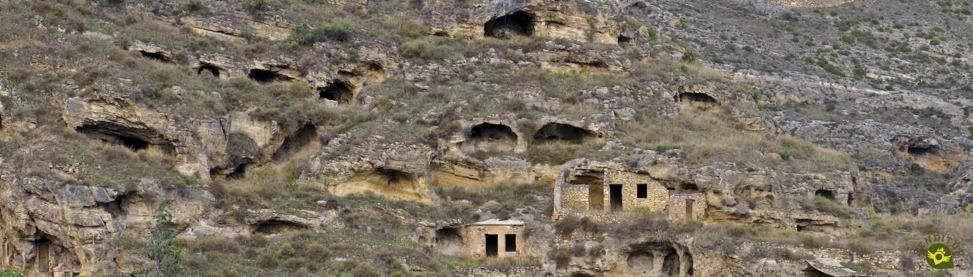
The last stage of the GR 93, or the first as the case may be, which takes us from the Alhama valley to the border between La Rioja and Aragon, crossing the Alcarama mountain range. We are surrounded by a landscape that is very different from that of the mountains of the Sierra de La Demanda. A landscape that is undoubtedly characteristic of this part of La Rioja, the final climax of this GR 93 section 10 Cervera del río Alhama-Valverde, which runs under the watchful eye of a nearby colossus, the Moncayo.
The waymarks of the GR 93 lead us through Cervera del río Alhama (0h 00min), from the square where the town hall is located. Almost immediately we meet the road that comes from Baños de Fitero, which we go uphill for a few metres, crossing it to change direction and enter the town again. Just before crossing the river Alhama again, the GR 93 marks make us turn off and go up a narrow street that finally takes us out of the town. This part of the route coincides with the marks and the route of the Path Green of the Alhama, in its course towards Aguilar del río Alhama. We leave behind the town from where we set off to go up the course of the river Alhama, dotted with vegetable gardens.
Almost without realising it, we reach the point where we have to say goodbye to this comfortable path and take the path that starts on our left.
This path takes us up the mountainside, although it quickly meets a path. We continue ascending, but when we reach the first bend in the path we have the option of turning off onto a path that starts on the left, and thus avoid the long bend in the path. After a while, the path returns us to the path and we continue along it until we reach another sharp bend where we say goodbye to the path for good. A long stretch awaits us ahead, crossing the occasional ravine until we reach a ravine where we will face another uphill stretch. At the end of this ascent we will find the path that we must follow until we reach a crossroads. Once there, follow the track on the right that will take you straight to the Valdegutur road after a while. This road is reached shortly after crossing another ravine, whose riverbed is usually dry. When you reach the road the GR 93 marks make you turn right again to walk the distance to Valdegutur on asphalt (2h 05min).
But before reaching the town, just after passing the hermitage of San Joaquín, we leave the road to continue along the path on our left that runs parallel to it. The GR 93 markings quickly make us change direction again, leaving Valdegutur behind us. As soon as we cross the Añamaza riverbed, a new stretch of ascent awaits us, which we start by leaving on our right the turning that, in 5 minutes, will take us to the Añamaza reservoir. We will continue at all times gaining altitude without leaving our dirt track at any of the crossroads we pass.
Once at the top, we will start to lose part of the height we have gained, following the path that is guiding us on this part of the route at all times.
After passing by the cemetery, our path turns into an asphalted track that takes us to the road that comes from Cervera del río Alhama. Just before reaching the road we have the possibility of taking a shortcut, leaving the asphalted track, which saves us a few metres. When you reach the road, follow it into the town. Although it quickly seems as if we are leaving the village, nothing could be further from the truth, as the road takes us out of this part of the village to take us to the main centre of Valverde (3h 15 min). The GR 93 reaches its end point after crossing the railway tracks, or what is left of them, and meets the N-113 national road as it passes through Valverde.
 |
 |
 |
 |
 |
| 1-Cervera del río Alhama | 0:00h | 520m | 0km | 30T 586857 4651133 |
| 2-Valdegutur | 2:05h | 555m | 8Km | 30T 590897 4647523 |
| 3-Valverde | 3:15h | 605m | 12.4Km | 30T 594304 4648328 |
Coordinates UTM Datúm WGS84

.png) Distance: 12.4Km
Distance: 12.4Km
.png) Time: 3:15h
Time: 3:15h
.png) Difficulty: Medium
Difficulty: Medium
 Slope: 835m
 Slope +: 445m
 Slope -: 390m
 Maximum altitude: 730m
 Minimum altitude: 520m

![]()
This schematic with the path is approximate and has been created from the derived cartographic base © Instituto Geográfico Nacional "Cuadrante 281-4 y 319-2 1:25.000".
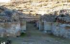

First Cistercian monastery to be established in Spain


Find out what to see in...
¿Did you know that...
The vast majority of the GR93 Sierras de La Rioja stages run through natural areas belonging to the Natura 2000 Network, without forgetting, of course, that some stages also cross part of a natural area included in the La Rioja Biosphere Reserve.
Don't miss out...
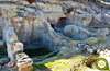
The panoramic views that you can enjoy from the viewpoint that you will find shortly after leaving Cercera del río Alhama. This viewpoint can be reached by following a small detour that ascends from the same route as the GR 93 and the Path Green of the Alhama.


From the commitment of SENDITUR with Nature and the respect to the balance of the environment, SENDITUR urges you to travel in a responsible way, with low environmental impact and respecting at all times the Natural, Cultural and Social environment wherever you go.

Besides sharing with all of us your experience on the route we would be grateful if you could write to us to inform us of any erroneous or outdated information you may have found, or simply to let us know what you think at Thank you.
Route information updated on 26-08-2020. The route may vary greatly depending on the time of year, weather conditions and terrain, as well as the actions of third parties and the evolution suffered in the natural environment where it is located. All opinions, advice and/or assessments made by SENDITUR in their descriptions are for guidance only and are subject to and/or refer to the specific conditions of the specific day of the route, referring to that specific day, taken from trained people, with the appropriate experience and with a high level of physical and technical preparation as a reference, as well as correctly equipped.
All the times are approximate and take an orientative character, the stops have not been taken into account, no matter how small they are. All the information related to the route, texts, images, videos, maps, diagrams, tracks, towns, and places of tourist interest are published as a guide, and may not coincide with the current state of each place. Before undertaking any activity, assess your technical knowledge, your physical condition, find out about the weather and the variations that the route may undergo, equip yourself correctly, be prudent and responsible at all times, and do not exceed your capabilities. SENDITUR is not responsible for any misuse or inappropriate use of the comprehensive guides of its routes and/or publications as well as its electronic guides, nor for any variations in their descriptions for the aforementioned reasons, and recommends that everyone be responsible and prudent in carrying out the activity. We also encourage you to read books and specialised guides to complement the information described above.
Continue watching …


 Previous: Section 9 Cornago-Cervera del Río Alhama
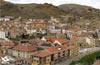


.jpg "Go to Contrebia Leucade")