Welcome to SENDITUR.COM · paths · routes · tourism
Stage 20 Rabanal del Camino-Ponferrada
The Cruz de Ferro, gateway to Bierzo
![]() Difficulty-Remarkable
Difficulty-Remarkable
![]() 7:40 h.
7:40 h.
![]() 32.3 km.
32.3 km.
The Cruz de Ferro, gateway to Bierzo
![]() Difficulty-Remarkable
Difficulty-Remarkable
![]() 7:40 h.
7:40 h.
![]() 32.3 km.
32.3 km.
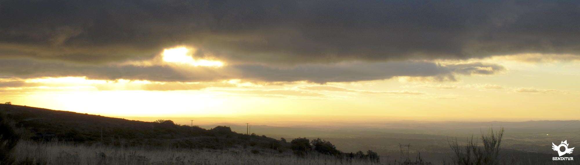
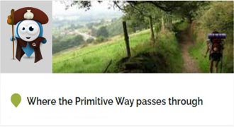
At the gates of the Mountains of León, in Rabanal del Camino, the ascent continues to Mount Irago, now the port of Foncebadón, which takes us to one of the milestones of the French Way, the Cruz de Ferro. Gateway into the land of Bierzo, which we will reach after a tireless descent that will take us to Ponferrada in the Valley of Sil, before passing through Molinaseca. A spectacular stage of the Way of Saint James that will offer us unbeatable viewpoints from where to enjoy the spectacle that the passage of the French Way through these lands offers. Added to ancestral traditions and the history of these lands and their people, make this stage has a special attraction that makes it one of those that every pilgrim has marked on his head.

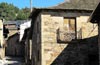
The stage 20 Rabanal del Camino-Ponferrada with 32,3 Km starts from Rabanal del Camino and continues with the long ascent of the port of Foncebadón, in search of one of the key points of the whole Way of Saint James. A pilgrims' hospital, built by the hermit Gaucelmo in the 12th century, gave life to Foncebadón. A town that has experienced a new resurgence, after its almost total abandonment, thanks to the French Way around which it was created. The Cross of Ferro, one of the outstanding points of the Way of Saint James is the antechamber of the entrance of this in the Bierzo. This place is full of symbolism, which serves as a preparation for another corner of the Way, Manjarín, whose bell replicates as if it were a lighthouse to guide pilgrims to their refuge. A crossing along the top of the mountain shoulder takes us to a steep descent that ends in El Acebo de San Miguel, which welcomes us with its characteristic slate roofed houses and its church of San Miguel.

This locality is located in a privileged balcony from where you can contemplate the valley that houses the Compludo Forge or the mountains that hide Peña Alba de Santiago. The French Way continues the descent through the lands of Bierzo to take us to Riego de Ambrós and the hermitage of San Sebastián, another clear example of typical architecture of the area, with slate roof houses and wooden balconies. The descent continues to lead us to the charming Molinaseca, whose Sanctuary of the Virgen de las Angustias of the 18th century, precedes the carefully maintained Romanesque bridge or Bridge of the Pilgrims that serves as access to the interior of the town, where we can contemplate its noble and emblazoned houses as well as the imposing church of San Nicolás de Bari of neoclassical style.

Campo is the next urban nucleus that crosses the Way, of ancestral homes and of medieval origin, its church of Nuestra Señora de La Encina de Campo from the XVII century and the Roman fountain at the entrance to the locality stand out. Ponferrada, built in the location of an old castro, with exceptional witnesses of its long history, such as the Castle of the Templars or the Basilica of Nuestra Señora de la Encina, patron saint of El Bierzo, next to the characteristic Clock street that gives access to the town hall square, and which are some of the wonders of the last great city that we will pass through before reaching Santiago and which is the final point of this stage.
Molinaseca is an attractive and interesting alternative end point of stage, where we can recover from the complicated descent and enjoy the attractions offered by one of the most beautiful towns on the Way.
This is a stage so that you can enjoy a large part of the route, through mountainous terrain, with a variety of pavements. The mileage is high and although bearable is demanding, but it is the sections of asphalt especially at the end and the poor state of part of the descent which will force us to be attentive and take the necessary measures to avoid injuries. With hardly any shade, in summer the effort is multiplied and the heat can increase as we enter the trenches and watercourses through which the route runs.
The water, so available in the first kilometers of the stage, is quickly reduced to the passage through the localities and although almost at the end we will cross some stream that can be used to cool down, we cannot leave it to luck to replenish the water reserves that we must carry.
Although some stretches of the route are almost covered by bushes, the almost absence of livestock means that they should not be a source of parasites. We are in the middle of the mountain and although the continuous passage of people drives them away, the local fauna can come and visit us at any time.
 |
 |
 |
 |
 |
 |
 |
 |
 |
 |
 |
| Rabanal del Camino |  |
|
|
|
|
|
| | ||
| Foncebadón | |
|
|
|
|
|||||
| Manjarín | |
| ||||||||
| El Acebo | |
|
|
|
|
|||||
| Riego de Ambrós | |
|
|
|||||||
| Molinaseca | |
|
|
|
|
|
|
|||
| Campo | | |||||||||
| Ponferrada | |
|
|
|
|
|
|
|
|
|
Calle Real, next to the church of La Asunción in Rabanal del Camino (0h 00min) is the starting point of this long mountain stage.

This street continues the ascent we left halfway yesterday and leads us to the outskirts of the town. Soon the cobbled street and the houses give way to a dirt track embedded between stone walls that delimit the fields.

The wide track, which we must not abandon, leads us on a continuous ascent, partly losing its good initial firm.

A few metres after passing a building, which may well be the town's water reservoir, we come to the meeting point of the road. It is advisable for cyclists to follow this road during this stage.

In front of us begins, on the other side of the road, the path we have to follow. This wide path continues the ascent, cutting the slope of the mountain, crossing the fields full of bushes.

The noise of the cars reminds us of the proximity of the road that a few meters above follows our same course.

After a short and gentle descent we arrive at a small rest area where the path seems to get lost, forcing us to look for the reference of the water pylon that marks the beginning of the path again.

The route follows the course that marks the trail now much narrower, but well marked, entering the vegetation that at times seems to make it disappear again and leaving behind a path that reaches this rest area from the nearby road.

This section in clear ascent, shows us clearly the mountainous terrain through which passes today's stage.

After a demanding ascent some solitary stairs serve us to save the earth slope that separates us from our friend the road.

Again we are forced to cross it, as the Way follows a wide dirt trail that begins on the other side.

This trail quickly turns to recover the course marked by the road, reminding us once again that we are ascending Monte Irago. The itinerary, although with enough distance, follows the winding course that marks the road.

The rocky path partly softens its unevenness shortly before reaching a new rest area, which we will cross leaving a large fountain on our right and a small track on our left that leads directly to the road. The ascent makes us continue to gain height allowing us to observe the wall of mountains that, to our left, mark the beginning of the Mountains of Leon with the Teleno as representative.

The path is still rocky and runs without separating too much from the road company.

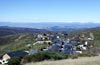
Without deviating at any time from the course that marks the path well defined by which we are going and that gives us small rest in its continued ascent we arrive at another rest area from where we can already observe the first objective of the day, Foncebadón.

The route continues without detours towards this locality, leaving behind as many paths as we find, these serve as access to the antennas and high tension towers that surround the area.

Once again, the road gets in front of us, forcing us to cross it in order to continue along the path that will take us to the interior of Foncebadón (1h 30min).

The track by which we arrived at this population makes us the guide for her leading us up to the outskirts of the same one.

On leaving the village definitively, the route leaves a track on the right to go straight on, allowing us to sense the final part of the ascent. The track with quite good firm continues in soft ascent for the moment, going to the meeting of the ruins of an old building.

The main track leaves behind the paths that descend towards the valley to continue halfway up the slope in search of higher altitude.

The road cuts us off again, so we have to cross it once more to continue the route, now next to it.

Our next objective of the day can already be seen pointing out to us the pass of mountain by which to save us this first obstacle that the French Way raises to us in many kilometers.

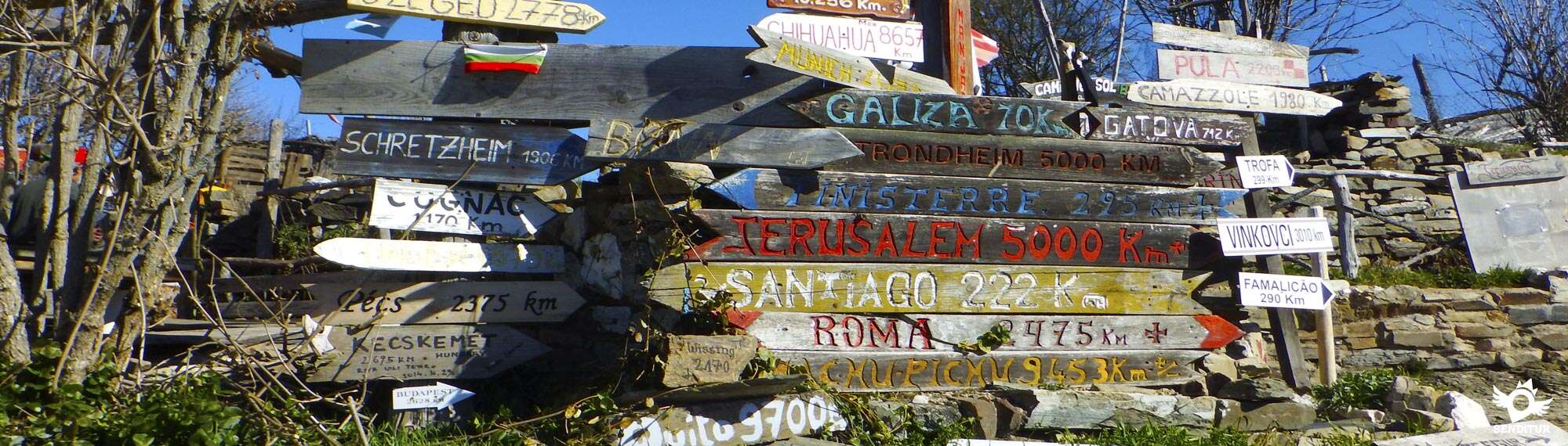
The Iron Cross (2h 15min) rises in the pile of stones that serve as its base, marking the false end of the ascent we have to face.
We leave behind this icon of the Way and continue along the andadero, which undertakes a first descent following, as could not be otherwise, the line that marks the road.

A long stretch awaits us in the company of the road, with the andadero delimited by some wooden trunks that will serve as a guide.

This well-defined path, and without trunks on its sides, and is losing its good firm little by little due to the tireless work of water. We leave behind some crossings, without abandoning the company of the road for now.

The route alternates gentle descents with short ramps that make us gain height again, making us advance through this mountainous terrain, moving away from the road to shorten the curves it draws.

Once again we come across the road, from which we had separated a few metres, and now we are forced to continue along it.

This stretch of asphalt is used to cover the few metres that separate us from Manjarín (2h 50min), to which we arrive next.

The road leads us through this peculiar place, allowing us to contemplate its curious and eye-catching corners.

Following the course marked by the asphalt we reach the height of a new detour, on our left begins a track where the route continues.

Shortly after starting the track we reach a new crossroads where we turn right again this time leaving the path that descends into the valley. This detour makes us recover the orientation line that marks the road to continue cutting the slope of the mountain.

A long watering hole and wooden benches serve as a reference to know that we are on the right course, from here the track becomes a wide trail that directs our steps towards the imposing antenna that crowns the top of the mountain in front of us.

We meet the road again to cross it once more, leaving it now on the opposite side.

As soon as we cross the road we turn left again, taking the course that marks the nearby road.

The route continues bordering the top, crowned by the great antenna that served us as lighthouse until here, this section crosses with several ways that ascend towards it.

The itinerary seems to go out again to the road but in reality it crosses the asphalted trail that goes up towards the antenna to go in search of a narrow path that advances a few meters ascending next to it and then to separate gradually, following the curve that draws under us the road.

The route now passes through a fairly cobbled mountain trail that clearly shows us what awaits us in the descent ahead.

The descent becomes more evident and leaves behind the paths that are found, the firm, full of slabs and loose stone, increases the possibility of slips. In the distance at the bottom of the valley you can already sense the end of the stage and the landscapes we will be walking through in the next few days.

The strong descent continues, giving us some short respite, to reach a new crossing with a track that cuts ours without contemplations.

Shortly after crossing this track we find again the obligation to cross the road to continue the descent towards the next town of the day that is already seen at our feet.

Again this part of the route increases its inclination that added to the stony ground through which it runs make this stretch a cumbersome descent.

After crossing more paths that do not have to confuse us, the route describes the typical zetas that partially soften their unevenness, leading us once again towards the road.

The way we are now going ends without further complications at the gates of the town, which we enter by following the inseparable road in its uninterrupted descent that will take us to the interior of El Acebo de San Miguel (4h 25min).
Once again, the road, turned into a beautiful street, will serve as an improvised guide, taking us around the whole town.

Without ever deviating from the Camino Real, the name given to this street, we reach the outskirts of the town, at which point the asphalt once again makes its presence felt.

A few metres further on we leave on our left the road that descends towards Compludo and its famous smithy, to go straight on. This stretch of road offers us a narrow trail on its edge and magnificent views of the valley and the mountains that surround us.

After a relatively long descent, after a few bends, we arrive at an esplanade where several paths offer us the possibility of leaving the road for a while. If this is our choice, on our right, hidden among the bushes, we will find the beginning of the most advisable and transited trail of all.

This well marked trail will take us, without detours and with the road to our left, across the field until we come across it again in front of us, avoiding a wide curve that it draws.

It is in this place where a new trail begins that will avoid us another long stretch of road.

This trail, wider than the previous one, takes us directly on a continuous descent towards the next locality of the day to which we have been able to observe perfectly for quite some time now.

The French Way without allowing any detour takes us quickly to the interior of Riego de Ambrós (5h 00min), making us cross the long street that crosses this town.
Our walk through the streets of Riego de Ambrós takes us to a fork where a house divides the street we are going down into two.

The route then continues turning left into the street that will take us to the limits of the town, leaving the one in front of us that will take us to the road.

Shortly after passing through the town square, just where the street begins to gain height, we have to detour following the one on our right that quickly finishes taking us out of the town, becoming a dirt path that looks more like a torrent of water.

This path in quite bad condition descends to a stream that we will have to cross to reach a somewhat clearer area of vegetation. Impressive chestnut trees are the antechamber of our gradual return to the road.

After recovering some of the lost height, the route turns to the right, leaving a path that goes straight on, to exit at the nearby road.

This small stretch of asphalt in which we continue with the descent ends just before the road describes a curve, place where a new path begins to the right where we have to continue. This path starts a gentle ascent saying goodbye to the road that goes away, in search of the best place to save the hill that presents itself to us.

Shortly after starting the route along this track, a few metres before reaching the height of a high-voltage tower, the itinerary leaves the wide track that continues its ascent towards the tower to continue along the path on the left that will take us towards the final descent to Molinaseca.

Soon we began the descent following the path that leads us, through a fairly cobbled terrain, to cross a small stream. The bad state of this part of the route has caused pilgrims to create a small trail next to the original one, thus avoiding us to pass through it.

After joining the two routes again, the terrain gives us a small truce until we again have to face the uncomfortable descent, fitted as if it were a trench walking on slippery stone slabs, through a fairly stark terrain that does not facilitate our progress.

Almost without realizing it, Molinaseca is closer to us than it actually is at the moment. The terrain becomes kinder, allowing us to progress more comfortably.

The meandering route comes close again to the inseparable road, which tempts us to continue along it, offering us a track that leads to it, a track that we leave to our left to continue straight ahead, facing a short but intense ascent.

Without deviating from the path we are walking on, which quickly begins the descent again, we find ourselves again with another path that takes us towards the road, an option that we will now follow in order to go out to it.

The route then continues the descent down the road towards the next town that already offers us the safety of its sidewalks.

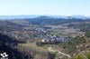
Following the course of the road that takes us into the town centre, we can contemplate the careful architecture that characterises this locality until we come across the Romanesque bridge over which we continue crossing the river Meruelo.

This bridge aligns us with the Calle Real that will accompany us on our way through Molinaseca (6h 10min).
Following the straight line that marks the Calle Real, we soon come across a crossroads that indicates the proximity of the inseparable road.

Without further ado, the route takes us back to the road that will once again be our companion for a while, although fortunately this section has a sidewalk that prevents us from walking on the road.

This journey passes between country houses and townhouses that almost make us miss the tortuous descent that brought us here.

With no room for error, the straight course of the road soon leads us to a demanding climb that at this point seems longer and heavier than it really is. We leave behind us some solitary path that goes out to our step to after crowning this mini-port to find us with the final point of the sidewalk.

Luckily a few metres further on we reach a crossroads where we leave the company of the road that leads to Ponferrada to continue, of the two more possibilities that arise, by the track on the left that continues with the descent begun shortly before.

This dirt track marks the limits of the urbanization we are passing through and leaves behind the accesses that are introduced into it.

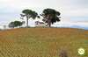
The undulating terrain forces us to a new climb through the first vineyards of the many that we will find in this part of the Way. Without deviating from the main track at the crossroads we find, we begin a new descent with the silhouette of Ponferrada watching us.

The next population of the day receives us forcing us to decide between two of its streets, being the street of the right that continues with the descent the one that takes us until the interior of Campo (7h 05min), leaving behind us the way that would take us until the Roman source of the locality.

The Plaza presents itself to us by making us cross it to follow the route along the street to the left of the two that begin in front of us.

Almost without realizing it, we leave the town and find ourselves walking along a road marked out by the houses of what looks like an urbanization.

This road, which we must never abandon, leads us to the final point of the stage, allowing us to see on one side the banks of the river Boeza and after it Ponferrada and on the other the imposing figure of Pico Pajariel.

After a long stretch of open country, the road ends when it crosses with another that will replace it as a guide to our steps.

We continue to walk through the houses that border it, more and more abundant, ignoring the crosses with which we come across.

After a short while this street we are going down joins with another tree-lined street where, without breaking the straight course we are following, we have to continue.

This short stretch ends in a wide square, to our right we can see the pedestrian bridge that will serve to cross the river Boeza.

As soon as you cross the river, the French Way turns to the left to continue walking through the orchards that extend along the banks of the river.

The street takes us, without loss, to cross under the railroad tracks and to begin the ascent that will return us to the protection of the buildings.

Once again we will be leaving behind the detours that we are until finishing the ascent, moment in which turning to the right we undertake the straight one to run by the street that takes us up to the interior of the city.

This street ends in front of the church of San Andrés, forcing us to turn left in search of the pedestrian crossing that will help us cross to the other side. The route then begins a new ascent bordering the Castle of Ponferrada.

The walls of the Castle will guide us to a square, where cyclists who are passing through the city must follow the street on the left that borders the limits of the castle, while the rest of pilgrims is the street on the right that will take us to the heart of Ponferrada (7h 40min).

The Virgen de la Encina square, with the unmistakable Clock street that transports us to the beautiful town hall square, serves as the final point of this stage.
 Distance. 32,3Km
Our route through Ponferrada will determine the final distance.
 Time. 7:40h
Expertise in descent may vary in part from this figure. If, for some reason, we are forced to follow the road because we cannot follow one of the sections of trails that shorten its itinerary, we will have to take into account the distance this adds to the total and the time it takes us to cover it.
 Time of year
In winter it is very common to find the layout totally snowed, remaining practically impassable, forcing us to follow the road. The landscape is spectacular and offers us different colour combinations in eac:season. Wit:practically no shaded areas, in summer it is advisable to take advantage of the coolness of the sunrise, while in winter in the early hours of the morning we can find ice on the route.
 Required equipment
Recommended boots, hiking clothing should be appropriate to the time of year and weather conditions. It is also advisable to bring some warm clothing and rain even in summer. Equipped backpack, canes, canteen and food. You can not miss the camera, sunglasses and sunscreen, it is also advisable a map of the area wit:the route and telephone wit:batteries charged. Consult our list of material and equipment to make the Way. Read more
 Difficulty. Remarkable
Physical
The profile, almost in its entirety is downhill, should not lead us to underestimate this toug:stage. It is precisely the long and demanding descent, whic:added to the state of certain parts of it contributes to increase the demand that can cause muscle and joint problems. The absence of shade in summer is another conditioning factor which, together wit:the morphology of the terrain, makes the hot days harder than one would expect. The ascent sections are mostly found at the beginning, althoug:there is some ramp that are interspersed in the descent, forcing us to make an extra effort.
Caution
The stretches of road are somewhat misleading in giving us the impression of being little traveled, given that this is not the case since the area is very touristic and there are not a few who come to know it. We must pay special attention in the descent to avoid falls, slips or other physical problems that these can generate. Everything is complicated in case of rain, snow or ice, the terrain is suitable for it and we can find areas of mud or very slippery stones and in winter some ice plate can play a trick on us. Attention the days of fog, in case of doubt it is preferable to follow the road, althoug:this supposes a few kilometers more, that will be nothing in comparison of if we get lost.
Orientation
Althoug:signposted, we must not forget that we are traveling a mountain area and there will be many paths and trails that we will find. In addition the pilgrims in their eagerness to shorten or to avoid some stretches, have created many trails that can make us doubt in more than one occasion. It is not advisable to leave the route, its layout is usually well defined. Every entrance to a city means increasing the difficulty to follow the marks and Ponferrada is not an exception wit:different alternatives of passage and not very good signposting.
 |
 |
 |
 |
 |
| 1-Rabanal del Camino | 0:00h | 1158m | 0Km | 29T 723151 4706908 |
| 2-Foncebadón | 1:30h | 1439m | 5.4Km | 29T 718369 4707761 |
| 3-Cruz de Ferro | 2:15h | 1497m | 7.4Km | 29T 716843 4707432 |
| 4-Manjarín | 2:50h | 1446m | 9.7Km | 29T 714758 4707527 |
| 5-El Acebo de San Miguel | 4:25h | 1152m | 16.7Km | 29T 708961 4708301 |
| 6-Riego de Ambrós | 5:00h | 931m | 20Km | 29T 707051 4710797 |
| 7-Molinaseca | 6:10h | 582m | 24.7Km | 29T 703601 4712503 |
| 8-Campo | 7:05h | 538m | 28.9Km | 29T 700040 4712452 |
| 9-Ponferrada | 7:40h | 545m | 32.3Km | 29T 697692 4713060 |
Coordinates UTM Datum WGS84

 Slope: 1897m
 Slope +: 641m
 Slope -: 1256m
 Maximum altitude: 1510m
 Minimum altitude: 504m

This sketc:of the route is not made to scale nor does it contain all the information relating to the area, it is merely indicative.

![]()
This schematic wit:the pat:is approximate and has been created from the derived cartographic base © Instituto Geográfico Nacional "Cuadrantes 192,191,159 y 158 1:50.000".
Senditur has manipulated the tracks to correct the aberrant points that may exist, caused by problems wit:the reception of the GPS signal. In any case the tracks are always approximate. SENDITUR encourages you to use the new technologies within your reach, using them as support and consultation in your activity, not basing the realization and orientation of the same only and exclusively on them, since they may see their functioning altered by very diverse causes, not functioning correctly and their indications may not be precise.


Para mi uno de los tramos más bonitos de este Camino y también duro.

Castle of the Templars, the most representative construction of Ponferrada
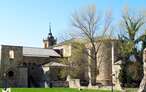
Benedictine monastery and Royal Palace of the Leonese monarchy

Find out what to see in...
¿Did you know that...
It is well known that when the pilgrim passes through the Cross of Ferro he must throw a pebble at its base to get rid of sins. This fact has left almost no stones in the surroundings, as pilgrims collect them instead of carrying theirs from their place of origin as is really marked by tradition.
Don't miss out...
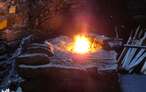
If you have the necessary time and sufficient energy, approximately 5 km from El Acebo de San Miguel is the smithy of Compludo where we show the daily work that used to be done in this place, whose rhythmic hammering, it is said, rumbled in the valley and was heard by pilgrims as if the steps of a fearsome giant were.


From the commitment of SENDITUR with Nature and the respect to the balance of the environment, SENDITUR urges you to travel in a responsible way, with low environmental impact and respecting at all times the Natural, Cultural and Social environment wherever you go.

Besides sharing with all of us your experience on the route we would be grateful if you could write to us to inform us of any erroneous or outdated information you may have found, or simply to let us know what you think at Thank you.
This route has been carried out in the field by SENDITUR on 02-10-2018. The route may vary greatly depending on the time of year, weather conditions and terrain, as well as the actions of third parties and the evolution suffered in the natural environment where it is located. All opinions, advice and/or assessments made by SENDITUR in their descriptions are for guidance only and are subject to and/or refer to the specific conditions of the specific day of the route, referring to that specific day, taken from trained people, with the appropriate experience and with a high level of physical and technical preparation as a reference, as well as correctly equipped.
All the times are approximate and take an orientative character, the stops have not been taken into account, no matter how small they are. All the information related to the route, texts, images, videos, maps, diagrams, tracks, towns, and places of tourist interest are published as a guide, and may not coincide with the current state of each place. Before undertaking any activity, assess your technical knowledge, your physical condition, find out about the weather and the variations that the route may undergo, equip yourself correctly, be prudent and responsible at all times, and do not exceed your capabilities. SENDITUR is not responsible for any misuse or inappropriate use of the comprehensive guides of its routes and/or publications as well as its electronic guides, nor for any variations in their descriptions for the aforementioned reasons, and recommends that everyone be responsible and prudent in carrying out the activity. We also encourage you to read books and specialised guides to complement the information described above.
Continue watching …
 Previous: Stage 19 Hospital de Órbigo-Rabanal del Camino
 Next: Stage 21 Ponferrada-Villafranca del Bierzo