Welcome to SENDITUR.COM · paths · routes · tourism

![]() Difficulty-Medium
Difficulty-Medium
![]() 1:15 h.
1:15 h.
![]() 2.8 km.
2.8 km.
![]() Difficulty-Medium
Difficulty-Medium
![]() 1:15 h.
1:15 h.
![]() 2.8 km.
2.8 km.
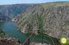
The town of Pereña de la Ribera in Salamanca, one of the gateways to the famous Well of the Fumes, holds some of the most spectacular places of all those that make up the Arribes del Duero Natural Park. One of these charming corners is the Well of Airón, less known than its renowned neighbor but with a great attraction to discover.

The route with 2.8 km, provided that we leave from the parking area located at the end of the road that comes from Pereña de la Ribera, transports us through this exceptional natural place. A natural place that has been part, and forms part, not only of the splendid nature that composes it, but also of the people who live and inhabited these lands as the remains of the mills we have to pass by testify. A nature that surely has to surprise us with the nourished life that shows to our step, jinetas, foxes or alimoches are only some of the species that inhabit the place coexisting with the thick vegetation that grows in these hillsides.

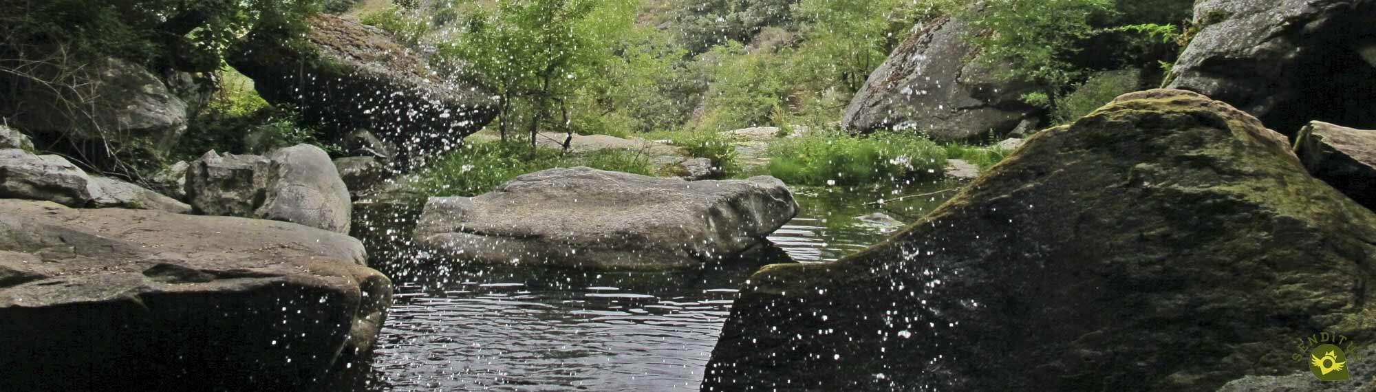
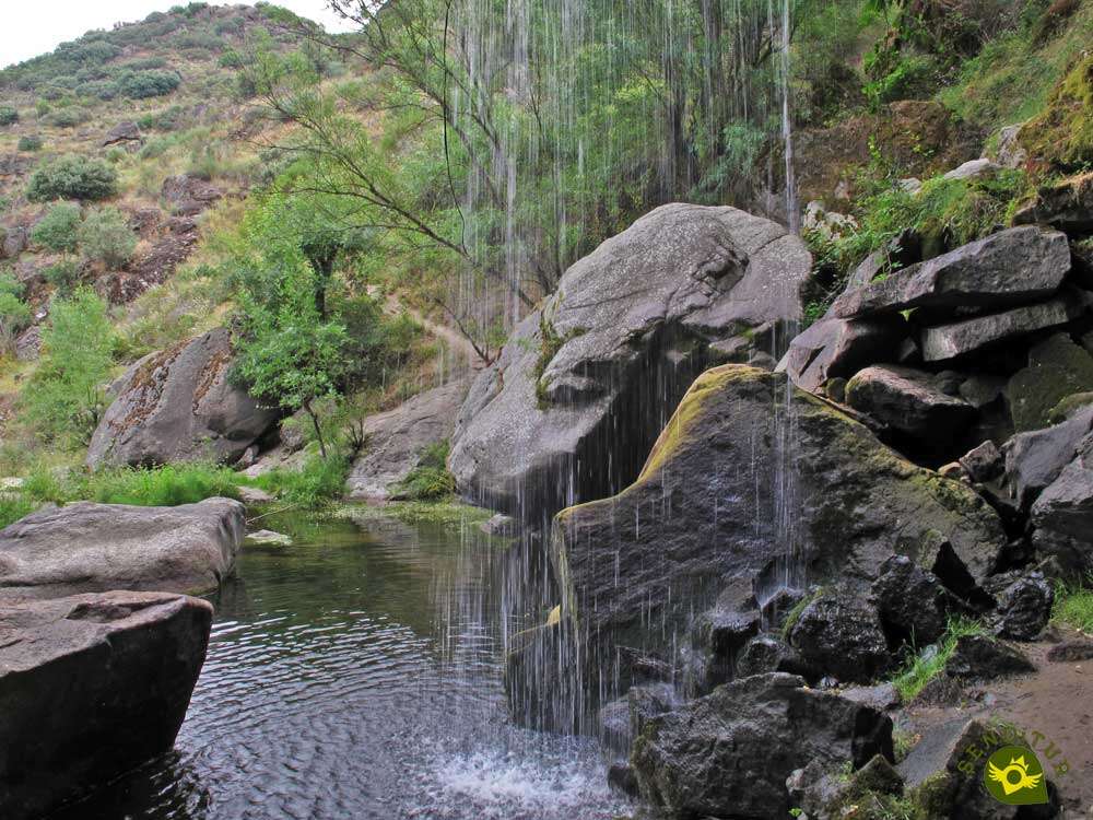
But if there is something that should surprise us on this route, it is undoubtedly the Well of Airón, a spectacular waterfall almost equally full of mysticism and beauty. A beauty and an aura of mystery to which the possibility of accessing the interior of the cave that the erosion has carved behind the curtain of water that falls into the void from the top of the ravine contributes significantly. These attributes make this place a must if we are visiting the Arribes del Duero Natural Park.

The local people say that many people have disappeared since time immemorial. Legend or reality, they say that the Well of Airón hides in its interior the sinister entrance to the underworld and that it is guarded by a capricious god of the waters, the wells and the depths. Everyone who enters its interior is observed by this god of the underworld who is capable of creating life with the waters he dominates, but also of taking possession of the souls to lead them, without possible return, if he so decides, to the other world whose entrance he guards.
We reach Pereña de la Ribera by following the road that connects it with the town of Trabanca. This same road also connects it with Masueco, which can be reached from Vitigudino by following the SA-314 or from the nearby Mieza and La Zarza de Pumadera. Once in Pereña de la Ribera we will find the pertinent signs that will guide us to the parking area set up at the beginning of the path. The path that leads to it is usually in relatively good condition, although it is not unusual to pass some areas that are somewhat decomposed due to the torrents that are formed on rainy days.
Quiet route for our dog, as long as he is used to this type of route.
It is not superfluous to bring him some water, although if the river allows it in the Pozo de Airón he will be able to drink as much as he needs.
It is quite likely that we will find some cattle grazing in the area, also we must not forget that we are in the Natural Park of Arribes de Duero and that it has its relevant legislation to follow.
After the long journey on the dusty track that has brought us from Pereña de la Ribera to here, the short parking area (0h 00min) where it ends, marks the beginning of our route.

A wide path, which seems more like the battered continuation of the road, allows us to advance without major problems.

Almost immediately we come across the beginning of the trail that will take us to the Well of Airón.

In this section the route follows a well trodden trail without too much slope, letting us intuit, on our left, the course of the creek that falls into the void later on.

As we advance along the trail, the vegetation allows us to contemplate the stream and its whimsical course in more detail. We will come across small bends that we can approach to take a careful look at some of the small waterfalls that the stream makes in this part of its course.

In front of us, the valley we are walking through gradually opens up, advancing relentlessly towards its union with the mighty Duero, which hides from our gaze behind the walls that imprison it. We then begin a rapid descent that will make us lose height quickly.

The trail winds repeatedly through the dense vegetation that populates these mountains. A zigzagging that allows us to contemplate in the distance the path that approaches the solitary viewpoint that can be perceived on the horizon. At the same time, the majestic presence of the Well of Airón, which we can already see, imposes itself on the surrounding landscape.

After a while we arrive at the detour we must take, radically changing our course and saying goodbye to the path that continues towards the distant viewpoint. A short stretch awaits us in front, while we enjoy the Well of Airón (0h 30min) which we quickly reach.

The only thing left to do is to enjoy the place, go inside the waterfall, if the flow and the slippery stones allow it, and go back to the car park (1h 15min) from where we started.
 Distance. 2.8Km
Skipping the detour may cause us to travel more distance than necessary.
 Time. 1:15h
The return will be the stretch that will take us the longest to cover since we will have to face almost all the positive slope of the route.
 Time of year
As with all the waterfalls, the flow of water will partly determine the beauty and interest of the route. It is important to realize that when you access the waterfall you are in the middle of the flow of water that descends through the ravine, a fact that may advise against entering it due to the danger it may have.
 Required equipment
On hot days it is important not to leave the water behind as we must not find sources on the way and the sensation of heat can be intense. As always we must adapt our equipment to the route and the time of year in which we venture to walk it and of course not try to do it with unsuitable shoes or poorly equipped because although it is a simple route we must not forget where we are. Consult our list of material and equipment for hiking. Read more.
 Difficulty. Medium
Physical
Without a great distance to travel, this trail accumulates in a short distance almost all the unevenness to overcome. For this reason it is important to take the ramps that we will find with a certain calm and not to harden the route without necessity.
Severity of the environment
As long as we do not abandon the path, we should not encounter any complications other than the stony nature of some areas, concentrated in its final stretch. Be very careful if you approach the bed of the creek, as it is usually nestled between vertical walls. Another point to pay attention to is the Well of Airón, here both its flow and the slippery stones that we will have to cross to approach its interior can play a trick on us.
Orientation
A perfectly defined path will be in charge of guiding us on this trekking route in the province of Salamanca. In addition we will have the invaluable help of some marks that will guide us at the beginning. The almost total lack of crossroads with other paths or trails also facilitates the task, we will only have to be attentive and almost in the Well of Airón to divert to it and not follow the path that would lead us in a first term to a beautiful viewpoint.
 |
 |
 |
 |
 |
| 1-Parking | 0:00h | 580m | 0Km | 29T 706001 4567959 |
| 2-Well of Airón | 0:30h | 455m | 1.4Km | 29T 705403 4568505 |
| 3-Parking | 1:15h | 580m | 2.8Km | 29T 706001 4567959 |
Coordinates UTM Datum WGS84

 Slope: 360m
 Slope +: 180m
 Slope -: 180m
 Maximum altitude: 580m
 Minimum altitude: 455m

This sketch of the route is not made to scale nor does it contain all the information relating to the area, it is merely indicative.

![]()
This schematic with the path is approximate and has been created from the derived cartographic base © Instituto Geográfico Nacional "Cuadrante 422-4, 25.000"
Senditur has manipulated the tracks to correct the aberrant points that may exist, caused by problems with the reception of the GPS signal. In any case the tracks are always approximate. SENDITUR encourages you to use the new technologies within your reach, using them as support and consultation in your activity, not basing the realization and orientation of the same only and exclusively on them, since they may see their functioning altered by very diverse causes, not functioning correctly and their indications may not be precise.


El Pozo de los Humos es el más conocido de esta zona pero este Pozo de Airón también es muy bonito y está mucho menos masificado que el otro.
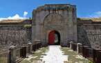
Star-shaped fortress, eternal watchtower of the Portuguese lands

¿Did you know that...
A little further on from where the Pozo de Airón is located there is another waterfall known as the Pozo de Botarata. It is known by that name because a woman known as María la Botarate threw herself into it, because of a lack of love.
Don't miss out...
The viewpoint you will find following the path from which we deviated to go down to the Well of Airón. From this viewpoint you can observe the passage of the majestic Duero through this area and enjoy the magnificent surroundings.


From the commitment of SENDITUR with Nature and the respect to the balance of the environment, SENDITUR urges you to travel in a responsible way, with low environmental impact and respecting at all times the Natural, Cultural and Social environment wherever you go.

Besides sharing with all of us your experience on the route we would be grateful if you could write to us to inform us of any erroneous or outdated information you may have found, or simply to let us know what you think at Thank you.
This route has been carried out in the field by SENDITUR on 04-07-2018. The route may vary greatly depending on the time of year, weather conditions and terrain, as well as the actions of third parties and the evolution suffered in the natural environment where it is located. All opinions, advice and/or assessments made by SENDITUR in their descriptions are for guidance only and are subject to and/or refer to the specific conditions of the specific day of the route, referring to that specific day, taken from trained people, with the appropriate experience and with a high level of physical and technical preparation as a reference, as well as correctly equipped.
All the times are approximate and take an orientative character, the stops have not been taken into account, no matter how small they are. All the information related to the route, texts, images, videos, maps, diagrams, tracks, towns, and places of tourist interest are published as a guide, and may not coincide with the current state of each place. Before undertaking any activity, assess your technical knowledge, your physical condition, find out about the weather and the variations that the route may undergo, equip yourself correctly, be prudent and responsible at all times, and do not exceed your capabilities. SENDITUR is not responsible for any misuse or inappropriate use of the comprehensive guides of its routes and/or publications as well as its electronic guides, nor for any variations in their descriptions for the aforementioned reasons, and recommends that everyone be responsible and prudent in carrying out the activity. We also encourage you to read books and specialised guides to complement the information described above.
Continue watching …


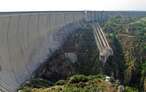
.jpg "Go to Almendra Dam and Reservoir")
.jpg "Go to Sanctuary of Our Lady of the Peña de Francia")