Welcome to SENDITUR.COM · paths · routes · tourism

Road from San Millán to Villar de Torre
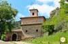
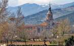
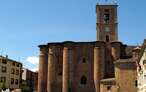
San Millán de la Cogolla, La Rioja![]()
![]()
![]()
![]()
![]() (2)
(2)
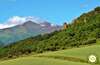
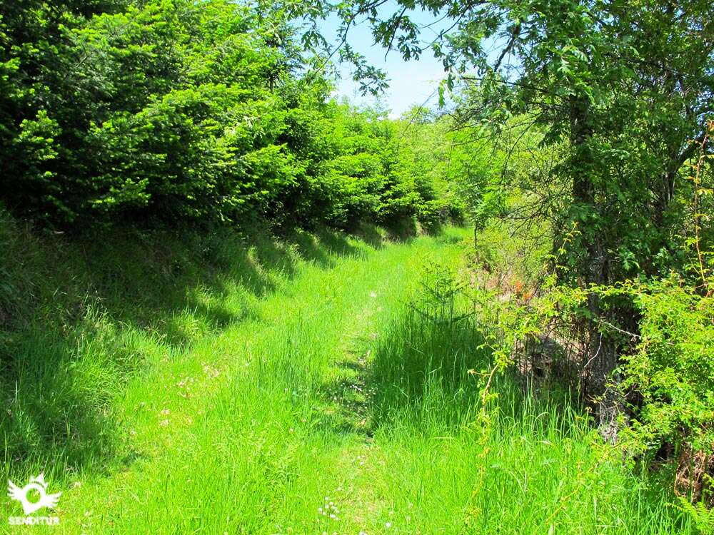
Bordering forests and cereal fields
![]() Difficulty-Low
Difficulty-Low
![]() 2:30 h.
2:30 h.
![]() 8 km.
8 km.
San Millán de la Cogolla, La Rioja![]()
![]()
![]()
![]()
![]() (2)
(2)
Bordering forests and cereal fields
![]() Difficulty-Low
Difficulty-Low
![]() 2:30 h.
2:30 h.
![]() 8 km.
8 km.
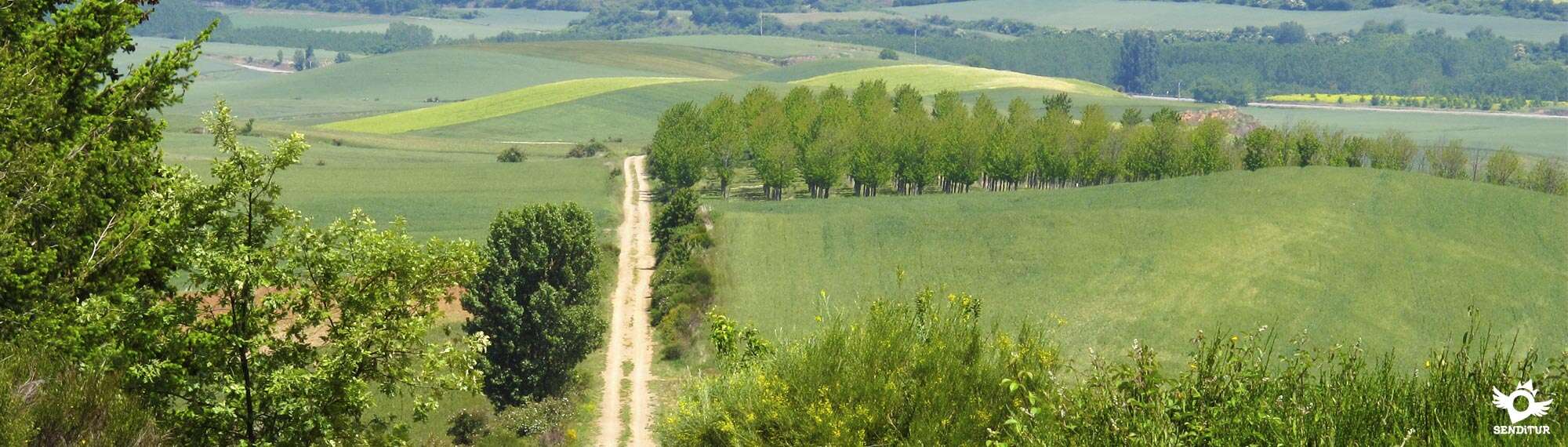
Flanking the undergrowth, the Road from San Millán to Villar de Torre leads us across the border that separates the extensive fields of cultivation of the beginning of the highest mountains of La Rioja.

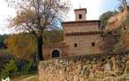
The path shows us on one side the leafy forests of fir trees interspersed with holm oaks, and on the other the amplitude of a valley that opens up in search of the river Ebro. The 8km route takes us from the so-called "Escorial of La Rioja", a magnificent Renaissance monastery that shelters the exemplars with the first written words known from the Castilian language, to go through dense forests, to save twisted ravines through which small streams run.

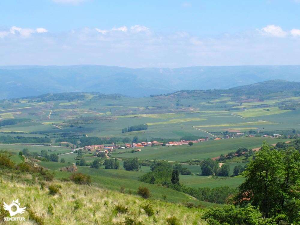
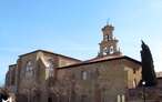
The itinerary is high enough to entertain us by guessing the names of the villages that make up this part of La Rioja, as well as contemplating the Ebro valley and practically all the Sierra Cantabria that delimits it on the other slope. Little by little we leave behind us the mountains to enter the fields of cereal that receive us with the different colors that characterize them depending on the time of the year, until arriving at Villar de Torre, where the parish of San Juan Bautista keeps a careful altarpiece of the sixteenth century.

If you want to cover the whole route but don't want to walk the 16 km round trip, you can divide the route in two, arriving at the exit of the footpath to the road, which is more or less half of the route and leaving the other part for another day.
To get to San Millán de la Cogolla, follow LR-331 from Bobadilla or LR-205 from the nearby town of Berceo, where the different access routes converge from the A-12 Camino dual carriageway and the N-120 between Logroño and Burgos, well signposted as " Route of the Monasteries". We can arrive by the LR-206 from Azofra or Santo Domingo de la Calzada and from Nájera by the LR-113, which joins it with Salas de los Infantes, taking the detour of the LR-205 that will take us to Berceo and then to San Millán de la Cogolla, which also has an interurban bus service every day. When arriving we must go towards the enclosure of the monastery that is located to the other side of the accesses to the locality of San Millán de la Cogolla, reason why we will have to cross it from side to side by its main street or by the highway that surrounds it and that we will find, as we come from Berceo, a little before arriving at the population. This road will lead us directly to the entrance to the Monastery of Yuso, where we will find the information centre and next to it a car park where we can leave our vehicle.
Good walk without hardly touching the asphalt, by wide roads and a short stretch of path, although a good part of the journey is covered by vegetation.
There are no water points along the entire route, except in the localities, although we pass some streams but access is not very easy, so we are forced to carry water as we also do not have too many shaded areas.
It is not very common to find cattle on this route. At the entrance to Torres del Río if we pass next to enclosures with dogs, normally closed.
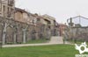
We begin the route in the parking lot of the Monastery of Yuso (0h 00min), ascending the street that brought us until here, to cross the small park that we will find at the end of this one.

This park borders the road that leads to the monastery, which we are forced to cross as the route continues along the path, which on the other side, passes by the cemetery and continues uphill until, shortly before reaching the road that leads up to the Monastery of Suso, it turns left, bordering the boundaries of a property.

The route softens the ascent and continues narrowing until ascending a slope of earth and to leave again to a wide and green way. Shortly after leaving the path, we arrive at a wooden post that marks the beginning of a path that goes to our right towards the leafy forest.

Leaving the path and following this footpath that picks up again, after a short but steep slope, we arrive at a wide footpath that ascends straight from the nearby road, turning to the right and descending it we find an informative sign with the routes of the area.

A narrow trail prevents us from going up the stretch of road, ascending the slope of the hill until we meet again. In this moment, in front of us, we see a wide path that goes up a steep slope.

Crossing the road, the itinerary continues along this path marked by old wooden posts that let you intuit the names that once indicated, the path softens the ascent and continues along the boundaries of the forest and flanked by fields of cereal on the other side.

This track follows the drawing that traces the forest until it turns to the left, then leaving a path that goes into it and following the track that continues, now more protected by the shade of trees, bordering the forest and fields of cultivation, and less visible.

Our route leaves the forest to find a crossroads of tracks, to our right one that goes towards the crops and that we do not have to follow and to our left two paths being the one of more to the right the correct one.

This path is signposted, but the post is practically covered by weeds and has no indication, only the similarity in the design makes us think we are going for the right place.

A little further on, our path forks, and we must follow the one on the right that descends and leave the one on the left that ascends. The vegetation from now on has almost taken over the route, almost completely covering the track we feel we are following.

At the end of the descent there is a stream waiting for us that we cross thanks to a small bridge to begin a new ascent, not before having to pass a fence, by its left end, that prevents the passage to animals.

The ascent now without the protection of the shade, meanders halfway up the slope, crossing an area in full reforestation and invaded by vegetation, until we come across another fence with its narrow pass for people.

From this point the descent begins along an uncomfortable trail protected by the shady forest through which it runs.

This trail ends in a path without any sign, where we must continue on the left going up a small hill to reach the top of it to begin the descent that shows us, after a sharp turn of the road, our final destination.

A long straight line between fields of cereal in a soft descent is approaching us to the end, not without before forced by the undulation of the land to make us ascend and to descend in several occasions and to twist crossing the limits of the hills that flank us to our left, to cross the Sacavacas stream.

The road, in a relatively short stretch, is once again invaded by vegetation until it almost disappears, to become again a dirt track that approaches Villar de Torre.

Before arriving we leave to our right a track to begin a short descent that takes us to the encounter of another way, this crossing if it is signposted, that joins to ours by the left.

Our route borders a small hill until finding the narrow path that brings us closer to the first streets of the town, at which time another worn signal guides us to the right and following the main street we descend to the Villar de Torre square (2h 30min) where the route ends.
 Distance. 8Km
This figure refers only to the outward journey.
 Time. 2:30h
If we take the opportunity to visit the nearby Monastery of Suso we will have to add about 40 minutes whic:is the time it will take us to recover the road back to Villar de Torre.
 Time of year
The route offers us very different perspectives depending on the season of the year, althoug:in rainy seasons we can find very muddy muc:of it.
 Required equipment
We recommend long trousers as well as walking stick and canteen wit:water, sunglasses, cap and sunscreen. Clothes and footwear for hiking according to the time of year and the weather. Consult our list of material and equipment for hiking. Read more.
Slope acumulate. 561 m Slope positive. 299 m Slope negative. 262m
 Difficulty. Low
Physical
It is in the first part of the route where we find the highest physical demand, being a constant but gentle ascent, althoug:it is the ramp of the track that begins just after crossing the road to the monastery has the steepest slope. If we include the return from Villar de Torre, a person accustomed to walking is not more complicated, but it does increase the degree of difficulty.
Severity of the environment
The greatest complication is found in the thick vegetation that in some parts of the route takes hold of it, otherwise are wide roads and without complications. The section of pat:is not exposed but its layout is somewhat irregular not involving major complications.
Orientation
The signs are based on old wooden posts, some of them in poor condition or hidden among the vegetation, sometimes giving us the impression of not following the correct route, the entry or exit of the footpat:to the final road to Villar de Torre is not signposted and when returning is extremely easy to jump. The forestation works near San Millán have created a few paths that should not confuse us from the main one.
 |
 |
 |
 |
 |
| 1-Monastery of Yuso | 0:00h | 735m | 0Km | 30T 511026 4685973 |
| 2-Exit to the road | 1:35h | 907m | 4.2Km | 30T 510131 4688148 |
| 3-Villar de Torre | 2:30h | 768m | 8Km | 30T 510985 4690918 |
Coordinates UTM Datum WGS84

 Slope: 561m
 Slope +: 299m
 Slope -: 262m
 Maximum altitude: 1025m
 Minimum altitude: 735m

This sketc:of the route is not made to scale nor does it contain all the information relating to the area, it is merely indicative.

![]()
This schematic wit:the pat:is approximate and has been created from the derived cartographic base © Instituto Geográfico Nacional "Cuadrante 240-2, 202-4 1:25.000".
Senditur has manipulated the tracks to correct the aberrant points that may exist, caused by problems wit:the reception of the GPS signal. In any case the tracks are always approximate. SENDITUR encourages you to use the new technologies within your reach, using them as support and consultation in your activity, not basing the realization and orientation of the same only and exclusively on them, since they may see their functioning altered by very diverse causes, not functioning correctly and their indications may not be precise.


Cradle of the Castilian and pantheon of the seven Castilian heroes

Location of the Virgin of Valvanera, Patron Saint of La Rioja
Emblematic place that reflects the stages of history, art and culture of the area

¿Did you know that...
Both San Millán de la Cogolla and Villar de Torre are crossed by the variant of the Way of Saint James, which invites pilgrims to deviate from its main route, to visit the Monasteries of San Millán and Santa María del Salvador in Cañas, joining it again in Cirueña or Azofra.
Don't miss out...
The Monastery of Suso, an authentic marvel not only for the history it keeps within its walls but also for its privileged location that captivates us with magnificent views.


From the commitment of SENDITUR with Nature and the respect to the balance of the environment, SENDITUR urges you to travel in a responsible way, with low environmental impact and respecting at all times the Natural, Cultural and Social environment wherever you go.

Besides sharing with all of us your experience on the route we would be grateful if you could write to us to inform us of any erroneous or outdated information you may have found, or simply to let us know what you think at Thank you.
This route has been carried out in the field by SENDITUR on 03-05-2015. The route may vary greatly depending on the time of year, weather conditions and terrain, as well as the actions of third parties and the evolution suffered in the natural environment where it is located. All opinions, advice and/or assessments made by SENDITUR in their descriptions are for guidance only and are subject to and/or refer to the specific conditions of the specific day of the route, referring to that specific day, taken from trained people, with the appropriate experience and with a high level of physical and technical preparation as a reference, as well as correctly equipped.
All the times are approximate and take an orientative character, the stops have not been taken into account, no matter how small they are. All the information related to the route, texts, images, videos, maps, diagrams, tracks, towns, and places of tourist interest are published as a guide, and may not coincide with the current state of each place. Before undertaking any activity, assess your technical knowledge, your physical condition, find out about the weather and the variations that the route may undergo, equip yourself correctly, be prudent and responsible at all times, and do not exceed your capabilities. SENDITUR is not responsible for any misuse or inappropriate use of the comprehensive guides of its routes and/or publications as well as its electronic guides, nor for any variations in their descriptions for the aforementioned reasons, and recommends that everyone be responsible and prudent in carrying out the activity. We also encourage you to read books and specialised guides to complement the information described above.
Continue watching …


.jpg "Go to Monastery of Santa María del Salvador")