Welcome to SENDITUR.COM · paths · routes · tourism
Route of Three Villas
Ancient roads linking more than just villages
![]() Difficulty-Remarkable
Difficulty-Remarkable
![]() 6:05 h.
6:05 h.
![]() 19.8 km.
19.8 km.
Ancient roads linking more than just villages
![]() Difficulty-Remarkable
Difficulty-Remarkable
![]() 6:05 h.
6:05 h.
![]() 19.8 km.
19.8 km.
![]()
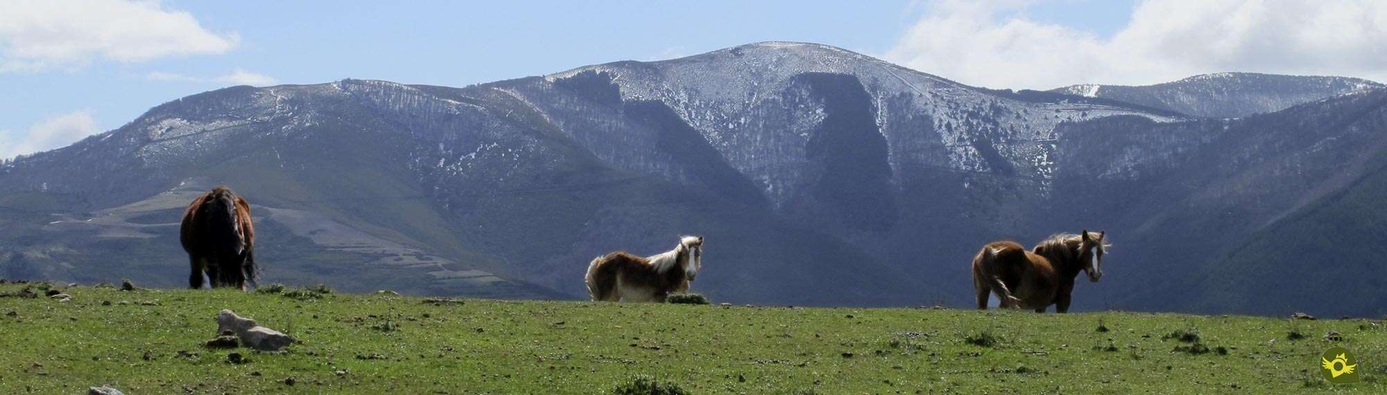
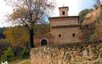
Anguiano, Tobía and Matute, three towns that have been united for centuries, beyond administrative or economic structures, by their people, their mountains and forests that have shaped traditions and customs forged by the spectacular landscapes that surround them. Landscapes, forest and mountains through which the Route of Three Villas runs, uniting nature, culture and history, signs of identity of these lands.

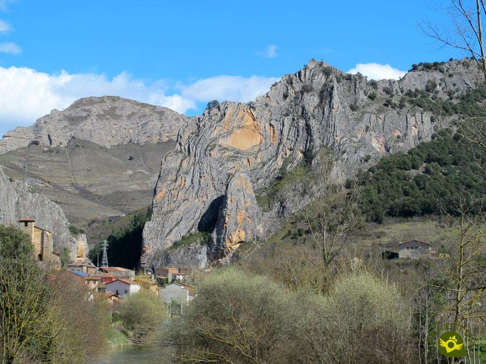
The route, with 19.8 km, could well start in any of these three villages. Anguiano seems to be the chosen starting point to fully immerse ourselves in this impressive tour. Anguiano is a town with three neighbourhoods, two of which are visited in this Route of Three Villas, the neighbourhood of Mediavilla and after crossing the famous Bridge of Mother of God, the neighbourhood of The Caves where the church of San Pedro awaits us, next to which the route takes us through. This is an area par excellence for trekking routes in La Rioja. In our first steps we will coincide with the GR 93, which crosses La Rioja from west to east, with the Route of Rocks, which also belongs to the Routes between Beech Forests, such as the one we are dealing with today, or the Path of the Chestnut Tree of the Nisia, which brings us closer to this unique tree in La Rioja, which is just over 400 years old. But our route quickly forces us to say goodbye to such pleasant company in order to go in search of the bank of the Najerilla River, which in its medium-high course bathes these lands. We left Anguiano not without first taking a look at its well-kept washing place, a sign of the activity that has taken place here for years. We walked aware of the road ahead and the rewarding effort it will take us to travel it. This effort is beginning to be noticed as we pass by the old hydroelectric power station. We then start a laborious ascent through the dense forest of holm oaks that surround us with their shade. On our way, we come across old corrals such as the one in Umbria, the remains of ancient work carried out in these mountains.

The ascent is long, but the reward is well worth the effort. Cervanco Pass gives us unbeatable views of both sides of the mountain. We are also at a new crossroads where the Route of Saint Quiles and the Route of Valvanera converge with ours. The Rigüelo ravine and its stream await us down the mountain, and towards it we continue to embark on a dizzying descent, enlivened by the cliffs of Peñalba and the silhouette of the Sierra of La Demanda. Once again, we are surprised by the dense beech forest, following the course of the stream just before it plunges down the ravine. In this section an alternative route awaits us, the Tres Villas variant, which allows us to shorten the route considerably and enjoy the beech forest we are walking through even more. The original route continues towards Peñalba, which precedes the pass of Londeras, or La Castillo as it is also known. From here, through the Entrepuerta ravine and under the watchful eye of the Tobía Rock, we descend to the valley of the river that bears his name. There Tobía and its church of Our Lady of the Angels await us, without forgetting its Oak of the Eleven, another imposing tree unique to La Rioja and just over 300 years old, a symbol of this town. From Tobía and in the company of the GR 93 we head towards the nearby Matute, which we reach after cooling our feet in the Tobía River. As soon as we enter this noble town, samples of its important history come to light, emblazoned houses, authentic Indian palaces next to its church of San Román make us forget for a moment the kilometres already covered. But the route reclaims its protagonism, partly shared now with other routes such as the Path of the Jump of the Water and the Route of Saint Quiles that replace the GR 93 of which we say goodbye for the moment. We will approach again the Rigüelo stream, just when it escapes from the rocks that enclosed it, to, saying goodbye to the Path of the Jump of the Water that runs through it, start a new and intense ascent that will return us to the mountains that we had abandoned for a moment.

The Londeperro sheepfold is the point where we must say goodbye to the San Quiles Route, which continues its ascent towards the summit of San Quirico and where we are joined by the route that follows the Tres Villas By-pass from La Cubilla, while we cut its slope through the colourful beech forest that populates it. The beech forest, as if by magic, leaves us in the middle of Clock Rock massif, a symbolic peak closely linked to the village of Anguiano, which we can see again at the bottom of the valley towards which we set our course. A quick descent awaits us, which will bring us closer to the Ayanatón Meadows, where we will again find the Route of Rocks, with which we will share a short stretch before it sets out towards the Cave of Nuño, or, if we so wish, follow its other slope to head towards the Chestnut Tree of the Nisia. Our route continues its descent with a view to the Najerilla valley towards which we are heading, but before that, an old acquaintance returns to share the journey. The GR 93 will accompany us in this last stretch that separates us from Anguiano, where this Route of Three Villas ends after crossing the Mother of God Bridge again.
Ancient legends say that around Peñalba and the Tobía Rocks, on foggy days, dark spirits hide and take advantage of the impunity granted by the poor visibility to grab all those who dare to leave the roads and paths and take them with them to the depths of the ravines where they will never be able to leave again.
The municipality of Anguiano is reached by following the LR-113 that links Nájera with the Burgos town of Salas de los Infantes. This same road, in Nájera, connects with the A-12, Autovía del Camino and with the N-120, between Burgos and Logroño. There is also an extensive schedule of intercity buses that connect Anguiano with both Nájera and Logroño. Once there, on the road that crosses the town, at the exit of Anguiano towards Monasterio de Valvanera, we will find a parking area where we can leave our vehicle.
This route is quite demanding for our friend both for its mileage and for its total slope, so it is important that he is used to this kind of routes.
A trekking route of this type requires more than ever that we carry enough water and food without leaving it to chance to locate water points, which although we will pass them are quite far from each other.
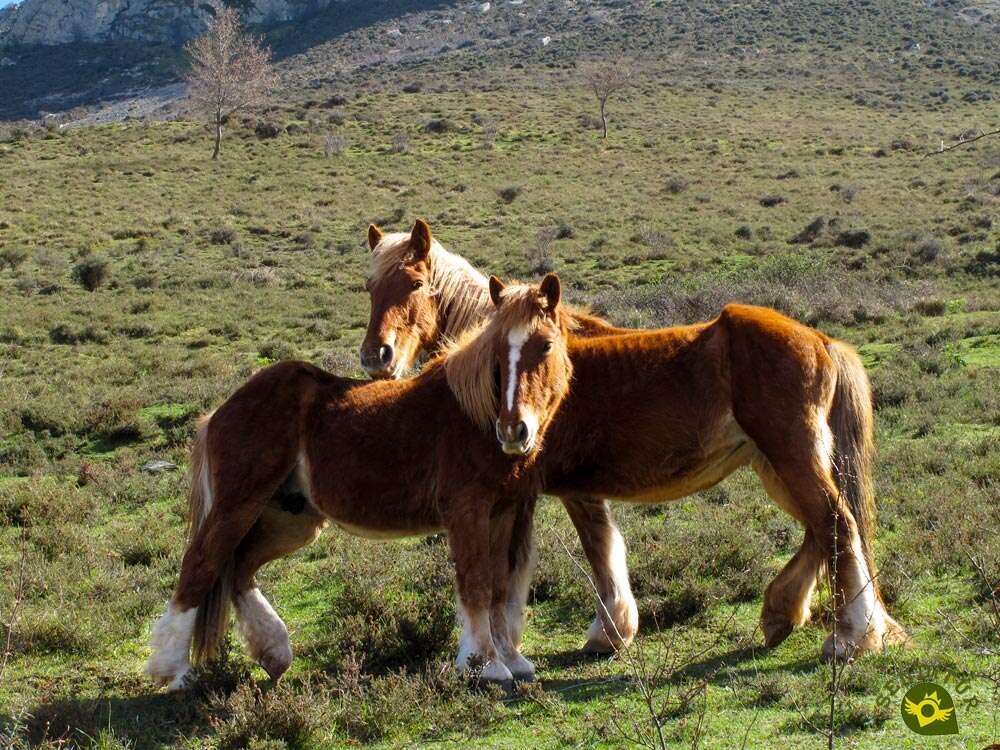
Cattle, horses, cows and sheep are common in these lands to which we must add a few dogs, especially in Tobia, will come out to draw attention to our path. The native fauna is also very abundant and varied, but it is somewhat more difficult to see, except for the birds.
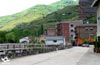
The Route of Three Villas begins next to the information panels of the Routes between Beech Forests that we have located in the parking that is in the road that crosses Anguiano (0h 00min), just at the exit of the town as we go towards the Monastery of Valvanera.

At the foot of the vertical rock that marks the road, we find the beginning of the street we must follow.

This street, through which we will later return, leads us directly to the crossing of the Mother of God Bridge. As soon as we cross it we will leave on our right the path by which the GR 93 arrives at Anguiano and our route once it is completed.

We continue without deviating, for now, leaving another street on our left to ascend towards the church of the Caves Neighborhood that we are visiting.

In this itinerary, in which we constantly follow the main street, we will also be accompanied by the Route of Rocks, which follows this same route on its arrival at Anguiano.

A short time later, just before our street narrows and a new ramp begins, we must continue along the street on the left, saying goodbye to the Route of Rocks and the Path that leads to the Chestnut Tree of the Nisia, a unique tree in La Rioja, from where those who wish to visit it will have the opportunity to take the Route of Three Villas by following the signposted footpath that will take them back to it without having to retrace their steps.

Our route continues through the streets of this Anguiano neighborhood in search of the nearby river. Soon the same houses of the town force us to turn again and now we are heading for the outskirts of the town.

We left Anguiano behind as we followed a perfect paved track that runs alongside the Najerilla River. This track leads us without any major complications to the encounter with the power station, upstream.

When we reach its height, we will begin the hard climb that awaits us. Quickly our track changes its perfect firmness, prelude of the stony road that awaits us.

The slope already makes it clear from the first moment the effort it will take to reach Cervanco.

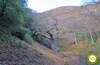
Shortly after passing by a lonely house, it was time to leave the road and go into the mountainside.

As soon as we take the detour, we will leave behind a first trail and, now, we will fully enter the ascent through the interior of the forest.

The decomposed trail makes us gain height not without effort, protected from the sun by the surrounding vegetation.

Our trail zigzags through the mountain looking to lower the slope and making us leave behind one or another trails.

The winding course of our trail leads us to the meeting of the path that reaches us from the Chestnut tree of the Nisia. We continue the hard ascent completely surrounded by the vegetation that also delimits our path.

The footpath we are following continues to make us change direction, although with longer stretches between each turn. There are several trails that we are leaving aside while we continue to gain height with each step.
.jpg "Better down the trail.")
On rare occasions these trails are only shortcuts or momentary detours that rejoin our path.

After a while we arrived at a clearing where the ruins of an old corral are located. Quickly and after having been able to contemplate for a moment the landscape around us, we go back into the forest to continue the ascent.

The stony trail doesn't stop trying to gain height quickly, not even giving us a moment's respite. We continue cutting the mountain side hidden from the sun by the surrounding vegetation.

From time to time the trees allow us to observe the mountains we are crossing and the valley we are climbing. The trail seems to have smoothed out its slope if only by a few meters.

After a while, we saved a small stream that runs downhill and warns us of the beginning of the final stretch of the ascent.

The trail seems to disappear among the vegetation, but if we look closely we will soon see its continuation.

We are facing a new steep slope where, at first, our trail is not so marked, forcing us to be attentive to the marks of the route.

The thickness of the vegetation has been giving way with each step, indicating the proximity of the end of the ascent. But we still have a stony ramp waiting for us that demands a new effort.

The height gained rewards us with beautiful panoramic views, giving good account of the energy spent.

The slope is smoothed out shortly before we reach the Cervanco Pass (2h 00min).

Here, apart from recovering our strength, it is also the point of union with the Route of Valvanera and the Route of Saint Quiles, which allow us to change route and get closer to some of these emblematic places.

Once we have recovered our breath, we begin the dizzying descent down the opposite slope to the one we have just climbed.

This time we see ourselves following a steep track that almost makes us happy to have reached the pass where we did.

As it could not be otherwise our track describes the typical curves in search of mitigating part of the unevenness that would otherwise have.

There are not many roads or crossroads that we encounter, yet in all of them it is very clear which way to go.

After a few turns and bends our track begins to lose its inclination, leaving us to enjoy the beautiful landscape it runs through.

In this section we will be accompanied by the stream that flows down the valley. The perfect state of the track we are on allows us to advance with a certain speed.

Shortly before leaving the beech forest we find ourselves at the crossroads with the starting point of the Tres Villas By-pass which, if we follow it, will take us to the Londeperro pass, just where the San Quiles route turns off, thus avoiding many kilometres. We continue along the track and almost without realizing it, we are deprived of the protection offered by the trees and at the same time we can contemplate the colossal rocks that we are crossing.

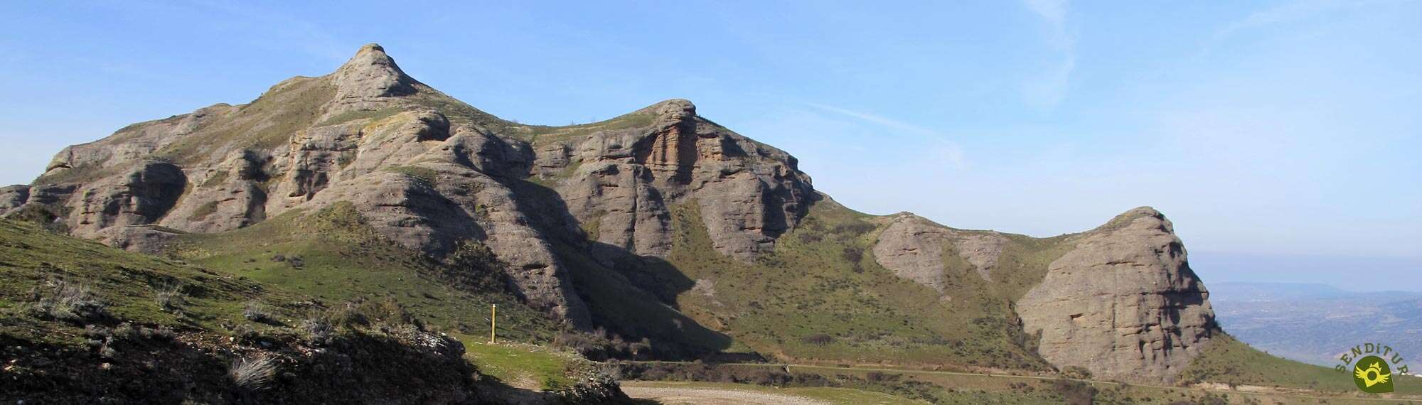
Peñalba watches us from above as we cut through its hillside following the path that guides us.

After a while we left the narrow footpath that still leads to the Monastery of Valvanera. Again we have to face a new climb that becomes a little harder than expected.

The imposing rocks of Tobía bring us closer with every step while we observe the deep ravines on our right, where we can also see part of the hard climb that awaits us a few kilometers ahead.

Just before we get ready to pass by the side of the rocks in front of us, the time has come to abandon the road we have been taking for so long, to start the final descent to Tobia.

We walk through a green meadow that quickly shows us the ravine where we have to descend.

We advance a few meters in search of the post that, a little further down on our left, marks the beginning of the footpath we must follow. Initially the route seems to want to make us go around Peñalba, the rock under which the road made us pass a while ago.

But nothing could be further from the truth because when it seems that it will make us start gaining height, the trail forks allowing us to continue with the descent.

Descenso que cada vez más evidentemente busca llevarnos a pasar entre las peñas que jalonan la barranquera que estamos bajando.A descent that more and more evidently seeks to take us past the rocks that mark the ravine we are descending.

A solitary tree marks the moment when the route finally plunges to the bottom of the valley.

Now without a clearly marked footpath, our reference, apart from the marks of the Route of Three Villas, is the gorge through which the valley seeks to leave the rocks that surround it.

Further down, the paths drilled by the animals that inhabit this place return. We continue the descent without any further complications than looking for the best route of the many that accompany us. A new valley opens up before us, towards which we seem to be heading.

We have to be attentive and not follow paths that take us out of the correct route without taking us anywhere and making us retrace our steps to recover the correct itinerary.

Near the end of the descent, we will have to go through a couple of gates that prevent the animals from passing. After the second barrier we have a few meters left to reach the end of the descent.

In front of us we find the road we must continue on. This asphalted track takes us quickly to the vicinity of the village we are about to visit.

The road will be in charge of guiding us through Tobia (3h 30min).
We follow the course of the road until shortly after passing the square where the town hall is located, we reach a fountain. Here we leave the main street to descend in search of the river we crossed earlier.

As soon as we cross it, a beautiful path starts on our right that practically makes us retrace our steps. A little further on we leave the pediment to one side to begin a steep ascent.

The ascent becomes less steep as we meet the path that we must follow and that once again sets us on the right course towards Matute. A little further on we will be forced to ford the stream, usually dry, that we had already crossed while following the conditioned path bordering Tobía.

The marks of the route make us cut through the mountainside, allowing us to contemplate the unmistakable Eleven Oaks at the top. There are several stream beds that we cross as we border Tobía, gradually leaving it behind us.

There are not many paths that we will come across and the markings remind us of the right path, without letting us lose the height we have gained for the moment. The imposing crags that rise up to our right watch us as we walk along this part of the route.

After a while and after crossing a new stream, we will begin the descent that will take us to the road that joins Tobía with Matute. We can already see the road on our left as we walk through a pine forest.

Almost without noticing it, we see a few metres further down the beginning of the dirt track to which we should head. We reach this path after a quick descent and continue along it.

The path forces us to make a new effort until we reach the turn-off that we must follow. All that remains is to follow the course of the main track, which leads us effortlessly and quickly to the gates of the town.

We walk through Matute down its streets in search of the square that houses the church. Once there, on our right, in the centre of Matute (4h 00min), we can see the signs informing us of the different routes that start from here or that pass through here, as is the case with our route.

From the square itself we find the beginning of the Main Street along which we will follow, leaving behind the church and the information signs of the itineraries available to us.

In this part of the route, the Route of Saint Quiles, the Path of the Jump of the Water and the Route of Three Villas coincide.

We quickly leave the main street to begin the ascent that will take us out of Matute following the marks, which in duplicate, indicate the itinerary.

With no more detours, Orive Street is in charge of guiding us through the town. The houses are giving way and soon we will be surprised by the abrupt landscape ahead of us.

We left Matute behind to continue our gentle ascent, now along a wide dirt track that takes us past a cattle fence.

Shortly after leaving this fence, in the middle of the curve, we leave the track we are on to start a fast descent that makes us lose the height gained.

The path we descend gives way to a conditioned trail with steps that takes us to the bottom of the valley.

At the end of this area of stairs the route continues up the ravine following the course marked by a small irrigation ditch. The Rigüelo stream accompanies us for a few metres while we go into the colossal rocks that rise above our heads.

We crossed a wooden gate and shortly afterwards we crossed the creek and walked the last few meters where we coincided with the stream.

As soon as we get out to a small clearing, our tour turns around, saying goodbye to the Path of the Jump of the Water, to begin the real ascent to Saint Quiles. A craggy footpath leads us quickly to a wide sheepfold.

As soon as we arrive, on our right we see the poles that force us to climb up the meadow to take the shoulder of the mountain.

We continue to gain height quickly while enjoying the spectacular landscape around us.

The trail we are on leads us to some lonely rocks that we saw on the left side of the mountain when we left Matute. We bordered this rock on the left to continue the ascent.

In this part of the route we move forward between the shoulder of the mountain on our right and a metal fence on the left.

The trail, somewhat blurred in some areas, is divided into more than one occasion forcing us to be attentive to the marks of the route to avoid being misled or making unnecessary efforts.

We advance along the hillside, as the fence separates from us with every step. Some lonely holm oaks on the shoulder of the mountain serve us as a reference in case of doubt, since the path continues its upward course leaving them on our right.

The slope, already less demanding, and the slightly more marked path give us a break that allows us to recover the necessary strength for the next hard climb that awaits us.

We arrive at the pass of La Pala, where several paths meet. Here we go up the few meters that separate us from the shoulder of the mountain.

Ahead of us lies a tough and steep stretch where we will continue to gain height. The decomposed trail leads us to a lonely holm oak to skirt a first hill.

Almost at the moment we will have to abandon the marked footpath we are on in order to go to the summit of a second hill and gain the shoulder of the mountain again.

This stretch, full of more or less marked trails, continues to make us gain height not without effort. Once we have overcome this stony obstacle, the route continues to take us to a large sheepfold.

In front of us we can already see the tree line marking and the post marking the Detour San Quiles (5h 00min), the point where the San Quiles Route and the Tres Villas Route separate and where the Tres Villas Variant also arrives from La Cubilla.

While the Route of Saint Quiles continues almost straight up to the beech forest, ours turns to the left and reduces the slope and leaving the route of the Tres Villas variant to the right.

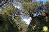
The route is prepared to cut the hillside of the mountain without going into the beech forest for the time being. Although this one, does not delay in taking possession of the land and wrapping us with its colorful embrace.

The trail we are following seeks to make its way through the trees, struggling with the leaf litter that hides its layout on many occasions.

We are facing a long stretch in which we will have to be alert to the marks in order to avoid misdirection. The roots of the trees next to the stones, in both cases hidden under the leaves, make it difficult for us to advance, making us progress a little more slowly than normal.

Luckily, on rare occasions, we will be able to enjoy small clearings where we can contemplate the landscape that the beech forest hides from us.

It is not surprising that from time to time, because of the leaf litter, we find ourselves in doubt as to which path we should follow.

The humidity, which is so necessary in a beech forest, means that mud is another of the usual protagonists of this part of the route.

After a while the dark forest seems to give way to the sun trying to make its way through the branches. In front of us we can already sense the limits of the beech forest towards which we are heading.

A wide meadow opens up before us, marking the beginning of the long descent to Anguiano.

Here the route is blurred, making it difficult to resume its course, if we continue straight as we have left the beech forest we will encounter the post that indicates the beginning of the new footpath.

A trail that will force us to turn around, and if we do not start to descend the mountainside, it almost makes us retrace our steps.

Before our eyes, a beautiful picture is shown next to the line that draws the route we are about to follow and that crosses a stony hillside.

We descend a few meters to a small esplanade where the route forks. On the left is the old footpath, a little more exposed to the ravine we are descending and probably more likely to be a little muddy.

While on the right we have a new trail, with plenty of loose stone, which crosses the stony hillside to join the old trail a little further down.

We follow the descent along the new trail, more direct than the old one, with our eyes set on the valley in front of us, to reach the junction of both trails, where we see that the old trail has seen how the debris of the new one cuts its route, forcing those who follow it to save them.

We continue the descent leaving behind the access to what looks like old corrals. We can already see the next crossroads we have to go through.

The footpath loses its inclination as we approach the Ayanatón Meadow (5h 35min), where we will join the Route of Rocks.
In this place we have the option of following the Route of Rocks to visit the Chestnut tree of the Nisia and from there to go down to Anguiano, or to continue with our Route of Three Villas.

We therefore continue with the descent, sharing the road for the time being with the Route of Rocks.

Once again, the slope becomes more noticeable and the road we are going through begins to draw the typical curves to minimize it. We quickly approach another of the crossroads of the Routes between Beech Forests.

On the next terrace we reach the detour to Cave Nuño (5h 45min), as the Route of Rocks continues from here to this mythical cave.
We continue with the path that winds through the mountain looking for the best places for the descent.

This part of the route, although well signposted and with a well-defined trail, forces us to be careful as there are several trails that we will encounter.

The route continues to lose altitude with each step as it leads to its end. Anguiano closer and closer seems to be watching us as we approach.

The trail is now smoothly leading to a reunion with an old friend. The GR 93 is again our companion in the last meters of this route.

We headed for the narrow bridge we passed at the beginning of the day.

When we reach it, we only have to cross it to go to the road where we started the route.

Anguiano (6h 05min) is the starting and ending point chosen for this Route of Three Villas.
 Distance. 19.8Km
We can shorten this figure by taking advantage of the variant of Three Villages.
 Time. 6:05h
How we face the first kilometers of the route will surely depend on whether the end takes longer than expected, since the ascent from Matute to the Saint Quiles detour is quite demanding and, if we arrive fairly, we may be choked more than expected. For the rest, and unless we vary the route in some of the crossings we pass, it should not take us much longer than the marked one.
 Time of year
This is a route that has many attractions throughout the year that encourage us to travel, but the autumn and spring give us an extra as a colorful landscape. In summer, at the mercy of the sun, a large part of the route may be harder than expected. With snow, the beauty of the area increases at the same time as the difficulty of the route and the time it will take us to complete it. Attention also with rain, fog or bad weather, it is much easier to get lost and the times to get to each place increase a lot.
 Required equipment
Due to its characteristics, this route obliges us, as it should not be otherwise, to equip ourselves correctly. Food, drink, map, compass and GPS that help us to follow the route or know where we are if necessary, warm and waterproof clothing, walking sticks, protection against the sun, first aid kit, a headlamp, objects that we should always carry in our backpack. It can also be a good idea to wear long trousers, to avoid rubbing against grass, branches and bushes. A pair of trekking boots will surely give us the comfort and stability that this route requires. Of course, we should not miss the photo camera, as well as we should always adapt our clothes and equipment to the time of year when we do the route. Consult our list of material and equipment for hiking. Read more.
 Difficulty. Remarkable
Physical
The distance and the positive slope, accumulated almost entirely at the beginning and at the end of the route, make it a demanding route, reserved for people used to long walks in the mountains. On the other hand, the many options for modifying the route that are presented to us, allow us to adapt the itinerary to the characteristics of each one, taking into account the particularities of the section that results from the variation, since this can become even harder, instead of simpler. The heat in summer will undoubtedly increase the demands of this, on the other hand interesting route, that if we take it with the necessary pause should not create too many problems, provided we are used to it.
Severity of the environment
Stony trails, sometimes muddy paths, tracks in quite good condition and sheepfolds covered by green grass is the terrain through which this Route of Three Villas passes. Therefore, as long as we don't go off the track, we don't have to worry about anything but avoiding slips and trips that could make us fall. Even so, we must not forget that we are travelling through a mountainous area with deep ravines and vertical rocks where there may be landslides or some animal may throw a stone at us if it is on the slope above us.
Orientation
Generally well signposted, it is the great amount of options we find along the way that may make us hesitate, especially when we arrive at Anguiano, where there is room for several routes that all end in this town. Also in the interior of the woods we will cross, we may find that the leaves or the vegetation make it difficult to follow the path, forcing us to scrutinize the land in search of the marks of the route. The sections of sheepfold, where the path blurs under the grass, are another point where we will have to sharpen our eyes to follow the course from mark to mark.
 |
 |
 |
 |
 |
| 1-Anguiano | 0:00h | 644m | 0Km | 30T 519270 4678620 |
| 2-Detour Chestnut tree of La Nisia | 0:10h | 635m | 0.6Km | 30T 518739 4678559 |
| 3-Cervanco Pass | 2:00h | 1225m | 5.1Km | 30T 515713 4679439 |
| 4-Tobía | 3:30h | 680m | 11.1Km | 30T 515258 4682898 |
| 5-Matute | 4:00h | 682m | 13.1Km | 30T 516884 4682913 |
| 6-Detour Saint Quiles | 5:00h | 1005m | 15.7Km | 30T 517186 4681002 |
| 7-Ayanatón Meadow | 5:35h | 867m | 17.9Km | 30T 518520 4679467 |
| 8-Detour Cave Nuño | 5:45h | 799m | 18.5Km | 30T 518747 4679434 |
| 9-Anguiano | 6:05h | 644m | 19.8Km | 30T 519270 4678620 |
Coordinates UTM Datum WGS84

 Slope: 2664m
 Slope +: 1332m
 Slope -: 1332m
 Maximum altitude: 1225m
 Minimum altitude: 635m

This sketch of the route is not made to scale nor does it contain all the information relating to the area, it is merely indicative.

![]()
This schematic with the path is approximate and has been created from the derived cartographic base © Instituto Geográfico Nacional "Cuadrante 241-1, 1:25.000"
Senditur has manipulated the tracks to correct the aberrant points that may exist, caused by problems with the reception of the GPS signal. In any case the tracks are always approximate. SENDITUR encourages you to use the new technologies within your reach, using them as support and consultation in your activity, not basing the realization and orientation of the same only and exclusively on them, since they may see their functioning altered by very diverse causes, not functioning correctly and their indications may not be precise.


Sendero algo exigente pero como muchos atractivos (Cervanco, Peñalba, Peña Tobía, Peña Reló) y que además partiendo desde Anguiano pasa por los casos urbanos de Tóbia y Matute.


Bonito recorrido, merece la pena el esfuerzo.

Location of the Virgin of Valvanera, Patron Saint of La Rioja

Cradle of the Castilian and pantheon of the seven Castilian heroes

¿Did you know that...
Both the Oak of the Eleven and Clock Rock, thanks to its location, have been used for years to determine the time of day. The Oak of the Eleven is so called because it is at that time when the sun hits the top of its branches. While Clock Rock is a real sundial, whose shadow, at the foot of the cliff, marks the time perfectly throughout the year.
Don't miss out...
The flora and fauna that this route treasures. Impressive beech forests, oaks, holm oaks, pines, white willows, are among others within its varied flora and as far as the fauna is concerned you can find from deer and roe deer to golden eagles, peregrine falcons, it is worth mentioning the colony of griffon vultures in the area of Peñalva and the Pyrenean Desman, unique in the area.


.jpg)

From the commitment of SENDITUR with Nature and the respect to the balance of the environment, SENDITUR urges you to travel in a responsible way, with low environmental impact and respecting at all times the Natural, Cultural and Social environment wherever you go.

Besides sharing with all of us your experience on the route we would be grateful if you could write to us to inform us of any erroneous or outdated information you may have found, or simply to let us know what you think at Thank you.
This route has been carried out in the field by SENDITUR on 17-04-2016. The route may vary greatly depending on the time of year, weather conditions and terrain, as well as the actions of third parties and the evolution suffered in the natural environment where it is located. All opinions, advice and/or assessments made by SENDITUR in their descriptions are for guidance only and are subject to and/or refer to the specific conditions of the specific day of the route, referring to that specific day, taken from trained people, with the appropriate experience and with a high level of physical and technical preparation as a reference, as well as correctly equipped.
All the times are approximate and take an orientative character, the stops have not been taken into account, no matter how small they are. All the information related to the route, texts, images, videos, maps, diagrams, tracks, towns, and places of tourist interest are published as a guide, and may not coincide with the current state of each place. Before undertaking any activity, assess your technical knowledge, your physical condition, find out about the weather and the variations that the route may undergo, equip yourself correctly, be prudent and responsible at all times, and do not exceed your capabilities. SENDITUR is not responsible for any misuse or inappropriate use of the comprehensive guides of its routes and/or publications as well as its electronic guides, nor for any variations in their descriptions for the aforementioned reasons, and recommends that everyone be responsible and prudent in carrying out the activity. We also encourage you to read books and specialised guides to complement the information described above.
Continue watching …