Welcome to SENDITUR.COM · paths · routes · tourism


Stage 06 Los Arcos-Logroño
The last steps of the Way through Navarrese lands
![]() Difficulty-Moderate
Difficulty-Moderate
![]() 6:55 h.
6:55 h.
![]() 27.4 km.
27.4 km.
The last steps of the Way through Navarrese lands
![]() Difficulty-Moderate
Difficulty-Moderate
![]() 6:55 h.
6:55 h.
![]() 27.4 km.
27.4 km.
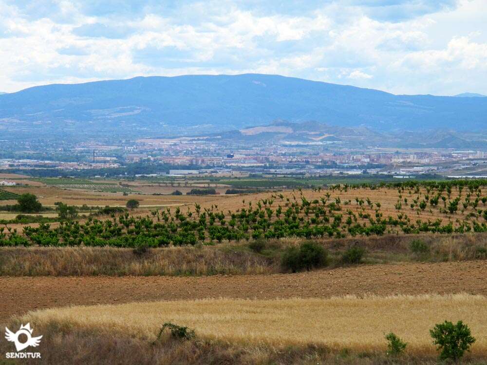
From the river Odrón to the river Ebro, the Way of Saint James descends from Los Arcos to the valley, going through twisted ravines between rounded hills, to reach the second great city through which the pilgrim passes, Logroño. A landscape that changes little by little and that allows us to contemplate the wide valley of the Ebro flanked by Sierra Cantabria to our right, with the solitary mount Joar, also known as Codés. The places that await us in the next stages can already be sensed from one of the balconies to the valley through which we will pass.

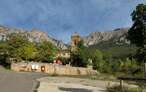
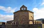
The first steps of this stage 6 Los Arcos-Logroño del Camino Francés de 27.4 Km remind us of the previous day. After leaving Los Arcos through the Puerta de Castilla, which delimits the locality, and crossing the river, we find ourselves again with the landscape that the previous day brought us here. The tower of the church of San Zolio of the seventeenth century, serves as a guide to reach Sansol, where begins the uncomfortable climb up and down that accompanied us to Viana. The nearby Torres del Río is our next stop where the singular church of the Holy Sepulchre built in the 12th century awaits us and whose octagonal plan fits into a small corner of the locality.

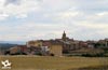
From here another strong slide takes us to the Romanesque hermitage of the Virgen del Poyo, at the top of the same name, and whose image, according to legend, returned to this place every time it was taken away by those of Viana. The Way continues with its undulating course to offer us a magnificent panoramic view of the Ebro valley and the next locality of the day and to begin the soft final descent to this one. Viana, welcomes us with its well-kept historic quarter, where the palaces that house the rich history that this town has are interspersed, in the Plaza de los Fueros, next to the baroque town hall, is the Ex-colegiata de Santa María de los siglos XIII y XVIII. Viana says goodbye to us between orchards to give way to the sanctuary of Nuestra Señora de las Cuevas, from the 17th century, an unbeatable place to rest and refresh ourselves on hot days.

The nearby wetland of the Las Cañas reservoir, a natural reserve, home to herons and martinetes among other birds, marks the border between Navarre and La Rioja. Our entrance to Rioja is by going up Mount Cantabria, where the vineyards on its slopes join the archaeological remains found on its wide summit. Once overtaken by its side this hill, we are shown a beautiful view of the city, where the needles of the towers of its churches stand out, which characterize its silhouette. The entrance of the French Way in Logroño surprises us crossing the Stone Bridge, it takes us to Rúa Vieja street and to cross its corners where they wait for us for example, the Walls of the Revellín, the co-cathedral of Santa María de la Redonda or the church of Santiago el Real among others, and it allows us to enjoy the character of its people.
At the entrance of Viana instead of entering it we can continue along the road and Solona Street, bordering the town until the meeting of the school, where we continue along the path, thus saving 1.5 km approximately. Although the visit to Viana is highly advisable for its beauty and history.
Complicated stage for our friends, to the distance of the same we have to add the long stretches by road, with what it supposes.
We will only find water points as we pass through the towns, as well as a couple of fountains, one between Torres del Río and Viana, and another in the hermitage of the Virgen de la Cuevas.
The most complicated area is before reaching Logroño, in the descent through Monte Cantabria, where there are a few guard dogs, with some margin in their ties, in the houses located at the edge of the asphalted track along which our path runs.
We start at the Plaza de Santa María de Los Arcos (0h 00min), next to the beautiful church that gives it its name, just leave the old town by the Portal de Castilla cross the NA-129 and the bridge over the river Odrón to continue straight along the street Jacobean Route.

Climbing up this street we are definitely leaving Los Arcos, the road goes up the gentle slope, to meet the national road and continue near it by a dirt track in good condition.

Shortly after passing a power station we find a crossroads and a small recreational area.

Continuing straight and leaving the road on our left for the moment, the path continues to move away from it between vineyards and cereal farms by comfortable terrain until you reach a small building where we must leave the wide road to continue turning right along a path that avoids us to go through the angular drawing it makes.

At the end of this short and wide path we are facing the path which, leaving left and right other options, we must continue. This new route, with something worse firm, continues, crossing the characteristic landscape to which a few olive trees are added, snaking between the hills that come out at our step and crossing a small stream we arrive until the stretch of road that turning to the left leads us to our next objective.

This long and narrow stretch of road, just before reaching Sansol, is shortened by a path, when it exists, between a grain farm and we avoid going through the wide curve of it, going out again a little further to reach Sansol (1h 40min).

Following the course of the road we cross this locality arriving at the height of the national one, where a pedestrian crossing allows us to cross to the other side, since the way continues by a walkway that begins next to the bus stop located in this margin of the roadway, to descend parallel to the road.

A few metres from this path, in the middle of a curve, the Way deviates to the left along a dirt track. After a few steps, turn right again and, bordering the wall of a house, go down a conditioned path.

In front of us the next locality of the day, to which we arrived after going down a kind of ravine that passes under a local road and crossing the river Linares we entered Torres del Río (1h 50min), following the east street to the church of Sepulcro.

When we reach this striking church, we continue climbing up the main street without leaving the steep rúa until we reach the Way of Saint James street, where we leave Torres el Río for good.

This first part of the road is conditioned to make it easier for us to progress on the long but gentle slope to the cemetery where it is once again the typical dirt road to which we are already accustomed.

From here begins the section that will take us, in constant ascent and descent, to cross ravines and hills. We continue our march along the dirt track descending towards the Balsero ravine, crossing some path that we leave behind us to continue straight ahead.

We see how the road approaches us as soon as it goes away again, to look for us again in the middle of a curve, as if it were locating the best place to cross it.

Just in this curve, in which it seems that we will have to cross the road, begins a andadero that, parallel to the national one, goes up the steepness that we have in front of us, to arrive at the exact point where, now yes, we have to cross to the other side of the road.

We continue along the dirt track that takes us to the Virgen del Pollo hermitage (2h 50min) but not before crossing a path that comes from the nearby road.

From the hermitage we start the descent again along the path that gradually loses its width until it becomes a path that ends in the national one that we must, for safety reasons, cross again as unfortunately our route runs a stretch through it, in the middle of a zone of curves.

Although we have to cross again a little further on, it is on this side where we can take advantage of a small path at the edge of the road that practically avoids us to walk along this road with hardly any hard shoulder.

Shortly afterwards we reach the height of the path that begins on the opposite bank, crossing the national we begin a hard but relatively short climb on a track not in very good condition, until we come back to another road where, turning left, we continue along the path that has formed to its side.

A few steps away, we cross to the other side and take the path to the right of the two who start at the same place.

This rugged way crosses a similar landscape of hills and ravines, leaving behind us all the access tracks to the nearby estates we find, saving the forks that it draws forced by the orography of the land thanks to paths that, well defined, cut it, avoiding us to cross the whole layout.

Following parallel to the nearby national road, which is located on our left, the path goes up the hill that separates us from the next objective of the day, until we reach the point where we are forced to cross it again, to continue along a path between vineyards, again find it at the top of the hill.

From here we alternate sections in which we have no choice but to go along the non-existent shoulder of the national road, or along the narrow path next to it, or along the edge of nearby farms if the crops permit.

We arrive at the beginning of a path that descends shortening one of the curves that the road makes, so that when it turns sharply away from it, continue along a path that follows the marked course of the road until it meets it again.

The way, until being with a hidden andadero to the edge of the highway, runs by the national highway.

This path, before reaching the town, gradually separates from the road, becoming a track that takes us to the industrial area of the town, where we cross it again and go down Calle el Cristo and, without deviating, enter the town.

This street comes up against an old defensive wall that forces you to border it by going out to the entrance door to the historic centre, as soon as you cross it on the left hand side you will find the narrow street that takes you to the Plaza del Coso where the Rúa Santa María begins, which crosses Viana (5h 00min), passing through its most emblematic places.

Following the course of this street we pass by the ruined church of San Pedro and leave the walled area through one of the gates of the enclosure.

Shortly after leaving the walled area, the route turns sharply to the left, continuing down the street that descends rapidly from the two that continue in the same direction.

We leave this street turning to the right in the second one that we find, continuing the descent until arriving at a square in front of the school of Viana, a pedestrian crossing facilitates the crossing to us to continue by the street that by the right descends bordering the enclosure of the schools.

Following the wall of the school and leaving on the right the street that continues next to the single-family houses in the area, the path continues between recreation estates and orchards until it reaches the height of a regional road that we have to cross as the path continues to the other side.

Shortly after encountering this road, the path approaches the national road again, avoiding this new crossroads by following the asphalted track that continues parallel to it and which, after leaving a couple of paths on the right, crosses the national road crossing it underneath and continuing on the other side.

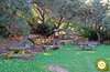
This narrow route at the edge of the road soon reaches the asphalted track that will lead us to the hermitage of the Virgen de las Cuevas (5h 40min). We arrive at the hermitage among more and more vineyard fields, turning off along the path which, after a first detour and just before an industrial pavilion, starts on the right, leaving the apparently main path to reach this place where, apart from the hermitage, there is a recreational area with a fountain.

As soon as you leave the hermitage enclosure behind, the path divides into three, and you must continue along the dirt track in the centre, leaving the asphalted road on the left and the dirt track bordering the hermitage. Shortly after starting this path, you will come across another one that crosses it.

Turning to the right we must continue along it, going through a somewhat arid area, until we reach a pine grove, on our right, where the itinerary is introduced leaving the main path that continues straight.

Crossing this shadowy pine forest we reach a modern wooden footbridge that allows us to cross again to the other side of the national one and continue along the wide pine forest path to the other side of the road, arriving at some industrial pavilions next to which the road passes, and where the entrance to the Autonomous Community of La Rioja is located.

From this moment on, the asphalted road passes through an industrial estate, crossing several times under the different communication routes and ascending step by step, leaving to the right and left all the roads that leave our path, the hill known as Monte Cantabria, which separates us from the view of nearby Logroño.

Having left the industrial area behind, escorted by the vineyards and with our sights set on the town, we start the descent that, passing by orchards, recreational estates and private cellars, takes us to the banks of the river Ebro. The riverbank we reach right after arriving at the cemetery, where a pedestrian crossing makes it easier for us to cross the road that stands between it and us.

We go up the course of the river by the beautiful park of the pilgrim towards the Bridge of Stone by which we cross the Ebro, to the beginning of this bridge is the office of information to the pilgrim.

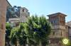
This bridge takes us directly to the old part of the city that we enter by the street Rúa Vieja, which is the second street on the right that we find when we cross the bridge, this street takes us to go through part of the historic quarter of Logroño (7h 00min), where this stage ends.

 Distance. 27,4Km
Our destination in Logroño will mark the total distance to be covered.
 Time. 6:55h
The time without stops can be shortened about 15 min if we do not enter Viana, but we will miss a beautiful town in addition to assuming the risk of walking on the National.
 Time of year
In summer, the hig:temperatures, wit:hardly any shady areas, will force us to be attentive to the water we carry, especially in the stretc:from Torres del Río to Viana, the longest between localities.
 Required equipment
Clothes and footwear according to the time of the year and to the meteorology, backpack, canteen wit:water and canes. Except for some stretc:between Torres del Río and Viana, the good condition of most of the route allows the stage to be carried out wit:the most comfortable footwear, except during rainy periods. You can not miss cap, sunglasses and sunscreen. Consult our list of material and equipment to make the Way. Read more
 Difficulty. Moderate
Physical
This stage is complicated not only because of the distance, whic:is considerable, but also because of the continuous saw teet:that go as far as Viana. The Way crosses the ravines and the hills throug:whic:it passes. To this we have to add the intense heat and the scarcity of shade that hardens it even more.
Caution
Wit:several sections by road the stage is somewhat exposed, in the first part we have a couple of kilometers by a local road that will take us to Sansol and that usually does not have muc:traffic. Afterwards, there are several junctions wit:the national road that, althoug:signposted, are still dangerous due to the sinuous layout of the road and the traffic that it still supports. After passing the hermitage of the Virgen del Poyo we will have to walk a short stretc:on the road, many reckless pilgrims continue on the right lane to avoid crossing to the other side. Since shortly after, we must cross again, as the access to the next andadero is in the same hand to whic:we arrived from the chapel. It is an area of curves wit:hardly any visibility and no hard shoulders, whic:has a small pat:next to the road on its left side, whic:will partly avoid us circulating on the national road. The last section of road is before the arrival to Viana that is made by the non-existent verge of the national one, to the entrance of the locality to cross it. The terrain presents us wit:intense descents that if it has rained may be slippery.
Orientation
It is in our passage throug:the localities where we will have more doubts, althoug:signposted is somewhat complicated to see some of these signs. The final part has suffered some modification but the way is clear and well defined. On our arrival in Logroño it is usual, althoug:it is signposted, to pass by the first bridge, the Piedra bridge, whic:gives access to the city and where the route continues to exit at a roundabout where on our right, between two buildings we will see Calle Rúa Vieja where the Way enters Logroño.
 |
 |
 |
 |
 |
| 1-Los Arcos | 0:00h | 445m | 0Km | 30T 566263 4713279 |
| 2-Sansol | 1:40h | 492m | 6.8Km | 30T 560247 4711522 |
| 3-Torres del Río | 1:50h | 462m | 7.6Km | 30T 559824 4711328 |
| 4-Hermitage of the Virgen del Poyo | 2:50h | 563m | 10.2Km | 30T 557702 4710180 |
| 5-Viana | 5:00h | 470m | 18.1Km | 30T 551609 4707148 |
| 6-Hermitage of the Virgen de las Cuevas | 5:40h | 394m | 21Km | 30T 550217 4705193 |
| 7-Logroño | 6:55h | 380m | 27.4Km | 30T 545586 4701904 |
Coordinates UTM Datum WGS84

 Slope: 953m
 Slope +: 443m
 Slope -: 510m
 Maximum altitude: 575m
 Minimum altitude: 380m

This sketc:of the route is not made to scale nor does it contain all the information relating to the area, it is merely indicative.

![]()
This schematic wit:the pat:is approximate and has been created from the derived cartographic base © Instituto Geográfico Nacional "Cuadrantes 171 y 204 1:50.000".
Senditur has manipulated the tracks to correct the aberrant points that may exist, caused by problems wit:the reception of the GPS signal. In any case the tracks are always approximate. SENDITUR encourages you to use the new technologies within your reach, using them as support and consultation in your activity, not basing the realization and orientation of the same only and exclusively on them, since they may see their functioning altered by very diverse causes, not functioning correctly and their indications may not be precise.


Que calor pasamos en esta etapa!!


Find out what to see in...
¿Did you know that...
It is believed that the military circumscription of the city of Curnonium, cited by Ptolemy in his Iberian Geography, was located in Los Arcos.
Don't miss out...
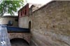
The Church of the Holy Sepulchre in Torres del Río is a 12th century Romanesque construction that stands out for its octagonal plan and caliphal vault with eight arches.


From the commitment of SENDITUR with Nature and the respect to the balance of the environment, SENDITUR urges you to travel in a responsible way, with low environmental impact and respecting at all times the Natural, Cultural and Social environment wherever you go.

Besides sharing with all of us your experience on the route we would be grateful if you could write to us to inform us of any erroneous or outdated information you may have found, or simply to let us know what you think at Thank you.
This route has been carried out in the field by SENDITUR on 16-09-2018. The route may vary greatly depending on the time of year, weather conditions and terrain, as well as the actions of third parties and the evolution suffered in the natural environment where it is located. All opinions, advice and/or assessments made by SENDITUR in their descriptions are for guidance only and are subject to and/or refer to the specific conditions of the specific day of the route, referring to that specific day, taken from trained people, with the appropriate experience and with a high level of physical and technical preparation as a reference, as well as correctly equipped.
All the times are approximate and take an orientative character, the stops have not been taken into account, no matter how small they are. All the information related to the route, texts, images, videos, maps, diagrams, tracks, towns, and places of tourist interest are published as a guide, and may not coincide with the current state of each place. Before undertaking any activity, assess your technical knowledge, your physical condition, find out about the weather and the variations that the route may undergo, equip yourself correctly, be prudent and responsible at all times, and do not exceed your capabilities. SENDITUR is not responsible for any misuse or inappropriate use of the comprehensive guides of its routes and/or publications as well as its electronic guides, nor for any variations in their descriptions for the aforementioned reasons, and recommends that everyone be responsible and prudent in carrying out the activity. We also encourage you to read books and specialised guides to complement the information described above.
Continue watching …


 Previous: Stage 5 Cirauqui-Los Arcos
 Next: Stage 7 Logroño-Nájera


.jpg "Go to House of Sciences")
.jpg "Go to Clavijo Castle")