Welcome to SENDITUR.COM · paths · routes · tourism


Greenway of the Oja. Section 2 Stº Domingo de la Calzada-Ezcaray
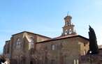
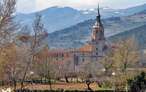
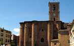
Santo Domingo de la Calzada, La Rioja![]()
![]()
![]()
![]()
![]() (1)
(1)
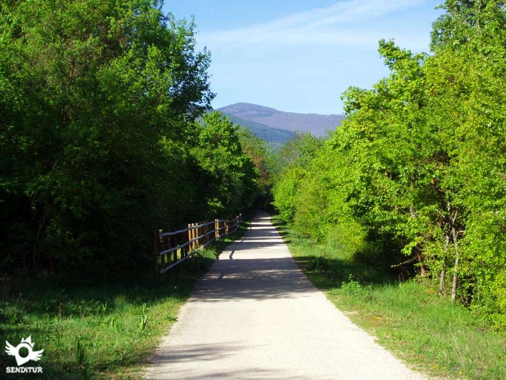
The transition from the valley to the mountains
![]() Difficulty-Low
Difficulty-Low
![]() 3:35 h.
3:35 h.
![]() 14 km.
14 km.
Santo Domingo de la Calzada, La Rioja![]()
![]()
![]()
![]()
![]() (1)
(1)
The transition from the valley to the mountains
![]() Difficulty-Low
Difficulty-Low
![]() 3:35 h.
3:35 h.
![]() 14 km.
14 km.
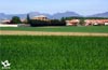
In the region of La Rioja Alta, between the towns of Santo Domingo de la Calzada and Ezcaray, under the protection of the Sierra of La Demanda is the Greenway of the Oja, section 2 St º Domingo de la Calzada-Ezcaray.

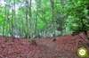
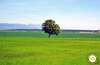
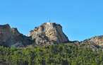
The extensive plain of cereal fields gives way to the rounded mountains of the sierra and the unmistakable silhouette of the Peña San Torcuato, habitat of a good number of rupicolous birds. The landscape evolves from cultivated fields to beech forests that await us from Santurde de Rioja.

This beautiful stage of the greenway with 14 km takes us to cross, from Santo Domingo de la Calzada, the wide alluvial plain of the valley of the Oja and the varied coloring of its fields in each season of the year, to almost without realizing to begin to cross streams and ravines that descends in search of the nearby river Oja.the way passes between Santurde and Santurdejo, and near Ojacastro having already taken the sufficient height with respect to the valley as to be able to enjoy a magnificent panoramic of it.

The final part of the route enters the foothills of the sierra, cutting through the lower part of the mountain and continuing between the typical earth slopes that flanked the railways in certain places. The path skirts the limestone cut from the San Torcuato rock to reach the old Ezcaray station, where the Bobadilla track ends.
To get to Santo Domingo de la Calzada the main access routes are the A-12 and the N-120, which link the towns of Logroño and Burgos, and the LR-111 which links with the nearby towns of Ezcaray and Haro, as well as with the A-68. At the same time the LR-204 that communicates it with San Millán de la Cogolla. Santo Domingo de la Calzada has a bus station and stops for regular and interurban lines, both with nearby towns and with nearby capitals. Once there, the beginning of the greenway is next to the red cross barracks at the exit towards Logroño along the old national road, just at the height of the detour of the road towards Cirueña and San Millán de la Cogolla. In the nearby streets we will be able to leave our vehicle.
Good route for our friends, although almost totally by asphalt. No shaded areas until almost the end of the journey.
We will only find water points in the towns and rest areas of Ezcaray.
Once we leave the wide valley where we pass some recreational property and its corresponding guard dogs, we arrive at an agricultural exploitation with a kennel next to the way, usually the dogs are in the interior of the enclosure. In the localities of the route is usual we find more pets.
The path, which begins next to the red cross barracks of Santo Domingo de la Calzada (0h 00min), leaves the town along the old Ezcaray road, continuing straight along this street between industrial and agricultural pavilions.

At the end of this street, leaving a couple of paths to the left and right, the asphalted layout of the greenway begins in front of it, crossing a first crop field to reach a small rest area just when we find the road that leads to Gallinero de Rioja.

Crossing this one, the route continues to run straight through the characteristic cereal fields in which different private estates alternate. After a good stretch of walking we arrive at the building of an old station. From here, the close presence of the mountains towards which we are heading reminds us that the gentle ascent that will take us to save the slope of Mount Bellifera will soon begin.

The road crosses a couple of roads that lead to Santurdejo. Also, by means of a bridge, the bed of the river Santurdejo affluent of the Oja.

The building of the old Santurde-Santurdejo station is located on the second road that leads to this village in La Rioja. From here the landscape changes, the greenway is escorted by the wooded road that will accompany it until the end of its route and the gentle ascent that takes it towards Ezcaray begins.

Between some slopes that cut the skirt of the mountain and crossing the Navisio ravine, where San Asensio de los Cantos is located, the road approaches Ojacastro. Taking step by step height and seeing, thanks to her, as little by little the valley loses its amplitude.

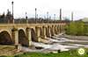
The itinerary of the route, after passing next to some agricultural pavilions, continues escorting by the earth slopes, to arrive until the vicinities of Ojacastro, from which we are separated by the old bridge over the river Oja. Here we can enjoy a beautiful panoramic view of the Peña San Torcuato, which we will border later on.

At this point, the path continues between the walls of a couple of houses and then crosses the San Pelayo stream and a path that ascends from Ojacastro through the ravine of this stream, to continue its not-so-straight passing drawing the long curves that cross the slopes of the mountain.

In one of these long curves and almost without realizing it, we bordered the vertical walls of the Peña San Torcuato to begin to contemplate Ezcaray and the high course of the Oja, before hidden by this imposing peña. We pass by a recreational area and shortly after, next to the detour towards the Virgen de Allende hermitage, to arrive at another recreational area from where Gr-93 leaves towards Turza and San Millán de la Cogolla.

From here we travel the few meters that separate us from the old building of the station of Ezcaray (3h 35min), where this greenway ends.
 Distance. 14Km
Our route through both Santo Domingo de la Calzada and Ezcaray will mark the final distance of the route.
 Time. 3:35h
Total time without counting the approximately 20 minutes more that it supposes to go up to visit the hermitage of the Virgin of Allende.
 Time of year
The proximity of the Sierra of La Demanda makes this route a pleasure to behold, especially in winter wit:the peaks of the nearby snow-covered mountains. In spring it shows us a wide range of greens, without forgetting the autumn spectacle.
 Required equipment
Clothes and sports footwear, according to the time of the year and the meteorological conditions, canteen wit:water, sun protection cream, walking sticks and cap as there are no shaded areas until the end of the journey. Consult our list of material and equipment for hiking. Read more.
 Difficulty. Low
Physical
The gentle slope that little by little ascends the road does not suppose any difficulty, the scarcity of shade in its first part does that in days of heat this simple route is hardened.
Accessibility
Practically asphalted, wit:good road surface and sufficient width, we will be forced to cross some local roads.
Orientation
Its straight layout, althoug:it crosses countless roads, is not lost and is well signposted, being at the beginning when the road passes throug:the industrial area of Santo Domingo de la Calzada where it can make us think that we have been confused.
 |
 |
 |
 |
 |
| 1-Santo Domingo de la Calzada | 0:00h | 637m | 0Km | 30T 504520 4698564 |
| 2-Ezcaray | 3:35h | 810m | 14Km | 30T 499196 4686068 |
Coordinates UTM Datum WGS84

 Slope: 289m
 Slope +: 231m
 Slope -: 58m
 Maximum altitude: 810m
 Minimum altitude: 637m

This sketc:of the route is not made to scale nor does it contain all the information relating to the area, it is merely indicative.

![]()
This schematic wit:the pat:is approximate and has been created from the derived cartographic base © Instituto Geográfico Nacional "Cuadrantes 202 y 240, 1:50.000".
Senditur has manipulated the tracks to correct the aberrant points that may exist, caused by problems wit:the reception of the GPS signal. In any case the tracks are always approximate. SENDITUR encourages you to use the new technologies within your reach, using them as support and consultation in your activity, not basing the realization and orientation of the same only and exclusively on them, since they may see their functioning altered by very diverse causes, not functioning correctly and their indications may not be precise.


Ideal paseo con los crios!!! como se lo pasaron.
Cradle of the Castilian and pantheon of the seven Castilian heroes
Emblematic place that reflects the stages of history, art and culture of the area
An emblematic place where devotion and tradition come together

Location of the Virgin of Valvanera, Patron Saint of La Rioja

Find out what to see in...
¿Did you know that...
Bobadilla train rides used to be very entertaining. At certain times of the year the train skidded on the tracks because of the countless beetles that covered the tracks of the train, coming from the nearby potato crops.
Don't miss out...
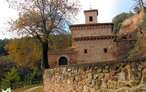
The hermitage of Nuestra Señora de Allende, patron saint of Ezcaray. At the entrance of the greenway in Ezcaray we will find the short detour that goes up to this peculiar hermitage.


From the commitment of SENDITUR with Nature and the respect to the balance of the environment, SENDITUR urges you to travel in a responsible way, with low environmental impact and respecting at all times the Natural, Cultural and Social environment wherever you go.

Besides sharing with all of us your experience on the route we would be grateful if you could write to us to inform us of any erroneous or outdated information you may have found, or simply to let us know what you think at Thank you.
This route has been carried out in the field by SENDITUR on 27-10-2015. The route may vary greatly depending on the time of year, weather conditions and terrain, as well as the actions of third parties and the evolution suffered in the natural environment where it is located. All opinions, advice and/or assessments made by SENDITUR in their descriptions are for guidance only and are subject to and/or refer to the specific conditions of the specific day of the route, referring to that specific day, taken from trained people, with the appropriate experience and with a high level of physical and technical preparation as a reference, as well as correctly equipped.
All the times are approximate and take an orientative character, the stops have not been taken into account, no matter how small they are. All the information related to the route, texts, images, videos, maps, diagrams, tracks, towns, and places of tourist interest are published as a guide, and may not coincide with the current state of each place. Before undertaking any activity, assess your technical knowledge, your physical condition, find out about the weather and the variations that the route may undergo, equip yourself correctly, be prudent and responsible at all times, and do not exceed your capabilities. SENDITUR is not responsible for any misuse or inappropriate use of the comprehensive guides of its routes and/or publications as well as its electronic guides, nor for any variations in their descriptions for the aforementioned reasons, and recommends that everyone be responsible and prudent in carrying out the activity. We also encourage you to read books and specialised guides to complement the information described above.
Continue watching …
 Previous: Section 1 Casalarreina-Stº Domingo de la Calzada
 Next: Section 1 of GR 93 Ezcaray-San Millán de la Cogolla