Welcome to SENDITUR.COM · paths · routes · tourism


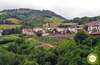
River Walk of the Arga Section of the Magdalena
A river full of history and character
![]() Difficulty-Medium
Difficulty-Medium
![]() 2:45 h.
2:45 h.
![]() 11.6 km.
11.6 km.
A river full of history and character
![]() Difficulty-Medium
Difficulty-Medium
![]() 2:45 h.
2:45 h.
![]() 11.6 km.
11.6 km.
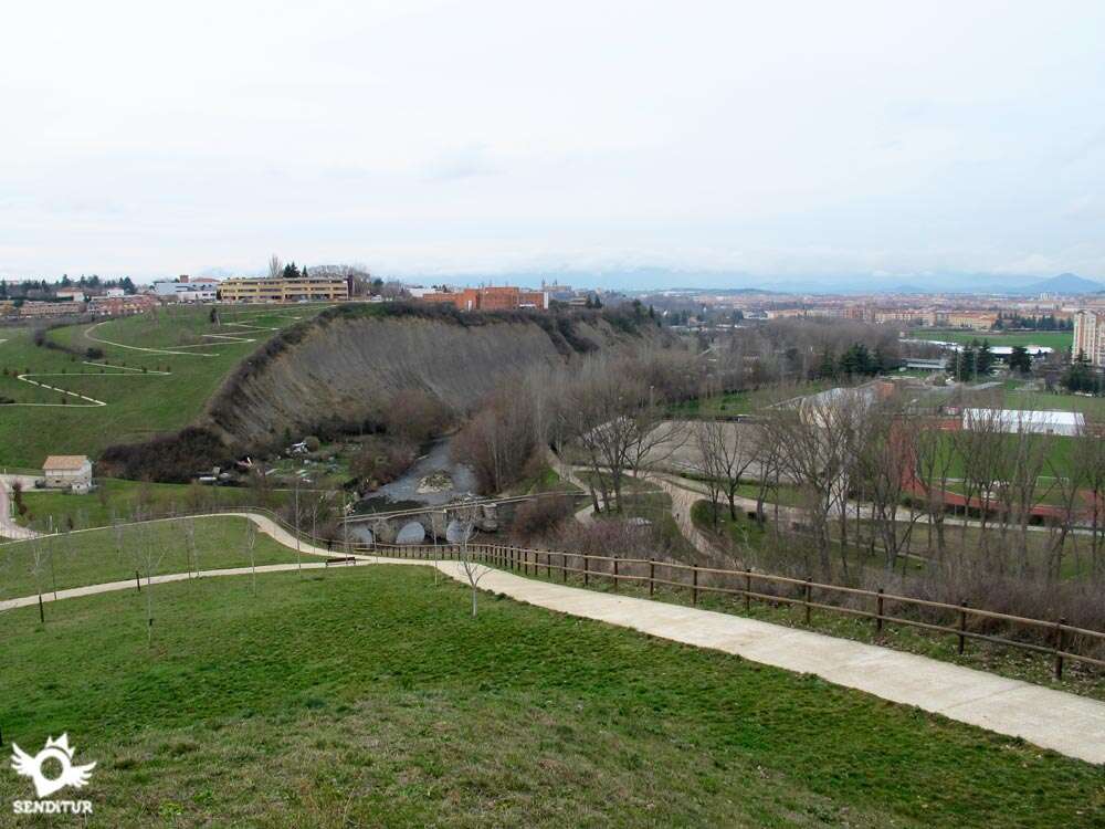
The river Arga from its origins in the Forests of Quinto Real until its mouth in the river Aragón, shortly before arriving at the Ebro, crosses from north to south the Navarras lands forming part of them at the same time that it leaves its mark there where it passes. Historical and cultural footprint that are added to the natural one whose importance does not leave any doubt. Footprints that we can discover and enjoy along the River Walk of the Arga in its section of the Bridge of the Magdalena.

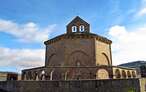
The route, with 11.6 km, begins in the recreational area of Iturgaiz Bridge, also known as the Bridge of Irotz which, built there in the twelfth century under the protection of the French Way of St. James, has seen the passage of countless pilgrims on their way to the tomb of the apostle. This bridge is the starting point, or end depending on how you look at it, of this River Walk of the Arga, which brings us quickly to the foothills of Zabaldika where, if we deviate, awaits us its church of San Esteban of the thirteenth century, that to its almost unalterable original architecture we have to add the real treasures that it keeps inside, such as its mythical bells. The river and these lands have been and are closely linked to the Way of Saint James and at each step we will find signs of this union. Although both routes separate when reaching the recreational area of Zabaldika, one heading towards Trinidad de Arre and the other following the course of the river, there will be several times when they will meet again, to the point that there are not a few pilgrims who choose the river walk as their official Way to Pamplona. The river, in its course through the Esteribar valley and more specifically as it passes through these lands, draws a whimsical riverbed that has given rise to fertile meanders where different towns have settled.

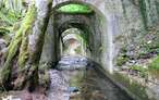
Localities such as Huarte have taken advantage of their resources to see industries linked to the river flourish, such as the timber industry that used the riverbed to transport valleys under the large trunks of the lush forests of the Navarrese Pyrenees. Mills such as Atea, Atondoa or La Peña, together with the network of strategically located dams, have allowed man to take advantage of the strength of the river for his own benefit. But this fluvial stroll of the Arga is something more than all that, the nature also knows how to take advantage of the resources of the river giving an unbeatable home to a nourished number of different animal and vegetable species that find around the Arga everything that they need. In Huarte there are several historic bridges that cross the river communicating both banks, bridges such as Artadiburua or Calvario and Dorraburu Bridge whose medieval origin tells the long history that was forged around the river. The river that bids farewell to Huarte and at the same time enters Villava, it twins with the river Ulzama. This is where the Molino de San Andrés is located, a hydraulic complex that for years has used the strength of the river first to grind wheat or corn and then to generate power as a hydroelectric plant. Not far from here is the Batán de Villava, which next to the Molino de San Andrés shows us today with its exhibitions and interpretation centers the importance that the river had in the lives of the people who lived here.

From here we only have a pleasant walk along the banks of the Arga that will take us to visit Burlada de soslayo, where the French Way of Saint James will greet us again for a moment. A route that will allow us to contemplate the silhouette of Pamplona, its slender cathedral and its defensive line like imposing walls. Not before stopping for a moment at the bend where the Caparroso Mill is located, today a brand-new sailing club. Or venture into the well-known footbridge that crosses the zigzagging Arga, before heading in search of the end of this stretch. Once again, the river makes clear its important communion with the Way of Saint James when we meet it again shortly before reaching the Bridge of La Magdalena, through which the Way of Saint James enters Pamplona. Here the point is put and followed to this Fluvial Stroll of the Arga that extends along the course of the river to its passage by Pamplona arriving even until well surpassed the city.
If you decide to go up to the viewpoint of Erripagaña, you don't need to go back on your steps because once up you can go down the other slope until you reach the next bridge that communicates with the River Walk, you can do this regardless of the direction in which you are traveling the route.
As far as Irotz we arrive following the N-135 between Pamplona-Iruña and Roncesvalles-Orreaga, turning off shortly after crossing Zabaldika, as we come from Pamplona, along the road that goes up to our right towards this town and almost at the moment we find the recreational area of the Bridge of Irotz where we can leave our vehicle. We also have a bus service from Monday to Saturday, which makes the journey Pamplona-Roncesvalles, with a stop in Zabaldika, another service is Pamplona-Zubiri-Eugui, this one from Monday to Friday.
Ideal walk to accustom our friend to the walks and the countryside. We could classify it as an urban footpath, with its advantages and disadvantages like the cement in all its layout. The fluvial park has stipulated a series of norms among which is the necessity to take the tied up mascots.
The water is almost guaranteed and not by the presence of a river to which it is not advisable that we let our companion enter, in the few places where he could arrive to do it, but by the recreational zones in which we will find points of water or the localities to which we can approach to obtain what we need.
The presence of pets is also habitual in this Fluvial Walk of the Arga, to which we have to add the dogs that guard the lands next to those that we will pass. In addition it is not strange to find with the fauna that inhabits in the bank of the river.
The recreational area of Iturgaiz Bridge (0h 00min) or Irotz Bridge as it is also known is the starting point of this River Walk of the Arga corresponding to the section that will take us to the Bridge of the Magdalena.

Leaving to our right the footpath by where the Way of Santiago Francés transits, which will be something more than our companion of route, we follow the conditioned way that runs following the descending course of the river Arga.

River that undoubtedly is the undisputed protagonist of this route. This comfortable route takes us quickly to the vicinity of Zabaldika, without getting close enough to walk its streets.

At this point there are many pilgrims who join us because for a short period of time we will coincide with the official route of the French Way of Saint James. We follow the cement track, which makes us leave behind the nearby town, heading towards the next recreational area through which we will pass.

Before reaching it, thanks to the tunnel that avoids us crossing the road, we will pass to its other side where, now, the Zabaldika recreational area awaits us.

Here we will say goodbye to the pilgrims who follow the official Way away from the river. Our route, as soon as we reach the area, turns round to the left and follows for a few meters the road leading to the area, making us cross the river Arga.

As soon as you cross the road, just before you see yourself in the middle of the road, the cement track begins again on your right, and you have to continue along it.

This route chosen by some pilgrims, especially cyclists, resumes the course of the river following its whimsical course. This stretch plays with us, taking us away from the road for a moment and then coming back to it.

The perfect cement track gives way to a dirt road which we will climb in search of the road again.

When we reach its height we will find a typical crossing of the Way of Saint James and the resumption of the cement track that we have to follow. The vegetation of the riverbank accompanies us on our walk, while alternating fields and pavilions on our left.

Once again the road approaches us, this time to say goodbye definitively as we head towards Huarte. The meanders drawn by the river have been used for crop fields that have given way to industrial pavilions next to which we pass.

A small milestone indicates our next arrival in Huarte, although we will have to cross the river again.

Shortly after passing this milestone we reach the height of the bridge over which we will cross the Arga to cross the other bank of the meander where Huarte sits.

From this point onwards, the urban areas next to the magnificent riverside orchards take on a greater role in the route. The route continues for now without separating from the river that continues to serve as a perfect guide.

Whenever the river allows it, we save the street that enters the town, passing through one of the eyes of the bridge on which it is supported.

This area delights us with a pleasant walk between the Arga and the orchards that take advantage of its fertile banks.

The perfect track leads us without complications, not letting us doubt at any time the right course to follow.

The wide curve drawn by the river, which we always carry to our left, at least for now, forces us to travel almost from side to side the limits of Huarte.

We leave behind some houses to head towards a sports complex that we have to pass, following at all times the marked layout of the cement track we arrived on.

The route takes us around this complex, taking us to a new pass under another street where we will continue.

Shortly after passing under this street we arrive at a bifurcation where our itinerary crosses the river again, bidding farewell to the town of Huarte. This area, a little further away from the river, cuts this new meander in which we find ourselves.

The route crosses the street that leads to one of the old bridges that cross the Arga to follow its unalterable course between orchards and fields.

This section takes us back to a new bridge where we will cross again to the other side of the river, which still runs separate from us.

The itinerary now passes through an urbanization in search of entering the term of Villava. This long street takes us without detours between the parcels that compose this urbanization.

A while later, when our street seems to come to an end, the route deviates to the left towards another of the old bridges over the Arga.

Although shortly before arriving at it it deviates once again, to descend in search of the underpass that allows us to cross the road that a moment ago cut the street we were passing.

As soon as we leave this pass we will see in front of us the Mill of San Andrés (1h 45min) towards which we are heading.

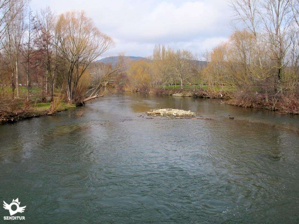
After enjoying this historical place we will continue our march that will take us to cross a new bridge, just at the same time that the Ulzama river joins with the Arga.

Together the two rivers, we are preparing to travel the river park that runs along its shore. This quiet stretch continues at all times, leaving the nearby river to its left, without leaving any room for doubt.

Those who wish to do so will have the chance to take a small detour to cross a new bridge and climb to a spectacular lookout point from which they can contemplate the arrival of the Arga River Promenade in Pamplona, a promenade that they can take up again later.

The rest of us will not leave the careful walk dotted with small rest areas where you can enjoy the environment that surrounds us.

We left behind the bridge where those who went up to the viewpoint returned to continue the course marked by the conditioned walk. Once again we have to pass under another road, this time the one that leads to Burlada.

This town encourages us to visit it, but the route barely touches it.

The itinerary meets the French Way of Saint James again for a moment, before saying goodbye to it and returning in search of the river.

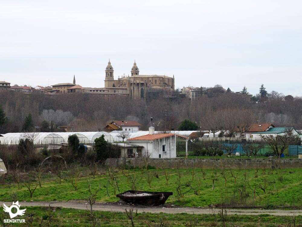
In front of us we have the final part of the River Walk of the Arga in its section of the Bridge of the Magdalena. Section in which we will not separate from the Arga at any time.

The proximity of the capital means that there are several roads or crossroads that we will come across. In all of them the itinerary continues without detours heading towards the next objective we have to pass.

The silhouette of Pamplona has been with us for some time now as we continue to explore recreational areas that alternate with orchard plots. The Caparroso Mill (2h 40min) shows us the proximity of the end of this route at the same time that allows us to enjoy the beautiful corner where it is located.

The walk that brought us here ends with the park that precedes the Magdalena Bridge.

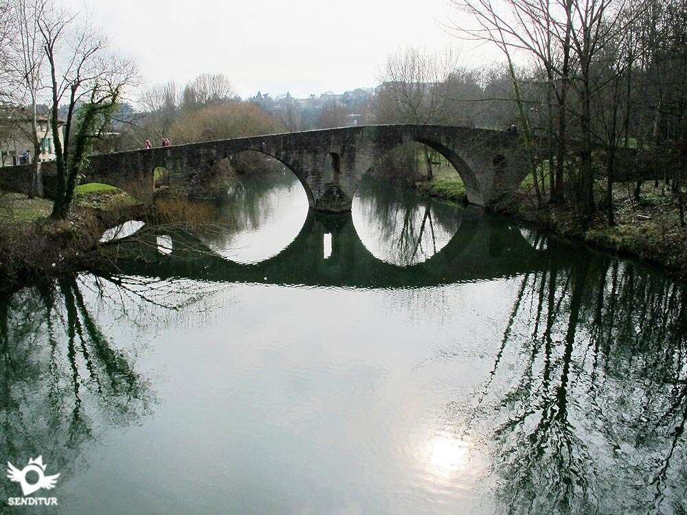
Shortly before reaching this historic bridge, the gateway to Pamplona, we will once again join the route of the French Way of Saint James that crosses the Bridge of La Magdalena (2h 45min) on its way to the centre of Pamplona.

Here, the River Walk of the Arga stops and continues along its route, which continues without crossing the Arga, following its course through Pamplona.
 Distance. 11,6Km
The route offers different alternatives that undoubtedly make this figure change depending on our itinerary.
 Time. 2:45h
If we decide to take the detour that ascends to the lookout point, it will take us a little longer to make the route, not because of the difference in distance, which is almost minimal, but because of the slope that we will have to bridge, which will require a greater effort and will undoubtedly affect the total time of the route.
 Time of year
Without a doubt it is a route to be able to enjoy it all the year, only we will have to inform us of its situation and to be careful when the Arga goes down grown since we do not stop transiting next to the bank of a river with zones that can be floodable.
 Required equipment
Being a practically urban route, with a firm in perfect condition and well-conditioned, even with public toilets, does not require at least initially and in normal conditions anything special beyond conditioning our clothes and footwear to the time of year in which we travel. Even so, it is not superfluous to carry some water just in case and protection against the sun that cannot be missing whenever we go for a walk. The camera is undoubtedly another good idea since we will know beautiful corners and part of the history of this area and its people. Consult our list of material and equipment for hiking. Read more.
 Difficulty. Medium
Physical
Initially only the mileage could represent a problem for someone who is not accustomed to walking, as the slope is virtually non-existent or even negative, as long as we do not climb to the lookout whose ramps are of entity.
Caution
We will have to be attentive to the bicycles that transit by this stroll since they are usually numerous. For the rest, and in normal conditions, we are in front of a perfectly conditioned route that hardly touches areas where we are near the traffic and that saves by means of bridges or tunnels the crossroads of highways.
Orientation
Well signposted, it is the perfect state of the route that will most guide us in our walk. In fact they are enough the signs with which we will be finding when coinciding several walks or ramales with ours, this, next to the marks of the Way of Santiago, can make us doubt in some occasion but to good sure the course of the river and our common sense will solve these doubts.
 |
 |
 |
 |
 |
| 1-Iturgaiz Bridge | 0:00h | 462m | 0Km | 30T 616450 4746256 |
| 2-San Andrés Mill | 1:45h | 421m | 7.4Km | 30T 614060 4742776 |
| 3-Caparroso Mill | 2:40h | 416m | 11.1Km | 30T 611541 4741412 |
| 4-Magdalena Bridge | 2:45h | 416m | 11.6Km | 30T 611365 4741854 |
Coordinates UTM Datum WGS84

 Slope: 224m
 Slope +: 89m
 Slope -: 135m
 Maximum altitude: 462m
 Minimum altitude: 416m

This sketch of the route is not made to scale nor does it contain all the information relating to the area, it is merely indicative.

![]()
This schematic with the path is approximate and has been created from the derived cartographic base © Instituto Geográfico Nacional "Cuadrante 141-2 y 115-4, 1:25.000"
Senditur has manipulated the tracks to correct the aberrant points that may exist, caused by problems with the reception of the GPS signal. In any case the tracks are always approximate. SENDITUR encourages you to use the new technologies within your reach, using them as support and consultation in your activity, not basing the realization and orientation of the same only and exclusively on them, since they may see their functioning altered by very diverse causes, not functioning correctly and their indications may not be precise.
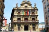
A milestone in the economic history of Navarre and Spain in the 18th century


Pilgrimage destination in honour of the patron saint of Navarre, Saint Francis Xavier

Find out what to see in...
¿Did you know that...
The Mill of San Andrés dates from 1541 and maintained its activity until well into the twentieth century. In addition, a short distance from it joins the French Way and the Baztan Way that runs through this beautiful region of Navarre.
Don't miss out...
The panoramic view that can be enjoyed from the top of the hill where the viewpoint of Erripagaña is located and that can glimpse, almost in its entirety, the layout of the River Walk as well as the silhouette of Pamplona and its cathedral.


From the commitment of SENDITUR with Nature and the respect to the balance of the environment, SENDITUR urges you to travel in a responsible way, with low environmental impact and respecting at all times the Natural, Cultural and Social environment wherever you go.

Besides sharing with all of us your experience on the route we would be grateful if you could write to us to inform us of any erroneous or outdated information you may have found, or simply to let us know what you think at Thank you.
This route has been carried out in the field by SENDITUR on 27-03-2016. The route may vary greatly depending on the time of year, weather conditions and terrain, as well as the actions of third parties and the evolution suffered in the natural environment where it is located. All opinions, advice and/or assessments made by SENDITUR in their descriptions are for guidance only and are subject to and/or refer to the specific conditions of the specific day of the route, referring to that specific day, taken from trained people, with the appropriate experience and with a high level of physical and technical preparation as a reference, as well as correctly equipped.
All the times are approximate and take an orientative character, the stops have not been taken into account, no matter how small they are. All the information related to the route, texts, images, videos, maps, diagrams, tracks, towns, and places of tourist interest are published as a guide, and may not coincide with the current state of each place. Before undertaking any activity, assess your technical knowledge, your physical condition, find out about the weather and the variations that the route may undergo, equip yourself correctly, be prudent and responsible at all times, and do not exceed your capabilities. SENDITUR is not responsible for any misuse or inappropriate use of the comprehensive guides of its routes and/or publications as well as its electronic guides, nor for any variations in their descriptions for the aforementioned reasons, and recommends that everyone be responsible and prudent in carrying out the activity. We also encourage you to read books and specialised guides to complement the information described above.
Continue watching …