Welcome to SENDITUR.COM · paths · routes · tourism

Stage 05 Pola de Allande-La Mesa
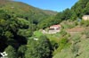
Pola de Allande, Principado de Asturias![]()
![]()
![]()
![]()
![]() (1)
(1)
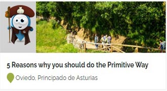
The queen stage of the Primitive Way
![]() Difficulty-Remarkable
Difficulty-Remarkable
![]() 6:10 h.
6:10 h.
![]() 22 km.
22 km.
Pola de Allande, Principado de Asturias![]()
![]()
![]()
![]()
![]() (1)
(1)
The queen stage of the Primitive Way
![]() Difficulty-Remarkable
Difficulty-Remarkable
![]() 6:10 h.
6:10 h.
![]() 22 km.
22 km.
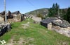
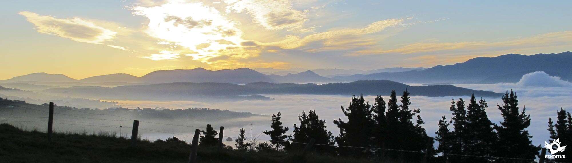
The rounded mountains that separate Pola de Allande and La Mesa are the main protagonists in this stage of the Primitive Way, which after climbing the renowned Pass of El Palo jumps from mountain to mountain in search of the small villages that hide in them. A route in which the spectacular landscapes it offers us, together with the beautiful landscapes we will pass through, more than justify the effort, in many cases almost titanic, that the pilgrims make to cover the distance that separates both localities.

The stage 5 Pola de Allande-La Mesa of the Primitive Way with 22 Km takes us, from the deep valley where Pola de Allande is located, to go up the bed of the river Nisón following the course that this one marks to us. We say goodbye to the locality leaving behind its indiano town hall to set course for the district of Cimadevilla and El Mazo along the road that goes towards the dreaded port. The still-laying ascent takes us, once the road company has been abandoned, to tiptoe past El Teixu, and continue up the riverbed surrounded by the thick vegetation that populates the fertile valley we are crossing. Green meadows and sturdy chestnut trees that, without realizing it as we ascend will give way to the bushes and pines more prepared for the inclement weather at these altitudes. Peñaseita returns us for an instant to civilization, to quickly leave us again in the middle of an exuberant nature that envelops us at every step. The ascent continues allowing us to enjoy, thanks to its now benevolent slope, the magnificent environment that surrounds us, streams that run towards the nearby river, imposing trees that offer us their pleasant shade, are a constant that alternates with some clear where we can already glimpse the mountains towards which we are heading.

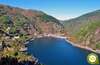
The Reigada marks the starting point of the true ascent, since until now and except for some sporadic ramp the hard ascent to the Pass of El Palo had not done honor to its deserved fame. From here, a somewhat more abrupt terrain awaits us, characteristic of the high areas of the valleys, in which the river will provide us with a beautiful corner where we can rest and recover our strength to face the final ascent. The inseparable road, as if it were an artificial border, marks the separation between the leafy valley and the gentle lines of the mountains. The ascent after this brief contact with the asphalt becomes even more remarkable, making us save in this short stretch the greatest unevenness of the entire ascent. The Pass of El Palo serves as the best balcony from which to contemplate the route and what remains in front of us, a route exposed to the elements where the ancient pilgrims who passed through here after crossing the Route of the Hospitals come to mind, imagining them fighting against the wind or sheltering themselves as they could from the rain. Montefurado awaits us after the delicate descent of the port, in which the slope and the paving of the path have nothing to envy to the ascent that we have just made. The small chapel of Santiago tells us about the existence here of the fifth hospital on the route that gave shelter to the hard-working pilgrims.

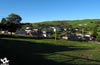
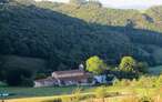
From now on, the Way of Saint James offers us an undulating and demanding itinerary that crosses the mountain range that separates us from each locality. The church of Santa María welcomes us to Lago, a town that surprises us with its granaries and well-kept houses and that takes us back for an instant to the road to leave it behind, following the path that crosses the high pastures and leading us towards a leafy pine forest. Once again we will see ourselves crossing this false plain with our eyes set on Berducedo, the largest of all the villages we pass in this stage. Its church of Santa María, from the 16th century, next to the yew tree that accompanies it, watch us as we pass through the town to undertake the last part of the day. As it could not be otherwise, a hard ascent awaits us that will offer us, once concluded, some beautiful panoramic views before undertaking the gentle descent that will take us to the last locality of the stage, but not before leaving us in mind the image of the imposing ramp with which we will begin the itinerary the following day. La Mesa next to its 17th century church of Santa María Magdalena, where this stage ends, sits at the foot of the Buspol or Peña os Coriscos as it is also known, a mountain that awaits us in the next stage.
This stage gives us several options both for the more physically prepared pilgrims and for those who want to take it easy and make the most of the environment that surrounds them. Some may extend the stage I have tried to reach Grandas de Salime, with the joker under the arm of the small village of Vistalegre that just cross the reservoir of Salime offers us an option as an alternative stage end, always confirming before we can count on it. The others can end the stage in the town of Berducedo, dividing the kilometres to Grandas de Salime by almost half between the two days.
It is a hard but beautiful stage where our friend will undoubtedly enjoy the tour. It is important that as always we control his impulses to avoid him wasting energy uselessly. We will have to be attentive to the sections by road that irremediably will have to cross at the beginning and at the end of the stage, in addition we will have to cross in several occasions the road.
In the first part of the route we will have water points and shady areas where you can rest and drink, but from the moment we undertake the final ascent to the Palo pass until the end of the stage we will only find water in the villages through which we will pass. It goes without saying that in a mountain stage like these its provisions of water and food with some extra ration, especially if it is summer, we can not miss.
The surroundings of the port of Palo is a livestock area par excellence so it is not strange to find the cattle and even a few semi-wild horses. For the rest as it comes being habitual we will find with the mascots that live in the villages by which we pass and that in the majority of the cases they are tied up or inside their enclosures.
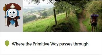
Variant: Stage 4b Ruta de los Hospitales
The church of San Andrés in Pola de Allande (0h 00min) is the starting point for this stage.

We walk along the main street that leads us directly to the road that we arrived at the previous stage and which crosses Pola de Allande, which has become one of its streets.

We advance through the town following the course of this road that leads directly to the Pass of El Palo. The river and a small park are on our left while we leave the town almost without realizing it.

We begin the long ascent to the Pass of El Palo following the road, without hard shoulder, that for now will be in charge of guiding us without demanding a great effort for the moment.

We advance along the road leaving behind the crosses that we find, such as the one that leads to the village of El Mazo. This long stretch of road makes us gain height little by little, preparing us for the unevenness that we will have to overcome later.
.jpg "We finally leave the road")
After a while we find the detour that will prevent us from continuing along this dangerous road, in any case cyclists is better to follow the road, also if the snow is the protagonist we will be forced to follow the asphalt to avoid unnecessary complications.

We descend a few meters heading to the bottom of the valley that we constantly carried to our left and by which we will make the ascent. We advance along a path forced to ford a small stream to gradually recover the lost height.

The path turned into a narrow trail embedded between the walls separating the fields of pasture leads us to the meeting with another asphalted road where we have to continue.

Without realizing it, we have just passed the village of El Teixu (0h 30min), which we left behind us quickly. We advance along what looks like an old road between fields, farms and old houses tucked inside the green valley.

The perfect track, totally conditioned and delimited by the wooden railing that borders it, takes us little by little towards our destiny giving us beautiful landscapes and some hard ramp.

Its well marked layout serves as a reference in the few crosses we encounter. Without realizing it, we see ourselves crossing the village of Peñaseita (0h 40min), which we had been observing for some time.

The idyllic walk comes to an end shortly after crossing the solitary houses of this village, becoming a wide trail that we have to continue.

There are several paths normally closed by the fence that we are leaving behind and that lead to the nearby river. We continue to gain height with each step, although for now not with the expected exigency, while we follow from afar the ascending course of the river.

The thick vegetation that surrounds us next to the marked path that we are walking leads us undoubtedly on the right path. The river is hidden at our feet while we continue ascending protected from the sun by the grove that surrounds us.

One or another solitary stream comes out to meet us, forcing us to ford it passing from stone to stone without losing our balance, or saving it thanks to the bridge that crosses it. This section of the path keeps quite a lot of humidity so we can find it quite muddy.

There are not a few trails and paths that we find although, as usual, it is the vegetation that marks out the path to follow.

We continue with the rumour of the nearby river along a wide path delimited by a barrier of stones and a slope of earth that mark the path.

Few have been the clearings that have offered us the route where to be able to contemplate the landscape that surrounds us, until the moment the thickness of the vegetation is the one that dominated all the route. For the moment, the path has alternated the ascent zones with more comfortable sections that allow us to recover from the effort made.

The route takes us to the path that leads from the road to La Reigada (1h 20min), a path through which we will cross the small village.

Just where the houses end, we find a bridge that allows us to cross one of the streams that flow into the river. We continue the ascent leaving to our left, as until now, the increasingly narrow riverbed.

Shortly after leaving behind this small village we will have to face a hard ramp that makes us gain height quickly. We can even say that now is when the real access to the Pass of El Palo.

We face the stretch of the ascent with the worst firm, and where greater slope we will overcome.

After a short while we come across the river that has accompanied us since the beginning, which has become a beautiful stream, forcing us to cross it several times.

Thanks to some battered wooden bridges that hardly resist the rigor of the elements we cross this beautiful corner that gives us the ascent to the Pass of Palo.

As soon as we cross this spot we start a steep path that makes us gain height very quickly, demanding a great effort to keep advancing.

This trail takes us in search of the road making us overcome the unevenness that still separates us from it. The road will be in charge for a short space of time to guide us in our route since we will quickly arrive at the place where we will have to leave it.

In the middle of the curve we find the detour we have to follow, an old section of the old road that takes us to the beginning of the trail that goes up the mountain. Once again it is better for cyclists to continue along the road.

A cobbled mountain trail that meanders along the slope of the mountain making us gain height again with great speed and effort.

The trail, always in continuous ascent, allows us to see the high part of the mountain towards which we are heading as we go up the last meters of the valley that led us here.

The thick vegetation has given way to bushes and a few pines that resist the rigors of the harsh winter that occurs in these lands.

The trail takes us, ascending, directly towards a slope of earth that serves as sustenance for the road.

But when we reach the height of a solitary trough, just when it seems that we will have to almost hopelessly climb the imposing slope, to our right continues the trail that continues with the ascent cutting the hillside of the mountain.

This cobbled path with a notable slope zigzags along the hillside to make it easier for us to cross the slope.

In the final part of the ascent the trail practically disappears covered by vegetation, are small wooden posts with yellow arrows to guide us to our goal.

The summit of Pass of El Palo (2h 35min), where we will meet the pilgrims who followed the Route of the Hospitals, welcomes us allowing us to contemplate the road traveled until here next to the one that awaits us in front.

From here we head for a dizzying descent, not without complications, at least in its first part, once again for cyclists is better to continue on the road at least to Lago.
We follow the line that marks the wiring that joins the imposing towers of high tension and that serve us as reference in case of fog, crossing a cobbled footpath that makes us lose height quickly.

The slope and the cobbled terrain forces us to descend with caution, leading us to the meeting with the road.

In front of us an opening in the guardrail that borders the road indicates the place where we must pass to continue the descent by the battered trail.

The itinerary descends with force cutting the skirt of the mountain offering us magnificent views.

The trail crosses an abrupt terrain that takes us for an instant out of the soft and rounded landscapes that surround us.

In the distance we can already observe our next destination in this mountain stage, while the high tension cables continue flying over our heads.

Our trail takes us to a path that makes us ascend in search of the nearby road, which runs on our right.

Upon reaching its height, a wooden post indicates the trail we must follow, separating us from the road that continues its course.

This narrow, well-marked trail leads us clearly to the small village in front of us, having already finished the strong descent.

We enter Montefurado (3h 05min) following the path that brought us here and that crosses the village embedded between the stone walls that delimit the fields and houses.

We advance leaving behind all the paths that leave our path, always following parallel to the road from which Montefurado separates us. We leave the village following the line marked by the stone walls that border our path, while we begin to gain height.

Soon we find what looks like the end of the road we are following, as the two options we have are cut by the fence. We must continue on the left either jumping the stone wall, thanks in part to the symbolic stairs that are created or trying to open the wire hatch that prevents the passage.

Once this obstacle has been overcome, we continue the ascent with the wall on our right, heading towards a rounded hill that we will hopefully border.

The green meadow we were walking through gives way to a narrow trail that barely makes its way through the leafy ferns that populate the hillside of the mountain we are ascending.

The cobbled trail makes us gain height, not without effort, leading us to a new gate that we must cross. Luckily, once this gate is crossed, the slope softens considerably, allowing us to contemplate the magnificent landscape that surrounds us thanks in part to the height gained in this ascent.

The trail cuts the hillside of this hill taking us without major complications to find a new path, accompanied by the inseparable road that runs a little lower and the endless power line.

We went out to the path, already in clear descent, setting an irremediable course for the reencounter with the road. As was foreseeable, we meet the road again, right at the point where it crosses the road to Pontenova.

The Primitive Way does not touch the asphalt and continues next to it following a narrow trail almost hidden by the vegetation that runs parallel to the road.

A long stretch awaits us following this trail that runs parallel to the road, although lower than it, cutting the mountain surrounded by the vegetation that grows on it. After a while the trail gains width giving us a little more margin and allowing us to advance more comfortably.

As usual, a new uphill section awaits us, which takes us past the cemetery of the next town we will pass through.

After passing it, there is an asphalted track that comes from the nearby road and will lead us to the next village of this stage.

The continuous ups and downs to which we should already be accustomed at this height, are the habitual tonic until the end of this stage, touching us now to descend until the same doors of the locality.

The church of Santa María de Lago welcomes us to the village marking the beginning of the hard ascent that will introduce us to Lago (4h 05min). We advance through the town gaining height with each step.

The Primitive Way insists on taking us back to the meeting of the road that awaits us a little higher up.

Finally we can see with some relief the end of this hard ascent that coincidentally coincides with the reencounter with the road.

When we reach its height, we turn round to return to the lost course and continue along the final part of the Lago.

Shortly after leaving the locality we find ourselves on our right with the beginning of a trail that goes up the slope of earth that borders the road allowing us to say goodbye to it for the moment.

This path turned into a trail through the vegetation demands a new effort to continue gaining height until we reach a new road that we must cross to continue the march.

This pleasant stretch, not exempt of unevenness, transports us through the green meadows heading towards a leafy forest of pines.

The route introduces us to the interior of the forest, allowing us to enjoy the freshness it offers.

The journey through the interior of the forest leads us once again to the encounter with the road, but just before touching it, it turns sharply as if it wanted to introduce us back into the interior of the forest.

Nothing could be further from the truth, since before entering it again we will turn off following a path that runs parallel to the road, enclosed between it and the edge of the forest.

This long stretch of path allows us to advance with some ease until we reach its end which, as could not be otherwise, is marked by the road, which we must cross.

As soon as we cross to the other side, to our right begins the path that we must follow and that will return to introduce us in the forest leaving to the left a pair of paths that also leave this place. The pine forest soon reaches its end while we must face a new climb surrounded by green meadows.

The well marked path guides us without too many complications leaving behind as many crosses as we go.

In front of us we can already sense the next locality that will take us to visit the Primitive Way in this mountainous stage.

Our path takes us directly to the track that will lead us to the next town that awaits us with open arms. The first houses of the town take us without delay to the road that crosses the town.

When we reach its height we have to follow a few metres along it, leaving behind us the tireless road that accompanies us from Pola de Allande.

We will quickly come across a street that we will descend and that will take us to the road. Although in this occasion we will not even have to step on it because at the moment we will find the street for which we will return to enter Berducedo (5h 00min).

The cyclists in this point are with a great doubt, if they decide to continue towards La Mesa they will face a route by mountain in which in more than one occasion to good insurance they will have to throw foot to earth to save some that another section in not very good state, by contrast the great majority of the route should not suppose major problems for fans to the mountain bike. The other option is to follow the road that will take you directly to Grandas de Salime giving a huge detour of several kilometers without leaving at any time the course of the road.

Shortly after starting the street we arrive at a new detour to the right that makes us go towards the church of Berducedo.

We then begin a new ascent through the streets of the town following the route that winds through them.

We are gaining height as we leave behind the different houses we find.

Little by little we leave the town following the marks of the Way of Saint James that now coincide with those of the GR 109, a long-distance path from Asturias that will largely accompany us to Grandas de Salime.

The ascent does not end for the moment while we leave Berducedo behind us, walking between fields and the occasional tree.

Soon the Primitive Way takes us to a strong ascent by a firm cobbled and without hardly shadow that the days of summer give us some freshness.

The route gains height by this path full of lascas and flanked by a barbed wire fence that serves as a reference to follow in case of doubt. Luckily, the ascent ends quickly at the same time that a new track stands in front of us.

We are in front of a bifurcation delimited by the forest and a livestock area. At this point it is the path on the right that we are going to follow. A path surrounded by vegetation leads us along the edge of the trees.

The ferns and vegetation that cover this route now with hardly any inclination allow us to recover strength to face the distance that still awaits us.

The track on which we are going, perfectly delimited by a wire fence on both sides of the path, leaves no room for doubt in the few crossroads we are going to find.

Our track suddenly ends when it comes up against the road we must now continue on. This road leaves hardly any space to separate us from the dangerous traffic, in front of a long stretch until the next population of the stage.

The solitary brands, when we meet them, reaffirm that we are going the right way. During this stretch of asphalt we will be able to observe the threatening and steep road that ascends cutting the hillside of the mountain in front of us and that seems to want to intimidate us, before in the next stage we have to face it.

The road which we do not leave at any time leads us directly to the town of La Mesa (6h 10min).

She herself is in charge of leading us through the town, taking us directly to the beautiful spot where her old church is located, where we put an end to this stage.
 Distance. 22Km
If for any reason you have to go on the road, the distance is significantly extended.
 Time. 6:10h
A deceptive stage because once we have passed the Pass of El Palo, where we arrived faster than expected, we feel that the hardest part has already passed, nothing could be further from the truth. The continuous ups and downs will slow us down more than we should and if we haven't saved enough strength, it may take us longer than expected.
 Time of year
The mountain gives us a landscape and sensations different from those experienced in other stages, without a doubt each season of the year brings its special characteristics making this a stage of great beauty. But also the mountain with bad weather conditions shows us all its crudity, considering situations that we should not underestimate no matter how much we are faced with a mountain of just over 1000 m altitude. The wind, the fog and of course the snow must make us think about the suitability or not of carrying out the route or waiting for the conditions to improve.
 Material required
We are facing a mountain stage in which cold, wind, rain or fog can surprise us even in the middle of summer so it is advisable more than ever to prepare the stage well by informing us of weather forecasts and equipping ourselves accordingly. Warm and windproof clothing can be very useful in these cases without significantly increasing the weight or volume of our rucksack. The walking sticks will be of great help not only in the ascent but also in the cobbled descent that we will face. The boots in this stage will give us an extra stability and grip that we will thank on more than one occasion, sunglasses, hat and sunscreen should be as always a travel companion. It is not too much and whenever possible to take with us a GPS with the track of the route and the mobile with the battery charged in case we could need them at any time. Consult our list of material and equipment to make the Way. Read more
 Difficulty. Remarkable
Physical
It is a demanding stage, not so much because of the ascent to Pass of El Palo, which is done more easily than one would expect since its profile keeps practically all the unevenness for the last kilometres, but because of what awaits us after crowning the port. To the strong descent that follows and that demands more effort than expected we have to add a continuous up and down with strong ramps that will contribute to harden the stage not allowing us to maintain a constant rhythm and undoubtedly making a dent in our legs. In addition, the heat in the second half of the stage and the humidity in the first can also be uncomfortable guests who play a trick on us. For the rest, taking with the necessary calm the unevenness that the route will pose us thanks to the relative short distance that this has, we will be able to overcome not without effort one of the stages most feared by the pilgrims in this Primitive Way, although some other stage is not left behind or even we could say that it overcomes it.
Caution
The terrain through which this stage passes will oblige us, especially in the descents, to cautiously go down the steep and cobbled ramps to avoid falls or injuries. Special care must be taken in the long stretches on the road as well as in the different crossings with which we are going to run into. Also the mud and the humid stones that we will surely find in our ascent next to the river can play us a bad trick. In normal conditions and with the due precautions commented this is a stage to enjoy the environment that surrounds us. However, we cannot forget that we are facing a mountain route that we should not underestimate because it does not run through large heights or renowned summits. Sudden changes in time can surprise us at any time, making progress very difficult, and it is also not advisable to leave the route to avoid complications or possible absent-mindedness that may cost us a few extra kilometres. It goes without saying that with snow or ice, common in the winter, things change radically increasing the difficulty of the route and undoubtedly the minimum material that we must carry, even making it inadvisable to perform the stage.
Orientation
In general well defined and signposted in its great majority, it is the vegetation that covers some signs and the barriers that prevent the passage to the animals what in normal conditions of visibility and state of the land more is going to make us difficult to follow a route that does not raise too many doubts, except if you do it by bicycle. If the fog is present we can find in certain points with a more obvious problem to find the marks and follow the correct route. If the snow is the protagonist and we risk to make the stage following the road, we have to bear in mind that although we can do it until Berducedo. It is here where we will see ourselves in the dilemma of continuing to La Mesa, with what this implies, to make the next stage from there that takes us almost entirely by mountain terrain without more contact with civilization than the people who inhabit this locality of departure and without feasible escapes to get us out of the mess in which we are involved. The other option we still have is to follow the road and make a long and dangerous traverse, without marks of the Way, following it at all times until Grandas de Salime and increasing considerably the kilometres to be covered, that is to say nothing advisable to do it walking.
 |
 |
 |
 |
 |
| 1-Pola de Allande | 0:00h | 525m | 0Km | 29T 694018 4793807 |
| 2-El Teixu | 0:30h | 594m | 1.7Km | 29T 692580 4794468 |
| 3-Peñaseita | 0:40h | 603m | 2.4Km | 29T 692060 4794792 |
| 4-La Reigada | 1:20h | 723m | 4.9Km | 29T 690096 4795853 |
| 5-Pass of El Palo | 2:35h | 1147m | 8.3Km | 29T 688399 4793714 |
| 6-Montefurado | 3:05h | 926m | 10Km | 29T 687004 4792845 |
| 7-Lago | 4:05h | 893m | 13.9Km | 29T 684051 4791451 |
| 8-Berducedo | 5:00h | 900m | 17.7Km | 29T 681311 4789200 |
| 9-La Mesa | 6:10h | 869m | 22Km | 29T 678390 4787386 |
Coordinates UTM Datum WGS84

 Slope: 1864m
 Slope +: 1105m
 Slope -: 759m
 Maximum altitude: 1147m
 Minimum altitude: 525m

This sketch of the route is not made to scale nor does it contain all the information relating to the area, it is merely indicative.

![]()
This schematic with the path is approximate and has been created from the derived cartographic base © Instituto Geográfico Nacional "Cuadrante 050, 1:50.000"
Senditur has manipulated the tracks to correct the aberrant points that may exist, caused by problems with the reception of the GPS signal. In any case they are always approximate. SENDITUR encourages you to use the new technologies within your reach, using them as support and consultation in your activity, not basing the realization and orientation of the same only and exclusively on them, since they may see their functioning altered by very diverse causes, not functioning correctly and their indications may not be precise.


Preciosa etapa del Camino Primitivo, un recorrido exigente pero satisfactorio.
A magical place of legends and mystery

Find out what to see in...
¿Did you know that...
This stage passes through the Natural Area of the Carondio and Valledor mountain ranges that extends from the interior of Asturias to the coast of Luarca. A space that stands out for its landscapes, its cork oaks such as the Boxu cork oak or its fauna, among which years ago we could find brown bears, also preserves countless vestiges of the primitive cultures of ancient settlers.
Don't miss out...
The Yew of the Lago, is a millenary yew declared natural monument on April 27, 1995 included in the protected landscape of the mountains of Carondio and Valledor. The tree is located near the church that was built next to him taking advantage of the fact that the Yew was venerated by the ancient tribes that lived there.


From the commitment of SENDITUR with Nature and the respect to the balance of the environment, SENDITUR urges you to travel in a responsible way, with low environmental impact and respecting at all times the Natural, Cultural and Social environment wherever you go.

Besides sharing with all of us your experience on the route we would be grateful if you could write to us to inform us of any erroneous or outdated information you may have found, or simply to let us know what you think at Thank you.
This route has been carried out in the field by SENDITUR on 16-11-2018. The route may vary greatly depending on the time of year, weather conditions and terrain, as well as the actions of third parties and the evolution suffered in the natural environment where it is located. All opinions, advice and/or assessments made by SENDITUR in their descriptions are for guidance only and are subject to and/or refer to the specific conditions of the specific day of the route, referring to that specific day, taken from trained people, with the appropriate experience and with a high level of physical and technical preparation as a reference, as well as correctly equipped.
All the times are approximate and take an orientative character, the stops have not been taken into account, no matter how small they are. All the information related to the route, texts, images, videos, maps, diagrams, tracks, towns, and places of tourist interest are published as a guide, and may not coincide with the current state of each place. Before undertaking any activity, assess your technical knowledge, your physical condition, find out about the weather and the variations that the route may undergo, equip yourself correctly, be prudent and responsible at all times, and do not exceed your capabilities. SENDITUR is not responsible for any misuse or inappropriate use of the comprehensive guides of its routes and/or publications as well as its electronic guides, nor for any variations in their descriptions for the aforementioned reasons, and recommends that everyone be responsible and prudent in carrying out the activity. We also encourage you to read books and specialised guides to complement the information described above.
Continue watching …


 Previous: Stage 4 Tineo-Pola de Allande
 Next: Stage 6 La Mesa-Grandas de Salime