Welcome to SENDITUR.COM · paths · routes · tourism

![]() Difficulty-Medium
Difficulty-Medium
![]() 4:00 h.
4:00 h.
![]() 15.6 km.
15.6 km.
![]() Difficulty-Medium
Difficulty-Medium
![]() 4:00 h.
4:00 h.
![]() 15.6 km.
15.6 km.
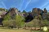
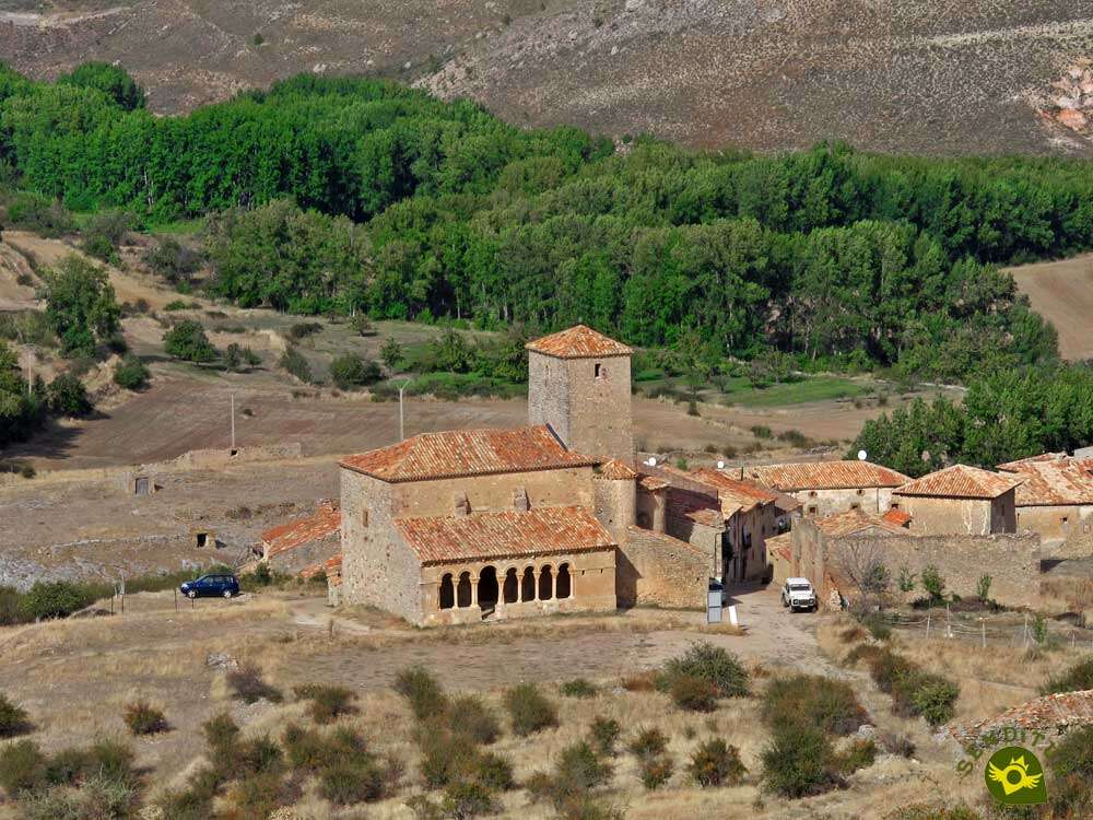
Surrounded by steep and breathtaking gorges stands the historic town of Caracena, a natural environment through which have passed over the years illustrious characters and powerful armies, making clear the strategic importance that this region had. A natural place that surprises by its inhospitable beauty and that today we can discover thanks to the trail that runs through the Canyon of Caracena.

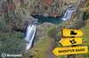
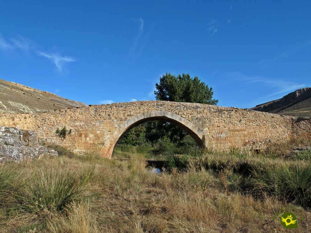
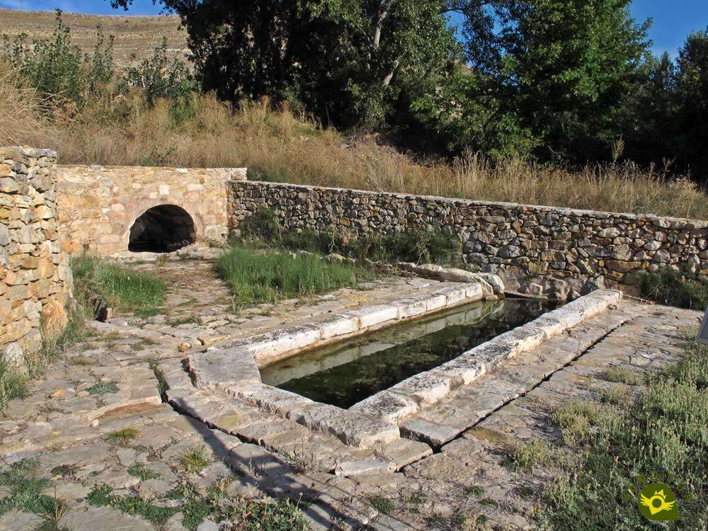
The route consists of 15.6 km and links the towns of Caracena, from where we started, and Tarancueña. Of the rich history that Caracena treasures we speak its castle, its church of San Pedro or corners loaded with history as those that await us just start the journey. An old watering hole and the Cantos Bridge, of medieval origin, are the last signs of civilization that we will find before entering the Canyon of Caracena. A gorge carved by the tireless flow of the Caracena River, also known as Adante, whose course we will have to cross repeatedly. A river with enough strength to practically destroy in one of its floods the old bridge that we crossed at the beginning of the route. An itinerary that surprises us with the curious formations that we will find on our way.

A route that is also used by the GR 86 or Iberian Trail Soriano as it passes through these lands. The Canyon of Caracena is gradually gaining in width while losing in spectacularity as it approaches Tarancueña, another of the gateways to this place. For this reason, many people who arrive at the old mill decide to return to Caracena either by the same route or by venturing into the moorland that precedes another of the jewels of this region, the Tiermes holm oak forests. But there are also many who enter the Canyon of Caracena from Tarancueña, or come to it to see it, following the dirt track that joins the old mill and the village of Tarancueña.

Legend has it that many years ago, when disputes over the dominion of these lands were at their height, news reached the castle lord of a fearsome army that was heading for the nearby castle of Gormaz to besiege and conquer it. Presto, the lord of the castle entrusted himself to San Pedro and Santa María and ordered a large part of his army to march quickly to contribute to the defence of the besieged castle. But this news was no more than an enemy ruse to gain control of Caracena more easily. The enemy troops, who promised to be very happy, decided to take advantage of the shelter of the narrow canyon of Caracena to advance against the castle without being seen. Suddenly the sun hid behind some mysterious darkness and a terrible storm broke out. Such was its magnitude that the river completely flooded the canyon taking with it everything in its path including the enemy army, leaving Caracena safe from its enemies.
To get to Caracena we have to do it either from El Burgo de Osma or from San Esteban de Gormaz, both in the middle of the national road that links Soria and Valladolid. In the town of La Rasa, these two routes converge to go together to Caracena, passing first through Fresno de Caracena, where they are joined by the road from Gormaz to Recuerda. You have to be careful because many of the navigators take the road that passes by the castle of Caracena and joins it with Cañicera. Another option that for the moment does not appear on many maps is the road that from Caracena itself connects it to Montejo de Tiermes among other towns. Once there and right at the crossroads with this road we will have a couple of esplanades where we can park our vehicle and start the route.
With hardly any unevenness, it is the distance that will demand more effort from our friend. We may have to help him at some rocky pass so that he can overcome it.
Although the river is always nearby, we should not forget to bring him his water and of course some food.
It is an area very conducive to unpleasant encounters with snakes, also pass areas where the vegetation is quite thick, so it is not a bad idea to exercise extreme caution.
On the same access road to the town of Caracena (0h 00min), just before it enters it, we will find next to the road the parking area from where our route begins.

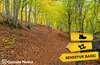
Some old signs indicate the route of the GR 86 Iberian Trail Soriano, our travelling companion, although for the moment we will not follow its course as we have to head towards the path that starts in the middle of the bend in the road.

This path takes us on a gentle descent to an old watering hole.

Right there a lonely sign marks the way that will lead us to our next goal, Cantos Bridge.

Almost without realizing it, we reached the shore of the Caracena River, which we crossed with the invaluable help of this ancient bridge.

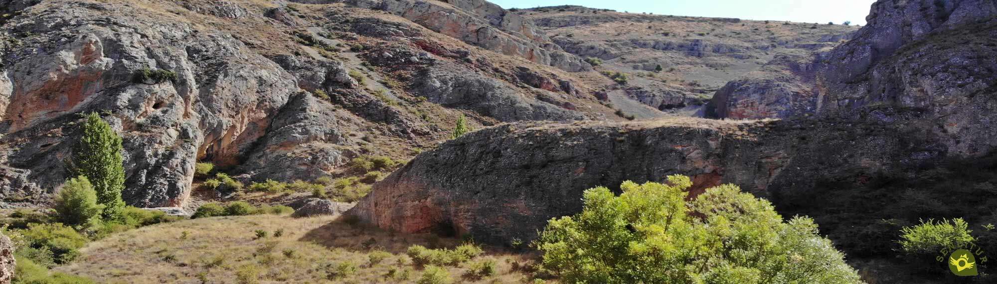
As soon as we do so, the route turns right to go up a rocky area in search of the access to the canyon we are about to go through.

After this short ascent we get ready to enter the Canyon of Caracena with the company of the GR 86 marks. We quickly see ourselves following the course of the Caracena River, nestled like the river between the vertical walls that mark it out.

With almost no time to get used to this inhospitable landscape, we are forced to wade through the river.

As if we hadn't had enough of this slippery pass, we'll have to cross the river again to keep going.

For now, the vegetation that grows around the Caracena riverbank provides some shade. With each step, we go deeper into the canyon, running along the base of the vertical walls that form it.

Little by little the trees are giving way, allowing us to contemplate the wild landscape around us.

There will be repeated occasions when we will find ourselves in front of a fork in the trail we are following, forcing us to be attentive so as not to miss the path to follow.

In general, these forks seek to overcome passages in which the river, if it has more flow, may cut us the pass. Once again, we will have to jump from stone to stone to ford the Caracena River.

The route allows us to enjoy the magnificent landscape that surrounds us, thanks to the open and uncomplicated sections that we will encounter.

After a while the trail of the GR 86 that we are following leads us to a stone arch that we will have to cross.

Already on the other side we find a short but steep step that separates us from the continuation of the trail.

There will be several rocky passes that we will have to overcome, although usually without them causing too many complications.

Complications that we will be able to find in the different moments in which the route forces us to wade the river as it happens soon after passing through the stone arch.

With every step we take the narrow canyon loses its fierceness as it gains in width.

The trodden trail leaves no room for doubt as to the route to be followed, although the vegetation seems to warn us of the stretch to come.

The river, as it could not be otherwise, also claims part of the limelight by making us face a new ford, the last one before starting the return.

As we already guessed, the vegetation almost completely hides the narrow path in this part of the route, making us make an effort to pass some areas.

The proximity of the river also means that, as on previous occasions, we must save a few rocky passes.

And as it also happened before, the path forks in search of possible alternatives that in most cases are worse options than the original one.

Sections with which the Canyon of Caracena seems to want to extend its wild character a little more. But this sometimes steep terrain touches its end, the narrow canyon softens its marked lines and lets the riverbank gain in width while we follow the course that marks the well-defined path we tread.

The remains of an old mill (1h 20min) mark the end of the trail and could well be said to be the most interesting stretch of the Canyon of Caracena.

For this reason, at this point, many people decide to return along the same route or, for the more adventurous, to ford the river again, to go up the ravine on our right, to return to Caracena by crossing the moorland at the top of the canyon. Taking advantage of this, we can visit the Castle of Caracena and the Church of San Pedro, among other wonders that this medieval town hides.

There are also those who follow the dirt track that leads here from the town of Tarancueña (2h 00min), to visit it and return to Caracena (4h 00min) by the same route by which we arrived.
 Distance. 15.6Km
Many only go as far as the mill, making the route much shorter.
 Time. 4:00h
This figure can reach 2h 40min, if we decide to put the old mill as a return point.
 Time of year
In general, any hiking route that runs through a ravine near the river that formed it is conditioned by the flow that it carries at the time of the route and this could not be an exception. As we have to wade the river several times we may find that it is impossible to do so. Another factor to be taken into account is the heat, as there will be no shaded areas along almost the entire route.
 Required equipment
The thick vegetation of several sections of the route and the presence of unfriendly reptiles make it advisable to wear long trousers and hiking boots as we will be more protected. Water and some food are also essential, and walking poles are also good companions for the adventure, which will be useful as we advance through the vegetation. Consult our list of material and equipment for hiking. Read more.
 Difficulty. Medium
Physical
Without a doubt, the total distance of this route is almost the entire physical difficulty that we have to face, especially if we do it in its entirety. The unevenness to overcome, unless we leave the route to follow, should not put us in complications.
Severity of the environment
Under normal conditions, we will encounter complications when we have to ford the river, as well as in some short, somewhat steep stretch, but with the proper precautions we should not get into difficulties. The route runs through the interior of a gorge so we are not exempt from possible falls of stones or landslides. It is very important to make sure of the state of the river and the weather forecast before venturing into the canyon, not only to prevent the flow cuts us off but also so that we are not surprised by a sudden flood.
Orientation
Initially the route does not present great complications in this section, the greater ones we will have them at the beginning, and in the different possible detours that will appear to us throughout the route. In case of doubt in most of them, as we advance, we will find the GR mark that verifies the correct choice. Those who venture back through the moorland must have experience in orientation and in handling the GPS, map and compass since there is no clear or marked path to follow and in much of the journey we will go cross-country.
 |
 |
 |
 |
 |
| 1-Caracena | 0:00h | 1066m | 0Km | 30T 492247 4581488 |
| 2-Old Mill | 1:20h | 1100m | 5Km | 30T 494055 4578465 |
| 3-Tarancueña | 2:00h | 1160m | 7.8Km | 30T 495147 4576295 |
| 4-Old Mill | 2:40h | 1100m | 10.6Km | 30T 494055 4578465 |
| 5-Caracena | 4:00h | 1066m | 15.6Km | 30T 492247 4581488 |
Coordinates UTM Datum WGS84

 Slope: 380m
 Slope +: 190m
 Slope -: 190m
 Maximum altitude: 1160m
 Minimum altitude: 1050m

This sketch of the route is not made to scale nor does it contain all the information relating to the area, it is merely indicative.

![]()
This schematic with the path is approximate and has been created from the derived cartographic base © Instituto Geográfico Nacional "Cuadrante 114-1, 25.000"
Senditur has manipulated the tracks to correct the aberrant points that may exist, caused by problems with the reception of the GPS signal. In any case the tracks are always approximate. SENDITUR encourages you to use the new technologies within your reach, using them as support and consultation in your activity, not basing the realization and orientation of the same only and exclusively on them, since they may see their functioning altered by very diverse causes, not functioning correctly and their indications may not be precise.


La ruta muy entretenida y el pueblo una preciosidad. Merece la pena acercarse hasta Caracena para conocerlo y hacer esta ruta de senderismo.

With a mountainous and wild character, The Caves, for the locals


Find out what to see in...
¿Did you know that...
The famous Wool Route passes through Caracena, one of the oldest commercial routes in the Iberian Peninsula, linking Alicante with Burgos. Today it is also known as the Jacobean Wool Route, one of the many routes that lead pilgrims to Santiago de Compostela.
Don't miss out...
The visit to the medieval town of Caracena, where you can discover not only its magnificent castle and the remarkable churches of Santa Maria and San Pedro, also awaits us noble buildings such as the tower of the old prison or the slender baroque style rollo that stands in the town square, among other jewels.


From the commitment of SENDITUR with Nature and the respect to the balance of the environment, SENDITUR urges you to travel in a responsible way, with low environmental impact and respecting at all times the Natural, Cultural and Social environment wherever you go.

Besides sharing with all of us your experience on the route we would be grateful if you could write to us to inform us of any erroneous or outdated information you may have found, or simply to let us know what you think at Thank you.
This route has been carried out in the field by SENDITUR on 06-10-2018. The route may vary greatly depending on the time of year, weather conditions and terrain, as well as the actions of third parties and the evolution suffered in the natural environment where it is located. All opinions, advice and/or assessments made by SENDITUR in their descriptions are for guidance only and are subject to and/or refer to the specific conditions of the specific day of the route, referring to that specific day, taken from trained people, with the appropriate experience and with a high level of physical and technical preparation as a reference, as well as correctly equipped.
All the times are approximate and take an orientative character, the stops have not been taken into account, no matter how small they are. All the information related to the route, texts, images, videos, maps, diagrams, tracks, towns, and places of tourist interest are published as a guide, and may not coincide with the current state of each place. Before undertaking any activity, assess your technical knowledge, your physical condition, find out about the weather and the variations that the route may undergo, equip yourself correctly, be prudent and responsible at all times, and do not exceed your capabilities. SENDITUR is not responsible for any misuse or inappropriate use of the comprehensive guides of its routes and/or publications as well as its electronic guides, nor for any variations in their descriptions for the aforementioned reasons, and recommends that everyone be responsible and prudent in carrying out the activity. We also encourage you to read books and specialised guides to complement the information described above.
Continue watching …


.jpg "Go to Hermitage of San Baudelio")