Welcome to SENDITUR.COM · paths · routes · tourism


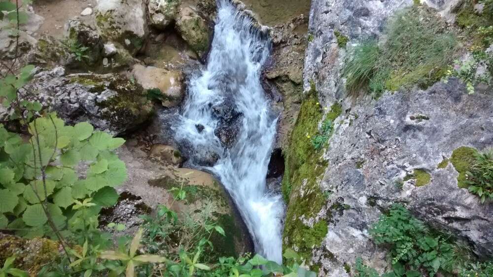
Gorge of the Purón River
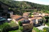
Herrán, Burgos![]()
![]()
![]()
![]()
![]() (2)
(2)
The narrow pass from the Ebro valley to the Cantabrian Sea
![]() Difficulty-Moderate
Difficulty-Moderate
![]() 3:10 h.
3:10 h.
![]() 10.4 km.
10.4 km.
Herrán, Burgos![]()
![]()
![]()
![]()
![]() (2)
(2)
The narrow pass from the Ebro valley to the Cantabrian Sea
![]() Difficulty-Moderate
Difficulty-Moderate
![]() 3:10 h.
3:10 h.
![]() 10.4 km.
10.4 km.
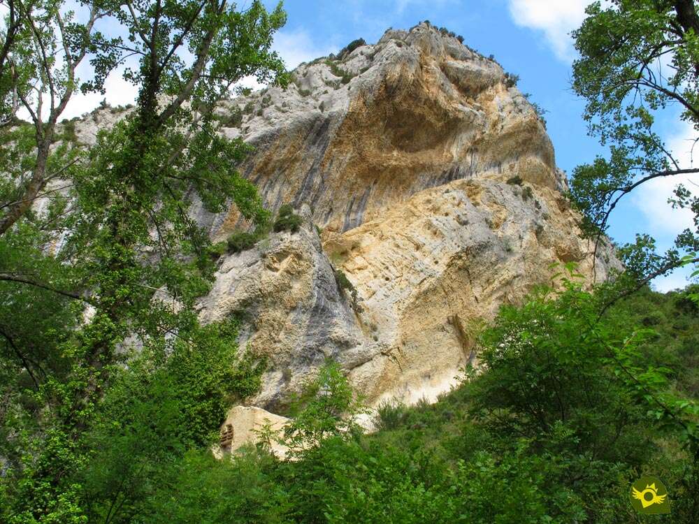
An old road joins, and still joins, the Tobalina valley, in Burgos, and the Valderejo Natural Park, in Álava, through the narrow Gorge of the Purón River sheltered by the Árcena mountains. A unique natural site, unbeatable habitat for numerous species of plants and animals, carved for centuries by the tireless work of the river in its course from its source in the vicinity of Lahoz to its mouth in the river Ebro, in the vicinity of Barcina del Barco.

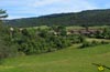
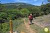
The route, with 10,4 Km or 7,8 Km if we return by the same itinerary, starts from the beautiful village of Herrán, a town from Burgos in the region of Las Merindades that proudly displays its well-kept houses that tell us about its medieval origin. From there, in a pleasant walk, we go up the course of the river Purón with the calm that this part of the valley transmits. The mountains seem to be closing with each step we take as if they did not want to let us go beyond where they allow us. But it is the river that has carved a narrow pass known as the Canyon of Las Puentes, named after the imposing Roman bridge that crossed the river at this point. In front of us, as if it were another place, we can see the interior of the Árcena mountain range in whose rocks live a good number of birds and where we can also find, embedded in the rock, the hermitage of San Felices and San Roque, to which we can ascend to visit it. This small parish dated approximately in the 8th and 9th century is believed to have been the predecessor of the nearby abandoned monastery of San Martín de Ferrán. From here we head towards the steepest and most rugged part of the gorge, leaving aside for the moment the paths that lead to the summit of Santa Ana and Villafría. Our path makes its way through the mountain, which has been carved both by the river and by man's hand in order to be able to advance without being cut off by the cliffs that stood between them. The route enters the gorge of the River Purón, where waterfalls alternate with backwaters and calm wells. The path, sometimes not suitable for people with vertigo, transports us through the interior of the narrow pass that the river has been forming.

Little by little the height gained and the distance travelled take us out of this spectacular landscape that is going to give its protagonism to a thick forest that hides us from the birds that surely fly over our heads. The forest gives way to a wide and greenish pasture through which we advance flanked by Santa Ana and Vallegrull, while in the distance the church of San Esteban awaits us, which aduras hardly resists the passage of time and abandonment. Ribera and its Romanesque church that keeps in its interior a true treasure, which if it continues like this will disappear, like the church, in no time. These are the Gothic murals discovered in the 1980s, when the 16th century altarpiece was taken from the church, which is still preserved today in the museum of Vitoria. The panoramic view from Ribera adsorbs us as we decide whether to return through the gorge, by the same route that brought us here, or climb to the summit of Santa Ana to enjoy unbeatable views from it. We set our course towards this summit before returning to Herrán, preparing to walk through the pastures and the forest that populates its hillside, but not before bidding farewell to the hidden remains of what was not so long ago one of the largest villages in the valley. The summit of Santa Ana does not detract from the expectations we had of it and rewards us for the effort involved in treading it with the image that we have of the gorge, the mountain range and the valleys that surround it. Including the majestic valley of the Ebro. Once dedicated the time that this top deserves we undertake the descent that will approach us furrowing the skirt of the mountain opposite to the one that we climbed, to the encounter of the footpath that crosses the gorge, just before arriving at the hermitage of San Felices and San Roque, where previously we had left behind the footpath that offered us to ascend to Santa Ana, and from there to return without haste to Herrán, point of beginning and end of this route.

It is also possible to visit the gorge of the Purón River from the Alava town of Lalastra, where the interpretation centre of the Valderejo Natural Park is located, and from where a good number of routes that run through the park start, including several that lead to Ribera, and from there we approach the most abrupt part of the gorge, including the ascent to Santa Ana, but in the opposite direction to that described, then descending to Ribera to return to Lalastra.
To get to Herrán we can do it from Miranda de Ebro following the BU-530 road that joins this city with Trespaderne, and then take the BU-532 after passing through Barcina del Barco or Quintana Martínez Galindez depending on whether we arrive from Miranda de Ebro or Trespaderne respectively. It is in this road BU-532 where we will find the accesses that lead to Herrán from Promediano or from La Revilla de Herrán. Also this same BU-532 communicates Herrán with the road that joins Trespaderne with Bilbao at the height of La Orden. Once there, access to Herrán is forbidden for vehicles of non-residents, so we will have several parking areas. The first and largest one is located as soon as you arrive in the town. From there, a road starts that crosses the Purón River and borders Herrán, taking us without further detours to the small car park where the road reaches its end and the route of the Purón River gorge begins, at the very gates of Herrán.
Exigente and beautiful route to do it with our friend, in which surely you will be able to enjoy as much as you want. He alone will have the necessary prudence not to expose himself unnecessarily to dangerous areas, even as we must always be attentive to him. We are in a natural park with its own regulations on pets, although initially not out of the normal.
Although we are much of the time next to the river Purón, it will not be easy to find points of easy access and even so it is likely that it is not very advisable to approach and of course that our pet enters the water, so we must bring his ration of provisions corresponding.
To the important local fauna that over our heads will not be so easy to see must be added the cattle of the area, horses, herds of goats and their corresponding shepherds dogs that accompany them in large numbers.
The route starts on the outskirts of Herrán (0h 00min), in the small car park at the end of the road that borders it.

We leave this well-kept village behind us and begin a pleasant walk following the wide track that runs embedded between the mountains.

Soon we left behind a cozy recreational area, to undertake a first ascent ramp while we followed closely the course of the river, which will mark much of the route.
.jpg "We're approaching the first part of the gorge.")
This initial effort comes at the same time as it shows us the narrow gorge from which the Purón River escapes. Before reaching it we will leave behind a small esplanade in which we could park, in the case of being open the towline that prevents the passage of vehicles at the beginning of the road.
.jpg "We entered the gorge")
A wooden door marks our arrival to this first narrowing of the route. The path, without losing its width, crosses this area between the rocks that protect this natural spot.

At the moment we arrive at the detour where we must say goodbye to the green and white marks of the PR with which we share the path, to continue along the river that now remains on our left.

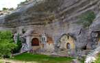
We quickly came across a large recreational area, next to the bridge that allows us to cross the river again to ascend to the nearby hermitage of San Felices and San Roque (0h 15min).

A narrow and steep trail brings us to this singular enclave embedded in the hard rock.
We returned again to the path we left to climb up to the hermitage, determined to continue the route along the cozy recreational area.

If it weren't for the solitary signs that warn us of our entry into the Valderejo Natural Park, we wouldn't be aware of stepping on Alava's land from this moment on.

Once again a demanding ramp makes us gain height quickly while the river is becoming lower and lower. A well-defined path is now our companion, which on more than one occasion we can leave for an instant to approach improvised viewpoints from which to contemplate the landscape that surrounds us.

We continue to gain height with the impression that we are heading towards the top of some of the mountains that surround us instead of entering the narrow gorge.

Even more so when our trail turns abruptly making us abandon the line that the river leads below.

But nothing further from reality, at the moment we find the bifurcation (0h 25min) of the path, where we will take up again the lost orientation.
The path that we leave behind is the one that climbs from this slope of the mountain to the mount of Santa Ana and it will be for the one that will return those that decide to ascend this mountain once crossed the gorge.

Our route continues with the ascent, now through a somewhat steeper terrain that still allows us to contemplate the deep gorge through which runs the Purón River.

The path, which is wide enough in the most exposed areas, is soon surrounded again by vegetation that partly hides the landscape. This zone of the route does not make us predict what awaits us, a little further ahead.

Almost without realizing it, we find ourselves nestled between the vertical rocky walls that mark our entrance, in the narrowest stretch of our route, by the gorge of the Purón River.

Once again we see ourselves walking along the river that runs a few meters below us. This part of the route, wide enough so as not to cause any problem, allows us to enjoy the environment with tranquillity.

There are several corners that we will find along the route in which the river will be back to our right.

There will be several small detours that will allow us to approach, with the necessary prudence, even more to the river, one of them is a few meters away from crossing it.

The route continues to make us gain height from time to time, while we follow the sometimes battered path. The river loses some of its protagonism, hidden as it is by the vegetation that populates this area.

The unevenness and the state of the land, especially if it has rained, have forced to install the typical wooden steps that facilitate our passage through this section of the route.

After a while the slope softens, here we will also find a steep detour conditioned with high steps that allows us to descend the cliff in search of the river bank, although the final stretch is not in very good condition.

We continue our way that takes us to cross another narrow area of the gorge, we see ourselves crossing a beautiful stretch that reminds us of other routes through famous gorges.

A wooden door, which we must cross, bids us farewell to this beautiful section of the route.

Quickly we will see ourselves crossing a leafy forest that takes us away from the gorge. There are several trails that we are going to find in this part of the route.

The marks of the GR that accompany us will be useful to us to be able to follow the correct way.

The well-defined trail takes us in search of the limits of the forest, maintaining the course marked by the hidden river that brought us here.

After a while the vegetation gives way and we see ourselves in front of another gate that gives way to a green meadow.

From here and with our sights set on our next destination we cross the meadow following the blurred path that runs through it. The battered church to which we are heading is already visible in front of us.

But first we have to find another recreation area that we reached after crossing another wooden gate. Now all we have to do is follow the path that starts from this recreation area.

For the moment we leave on our right the path that leads to Lalastra, another of the starting points of the hiking routes that run through this place, to ascend in search of the church.

A few meters away a sign indicates the beginning of the short trail that will take us to the church of Ribera (1h 05min).
Once we have enjoyed the views that both the church and its enclave offer, we will descend following our steps up to the crossroads with the Lalastra path that we left behind.

Once there we will have to decide if we will return by the same place we arrived, that is to say through the gorge or we will venture to crown the summit of the Santa Ana.

If so, we'll follow the road to Lalastra for a moment. As soon as we cross the river we will say goodbye to it to set our course towards the unmistakable summit we are going to visit.

There are several trails that cross these lands and at the moment we leave behind another of those that lead to Lalastra. The track we go along allows us to contemplate calmly the mountain towards which we are heading.

To our right we see a green meadow through which a blurred path seems to ascend after crossing a stream that runs in search of the Purón River.

We advance a few more meters to the encounter of the detour that we must follow. A small wooden bridge allows us to cross the stream without problems.

As soon as we cross the bridge, the route goes towards the blurred path we had previously observed.

From now on we will have to be very attentive to the yellow marks that indicate the route, since in this area of the route is not as defined as before.

As only reference we will have the descending course of the stream and the yellow circles almost hidden by the vegetation.

We soon reached the road we had previously observed from the track we left Ribera.

The route follows a tangled trail, which runs parallel to the presumed path. In fact it is possible to choose which of the two we want to follow since both ascends almost united separating the two meadows that we have to both sides of us.

A high tension line marks the moment when it is now better to follow the trail, darker and without so much vegetation.

The trail takes us back to the meadow, which we must now cross to continue bordering it on its other side.

The route for the moment runs along the line that marks the separation between the meadow and the pine forest that we are bordering.

We must remain vigilant and calmly look for yellow markings indicating the route.

Our trail, as one might expect, is introduced into the forest where, fortunately, its definition improves, allowing us to follow it more easily.

We continue to gain height while still giving the impression that we are moving away from our goal.

After a zigzagging of the trail, it takes us to a path by which we will advance a few meters to our left.

We quickly came across the continuation of the trail that enters the forest, making us abandon the relative comfort of the path.

Once again we see ourselves walking along a pleasant trail protected from the sun by the trees that surround us.

Our trail leads us to a small clearing preceded by a gate that allows us to cross the fence that separates us from it.
.jpg "We stay on course until we reach the route posts.")
Once again we see ourselves sensing the course of the route as we cross this area. In front of us we have a crossroads and to our right the detour towards Santa Ana (1h 50min).
We leave this crossing to which we will return after the ascent and we undertake the march towards the summit of this mountain.

Soon we realize the type of layout that awaits us, a mountain trail that struggles to make its way through the thick vegetation.

A few metres further up, our trail leads to a wrecked path that ascends in search of the turrets of the power line that crosses this mountain.

We ascend through it but it soon turns back into a trail that cuts through the mountainside. When the path reaches the height of one of these towers, it turns abruptly, heading towards another of these towers.

With the power line over our heads we continue to gain height approaching with each step to the metallic tower.

When we reach your height, on our right, we will see the continuation of the trail that now if you undertake the steep ascent that will take us to the top.

This part of the route, quite decomposed and cobbled to which the exuberant vegetation is also added, does not allow us to advance easily.

We will be forced to save some abrupt stretch, although without complications for someone accustomed to this type of land.

Section like the one that precedes the summit, in which we will surpass the rocky zone that gives him access.

Once at the summit of Santa Ana (2h 10min) we will see our effort rewarded with the magnificent panoramic views offered by this beautiful mountain.
Once the breath has recovered, we will start the descent with due caution, following the same route we used to climb.

It is important not to skip the few junctions or detours that we are going to find, to arrive without problems until the field where we take the detour towards Santa Ana (2h 25min).

Once there, we will continue descending by our right, or of front if we take as reference our arrival from Ribera.

A long descent awaits us in front to reach the gorge of the Purón River. The path to follow, clearly marked, does not leave much room for doubt in the few junctions we have to find.

As could not be otherwise our trail begins the cumbersome zigzagging that leads us to lose altitude with a certain calm.

The rather cobbled terrain reminds us with each step that the descent also has its demands.

Little by little and after several meanders along the slope of the mountain, we come closer to the junction with the path that led us to the inside of the gorge.

The Bifurcation (2h 45min) that joins us with the gorge route also marks the end of the descent from Santa Ana, although we still have a good stretch of descent to the hermitage of San Roque and San Felices (2h55min) following, of course, a route already known.

Once in the hermitage we only have to travel the distance that separates us from Herrán (3h 10min) where this route ends.
 Distance. 10.4Km
If we have to park our vehicle in Herrán, we will have to add the additional distance involved.
 Time. 3:10h
Assuming the stretch of ascent to Mount Santa Ana means approximately 1h more compared to returning through the gorge. The possible detours approaching the river bank are not counted.
 Time of year
The water is one of the protagonists of much of the route, so for good and for bad totally conditions this route making it even unadvisable depending on what days. The birds also have their importance, when crossing this natural space that is their habitual habitat, being the months of spring and summer the period of breeding of the great majority of them.
 Required equipment
Under normal conditions, a pair of hiking shoes would be enough if we only went through the gorge, while if we go up to Santa Ana the boots are more advisable. For the rest, we have to take some food and of course water, to which we have to add as always the protection against the sun and the suitable clothes for each time of the year, it has to be part of our habitual equipment. Consult our list of material and equipment for hiking. Read more.
 Difficulty. Moderate
Physical
Of course, the greatest difficulty of this route is marked by the ascent to Santa Ana, which if not carried out would greatly reduce the degree of demand we face. The heat can also contribute, considerably hardening the day, as this area withstands high temperatures in summer. The absence of fountains along the route forces us to be predictive to avoid unnecessary bad times.
Severity of the environment
Possible landslides, the flow and force of the river, areas exposed to vertical falls, cobbled sections and small climbs are factors that are present and to which we are exposed in one or another section of the route, but with sufficient prudence and common sense, except for situations that do not depend on us, should not pose any problem. Of course with rain, snow or ice everything becomes much more complicated and even unadvisable, depending on what situations.
Orientation
The large number of trails that cross this area can generate more than one doubt, getting to confuse us with some brands and others. Our path is defined by clearer yellow marks on the way up to Santa Ana, which on the other hand is where the most difficult route is to follow since the vegetation almost completely covers the path, making it disappear in some sections. When we arrive at the hermitage of San Roque and San Felices we should not be confused by the green and white marks of the PR, since it leaves the company of the river, while we continue next to it.
 |
 |
 |
 |
 |
| 1-Herrán | 0:00h | 582m | 0Km | 30T 481423 4741281 |
| 2-Hermitage of San Roque and San Felices | 0:15h | 640m | 1.1Km | 30T 481316 4741990 |
| 3-Bifurcation | 0:25h | 653m | 1.6Km | 30T 481240 4742395 |
| 4-Ribera | 1:05h | 774m | 3.9Km | 30T 481210 4744287 |
| 5-Detour to Santa Ana | 1:50h | 907m | 6.3Km | 30T 481799 4742888 |
| 6-Santa Ana | 2:10h | 1039m | 6.9Km | 30T 481488 4743071 |
| 7-Detour to Santa Ana | 2:25h | 907m | 7.5Km | 30T 481799 4742888 |
| 8-Bifurcation | 2:45h | 653m | 8.8Km | 30T 481240 4742395 |
| 9-Hermitage of San Roque and San Felices | 2:55h | 640m | 9.3Km | 30T 481316 4741990 |
| 10-Herrán | 3:10h | 582m | 10.4Km | 30T 481423 4741281 |
Coordinates UTM Datúm WGS84

 Slope: 1330m
 Slope +: 665m
 Slope -: 665m
 Maximum altitude: 1039m
 Minimum altitude: 582m

This sketch of the route is not made to scale nor does it contain all the information relating to the area, it is merely indicative.

![]()
This schematic with the path is approximate and has been created from the derived cartographic base © Instituto Geográfico Nacional "Cuadrante 0136-2 y 0110-4, 1:25.000"
Senditur has manipulated the tracks to correct the aberrant points that may exist, caused by problems with the reception of the GPS signal. In any case the tracks are always approximate. SENDITUR encourages you to use the new technologies within your reach, using them as support and consultation in your activity, not basing the realization and orientation of the same only and exclusively on them, since they may see their functioning altered by very diverse causes, not functioning correctly and their indications may not be precise.


Valle de Valderejo, único y espectacular. http://sendaraba.blogspot.com.es/2016/09/paseos-en-la-naturaleza-senda-del-rio.html Una nueva experincia para los sentidos.


La ruta del desfiladero es chulísima, pero el día que estuvimos nosotros hacia mucho calor.

Muy bonito el desfiladero, también merece la pena subir al Santa Ana por las vistas que se tienen, aunque sea algo dura la ruta si lo hacemos.


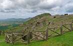
According to historians, Alava's best-preserved fortified complex


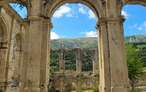
An emblematic place where devotion and tradition come together
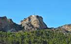
The largest karstic complex in caves on the Peninsula Ibérica

¿Did you know that...
Ribera at the beginning of the 20th century had approximately 31 houses and a little more than 93 inhabitants, which made it one of the most important villages in the area. Since then it began a slow depopulation giving as a result its total abandonment there by the end of the 60s.
Don't miss out...
The visit to Herrán, the locality well deserves to dedicate to him a pleasant stroll by his streets discovering his stately and taken care of houses or approaching us until his erect church from which it is possible to be seen an ample panoramic of the town and his surroundings.


From the commitment of SENDITUR with Nature and the respect to the balance of the environment, SENDITUR urges you to travel in a responsible way, with low environmental impact and respecting at all times the Natural, Cultural and Social environment wherever you go.

Besides sharing with all of us your experience on the route we would be grateful if you could write to us to inform us of any erroneous or outdated information you may have found, or simply to let us know what you think at Thank you.
This route has been carried out in the field by SENDITUR on 29-7-2018. The route may vary greatly depending on the time of year, weather conditions and terrain, as well as the actions of third parties and the evolution suffered in the natural environment where it is located. All opinions, advice and/or assessments made by SENDITUR in their descriptions are for guidance only and are subject to and/or refer to the specific conditions of the specific day of the route, referring to that specific day, taken from trained people, with the appropriate experience and with a high level of physical and technical preparation as a reference, as well as correctly equipped.
All the times are approximate and take an orientative character, the stops have not been taken into account, no matter how small they are. All the information related to the route, texts, images, videos, maps, diagrams, tracks, towns, and places of tourist interest are published as a guide, and may not coincide with the current state of each place. Before undertaking any activity, assess your technical knowledge, your physical condition, find out about the weather and the variations that the route may undergo, equip yourself correctly, be prudent and responsible at all times, and do not exceed your capabilities. SENDITUR is not responsible for any misuse or inappropriate use of the comprehensive guides of its routes and/or publications as well as its electronic guides, nor for any variations in their descriptions for the aforementioned reasons, and recommends that everyone be responsible and prudent in carrying out the activity. We also encourage you to read books and specialised guides to complement the information described above.
Continue watching …


.jpg "Go to Natural Monument of Ojo Guareña")