Welcome to SENDITUR.COM · paths · routes · tourism
Linear Park of the Nervión
Laudio-Llodio, Álava - Araba![]()
![]()
![]()
![]()
![]() (0)
(0)
An ideal walk for both walking and cycling
![]() Difficulty-Medium
Difficulty-Medium
![]() 2:45 h.
2:45 h.
![]() 10.6 km.
10.6 km.
Laudio-Llodio, Álava - Araba![]()
![]()
![]()
![]()
![]() (0)
(0)
An ideal walk for both walking and cycling
![]() Difficulty-Medium
Difficulty-Medium
![]() 2:45 h.
2:45 h.
![]() 10.6 km.
10.6 km.
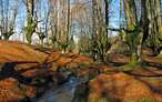
Nestled among green mountains is the Ayala Valley, a historical territory dotted with beautiful villages and impressive natural sites. One of the undisputed protagonists of this valley is the river Nervión which, in its tranquil course towards the Bay of Biscay, gives us valuable natural surroundings such as the well-known Jump of the Nervión.

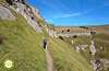
The route of the Linear Park of the Nervión along its 10.6 km joins the towns of Amurrio, Luiaondo and Llodio allowing us to discover the hidden corners that the river draws in its path, without doubt a whole cultural and natural heritage of this land. Starting from the parish of Santa Cruz de Gardea, where we connect with the walk that comes here from Llodio, joining and extending definitively this green route, we begin to go up the course of the Nervión. The route allows us to advance with the necessary calm as to, with luck, discover the kingfisher or the dipper, while we enjoy the freshness provided by the exuberant vegetation that characterizes this area of the Basque Country. The Nervión has been and still is part of the history and life of the people who lived here, proof of which is the Otazu medieval bridge, the old gateway to the town of Luiaondo.

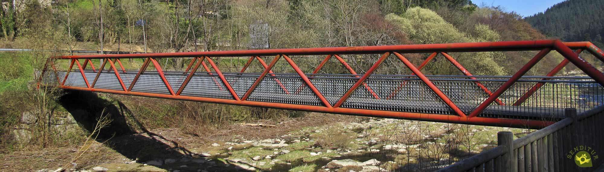
But our tour shows us more details of the history of this land as we go along, an old mill now in disuse or the bridge of Zubiaurre are some of the charming corners we have to visit. But if there is something that characterises this bike path, the numerous footbridges that we will cross as we go along it, footbridges that allow us to jump from one side of the Nervión to the other so that we do not miss a single detail of its passage through this area of Alava. The Salbio halt was the old point and end of the Linear Park of the Nervión. Fortunately, today we can continue our journey to the very heart of Amurrio, where we will have a couple of points of our choice to end this green route.

Along the route we will have several stops and train stations that will allow us to organize the tour to our liking. For example, we can return to the starting point by taking one of the many suburban trains that connect the towns of Amurrio, Luiaondo and Llodio, thus avoiding adding another 10 km to the total distance of the route.
To reach both Llodio and Amurrio we can do it from Bilbao either following the AP-68 or through the BI-625 road, these same roads but in its Alava side reach these two towns from Vitoria. There are also roads that connect Amurrio with the neighbouring towns of Arceniega and Orduña. Of course we also have a local service with several stops in both towns. Once there, next to the parish of Gardea, we will find a parking area where we can park our vehicle, and in both Amurrio and Llodio we will also have parking areas available.
Practically the entire route, except for a short stretch, is on cement and asphalt which can hurt our friend's pads given the distance to be covered.
It's not a bad idea to bring him some food and water, just in case. Pay attention to the sections where the traffic is more present than desirable.
It is not unusual to find more pets walking or living there, which forces us to be vigilant to avoid problems. Also the cattle, especially in the area of Amurrio, will be present although those usually graze in the farms.
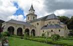
The Parish Church of Santa Cruz (0h 00min), in the district of Gardea in Llodio, is the starting point of this green route through the Ayala Valley.

To begin the route we will only have to cross the bridge that crosses the bed of the Nervion River.

Once on the other side we will be joined by the walk that comes from the nearby Llodio and together we will begin to ascend the Nervion.

This first part of the route follows the course of a rather quiet road that gives access to the farmhouses in the area.

After a while we'll run into the first of the catwalks we're going to meet. In this case this footbridge takes us back to the opposite bank of the river to continue our journey along the access road to Llodio.

This is perhaps the least attractive section of the entire greenway we are following, being so close to the busy road.

Luckily, soon our route begins to put barriers between the road and us, isolating us in part from it. After a while, we will see ourselves again saving the Nervion riverbed thanks to another footbridge that crosses it.

This section takes us directly to the encounter with another asphalted track that we must follow. We leave on our right the bridge that connects our track with the nearby road to continue up the river.

Almost immediately, we reached the point where we said goodbye to this quiet track, to resume the course of the green route.

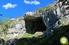
The historic Otazu Bridge invites us to stop and enjoy the beautiful surroundings.

After that we continue the route keeping the Nervion riverbed on our right, at least for the time being.

Little by little, the next town we visit on our route becomes visible, almost at the same time as we cross the river again.

An old mill welcomes us to Luiaondo (1h 10min), although we will hardly step on it.

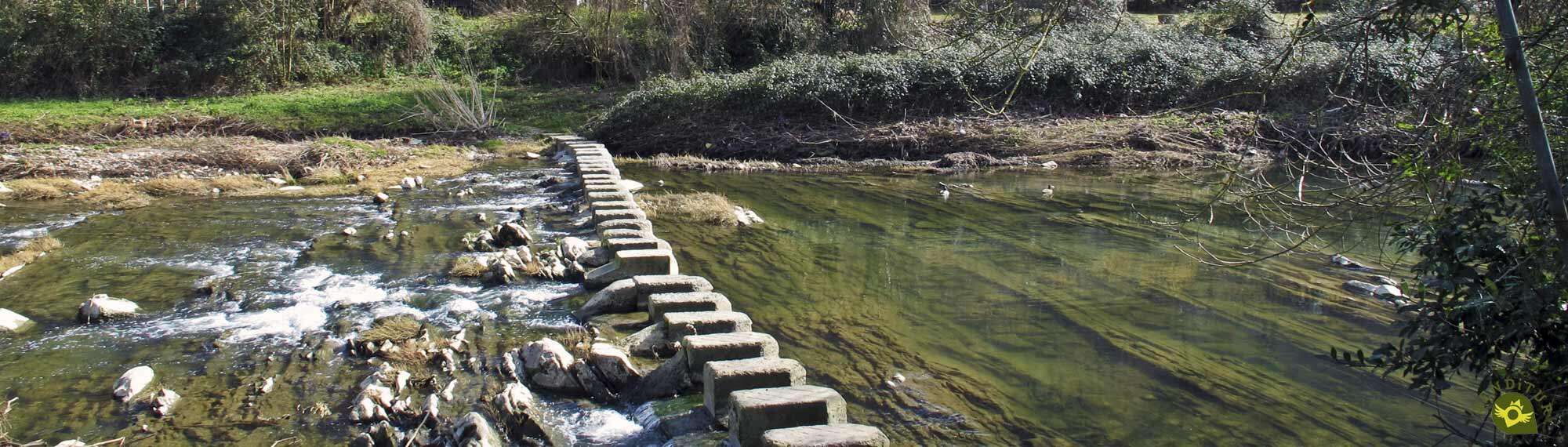
The fact is that the green route of the Linear Park of the Nervión, as could not be otherwise, is hardly separated from the riverbed.

Riverbed that we will soon wade through again, thanks to an old bridge. On the other side, a new road awaits us, which will be in charge of guiding us through this part of the route.

This road leads to Luiaondo train station, which we avoid by skirting it.

A detour that takes us to the other access road that this station has and that will serve us to leave it little by little behind.

This cumbersome stretch reaches its end after leaving on our right another of the bridges that gives access to the town of Luiaondo, from which we also say goodbye for good.

Again we will see ourselves following the conditioned path that runs between the river and the train tracks.

A long stretch of footbridges allows us to cross the mouth of the Izoria River into the Nervion.

After doing so, we will be tempted to take the short detour that will take us to a lonely lookout point.

Our route follows its course without being separated from the quiet flow of the river, even if it has to cross the train tracks to do so.

A river, the Nervion, which we will once again wade through to follow our route on the opposite bank. Although, as it could not be otherwise, we will soon cross it again to go in search of the Salbio stop (2h 00min).

It is in this stop that, not long ago, this route of the Linear Park of the Nervión ended. While now it continues its course towards the ever closer Amurrio.

This enlargement hardly alters the landscape that had accompanied us until now. Once again we will have to face a series of asphalted tracks and crossroads that we will leave behind.

For a moment we'll go back to the train tracks. Although we will quickly move away wrapped by the green landscape around us.

The marks of the itinerary leave no room for doubt at the various crossroads we come across, marks that lead us to another new footbridge that we could already appreciate in the distance.

This area of the route, although it follows the course of the Nervión River, allows us to contemplate a different landscape compared to the one that had accompanied us until now.

The closeness of Amurrio is becoming apparent, as we are forced to save an industrial area.

Whose access we will leave aside to continue the march towards Amurrio.

Luckily we found a conditioned path again, which gives us back the peace of mind we were used to.

The end of the route is near and Amurrio can already be seen clearly. Without hardly noticing it we arrive at the crossroads where we must decide which will be the end of our route.

On the right, just 300 m away, the Iparralde station awaits us, one of the final points of the route.

If this is not our destination, we will only have to continue straight ahead and in just 500 m reach almost the same centre of Amurrio (2h 45min), where we will also put an end to this green route of the Linear Park of the Nervión.
 Distance. 10.6Km
This figure will vary depending on where we start and end our route.
 Time. 2:45h
This figure, as in the section on distance, only takes into account the outward journey. If our point of departure or arrival is the town of Llodio we will have to add 2 km more to the route, that is about 30 minutes more.
 Time of year
There is no doubt that the flow of the River Nervión, together with the state of the vegetation surrounding the route, has a significant influence on its attractiveness, but given its characteristics, this is a perfect route to do all year round, except for a few days.
 Required equipment
Although at various points along the route we will find fountains, it is not a bad idea to bring some water, especially on warm days. The condition of the route allows us to have margin at the time of choosing the footwear that we will take, is not a bad idea to help us of some walking sticks, mainly if we have thought to return walking to the departure point. Consult our list of material and equipment for hiking. Read more.
 Difficulty. Medium
Physical
In this route it is the distance that contributes almost the totality of its degree of difficulty, even more if we decide to return on our steps, in which case we would already be talking about a demanding route, and not because of the slope that we will have to overcome.
Severity of the environment
Under normal conditions, and of course by applying common sense at all times, on this route we should only be concerned about the traffic on the sections where we coincide with it, and not only when we walk on one of the roads, but also in the area where it runs alongside us. It is true that some bollards provide us with some security, but even so it is advisable not to get distracted.
Orientation
Perfectly marked and delimited by the conditioned path that forms it, it is the multiple possibilities of beginning or end of the route that offer us the most headaches.
 |
 |
 |
 |
 |
| 1-Parish of Santa Cruz de Gardea | 0:00h | 133m | 0Km | 30T 501805 4775065 |
| 2-Luiaondo | 1:10h | 166m | 4.2Km | 30T 500276 4771728 |
| 3-Salbio Train Station | 2:00h | 187m | 7.5Km | 30T 500050 4769023 |
| 4-Iparralde Train Station | 2:35h | 205m | 10.1Km | 30T 500456 4767119 |
| 5-Amurrio | 2:45h | 210m | 10.6Km | 30T 500155 4766813 |
Coordinates UTM Datum WGS84

 Slope: 142m
 Slope +: 67m
 Slope -: 45m
 Maximum altitude: 210m
 Minimum altitude: 133m

This sketch of the route is not made to scale nor does it contain all the information relating to the area, it is merely indicative.

![]()
This schematic with the path is approximate and has been created from the derived cartographic base © Instituto Geográfico Nacional "Cuadrante 086-2 y 086-4, 25.000"
Senditur has manipulated the tracks to correct the aberrant points that may exist, caused by problems with the reception of the GPS signal. In any case the tracks are always approximate. SENDITUR encourages you to use the new technologies within your reach, using them as support and consultation in your activity, not basing the realization and orientation of the same only and exclusively on them, since they may see their functioning altered by very diverse causes, not functioning correctly and their indications may not be precise.


¿Did you know that...
In the town of Luiaondo there is a stone cross that marks the place where the so-called Malato Tree used to stand, a tree that appears on the coat of arms of Bizkaia. Legend has it that the squires and knights accompanied the Lord of Biscay, without being paid anything.
Don't miss out...
The visit to the different towns through which the route passes, Amurrio, Luiaondo and Llodio, each one of them contributes with its monuments and history an added value to this green itinerary of the Linear Park of the Nervión.


From the commitment of SENDITUR with Nature and the respect to the balance of the environment, SENDITUR urges you to travel in a responsible way, with low environmental impact and respecting at all times the Natural, Cultural and Social environment wherever you go.

Besides sharing with all of us your experience on the route we would be grateful if you could write to us to inform us of any erroneous or outdated information you may have found, or simply to let us know what you think at Thank you.
This route has been carried out in the field by SENDITUR on 23-02-2019. The route may vary greatly depending on the time of year, weather conditions and terrain, as well as the actions of third parties and the evolution suffered in the natural environment where it is located. All opinions, advice and/or assessments made by SENDITUR in their descriptions are for guidance only and are subject to and/or refer to the specific conditions of the specific day of the route, referring to that specific day, taken from trained people, with the appropriate experience and with a high level of physical and technical preparation as a reference, as well as correctly equipped.
All the times are approximate and take an orientative character, the stops have not been taken into account, no matter how small they are. All the information related to the route, texts, images, videos, maps, diagrams, tracks, towns, and places of tourist interest are published as a guide, and may not coincide with the current state of each place. Before undertaking any activity, assess your technical knowledge, your physical condition, find out about the weather and the variations that the route may undergo, equip yourself correctly, be prudent and responsible at all times, and do not exceed your capabilities. SENDITUR is not responsible for any misuse or inappropriate use of the comprehensive guides of its routes and/or publications as well as its electronic guides, nor for any variations in their descriptions for the aforementioned reasons, and recommends that everyone be responsible and prudent in carrying out the activity. We also encourage you to read books and specialised guides to complement the information described above.
Continue watching …


.jpg "Go to Sanctuary of Our Lady of the Holm oak")
.jpg "Go to Tower-Palace of the Varona family")