Welcome to SENDITUR.COM · paths · routes · tourism
![]() Difficulty-Moderate
Difficulty-Moderate
![]() 3:35 h.
3:35 h.
![]() 13.8 km.
13.8 km.
![]() Difficulty-Moderate
Difficulty-Moderate
![]() 3:35 h.
3:35 h.
![]() 13.8 km.
13.8 km.
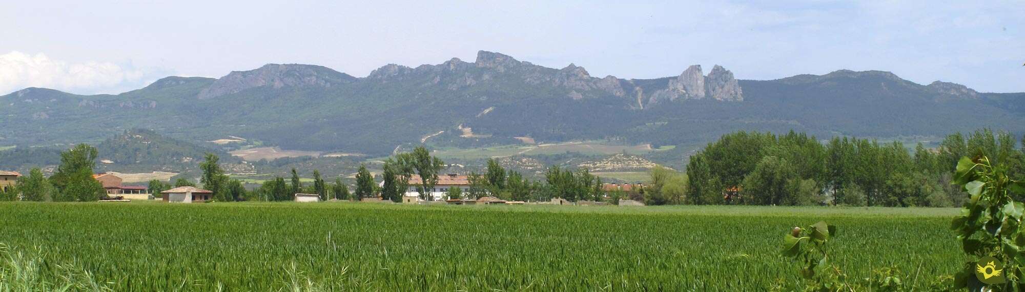
The landscapes of La Rioja Alta mix steep mountains with quiet valleys through which flow emblematic rivers that lend part of their character to these lands. It is in the wide valley, at the foot of the Obarenes Mounts, following the course of two of these rivers, that the Green Route of the Oja Tirón runs. A hiking route in La Rioja that serves not only to link the old Bobadilla train station in Haro with its historic layout in Casalarreina, also gives us the opportunity to know and discover some of the natural and cultural values that treasures this region of La Rioja.

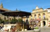
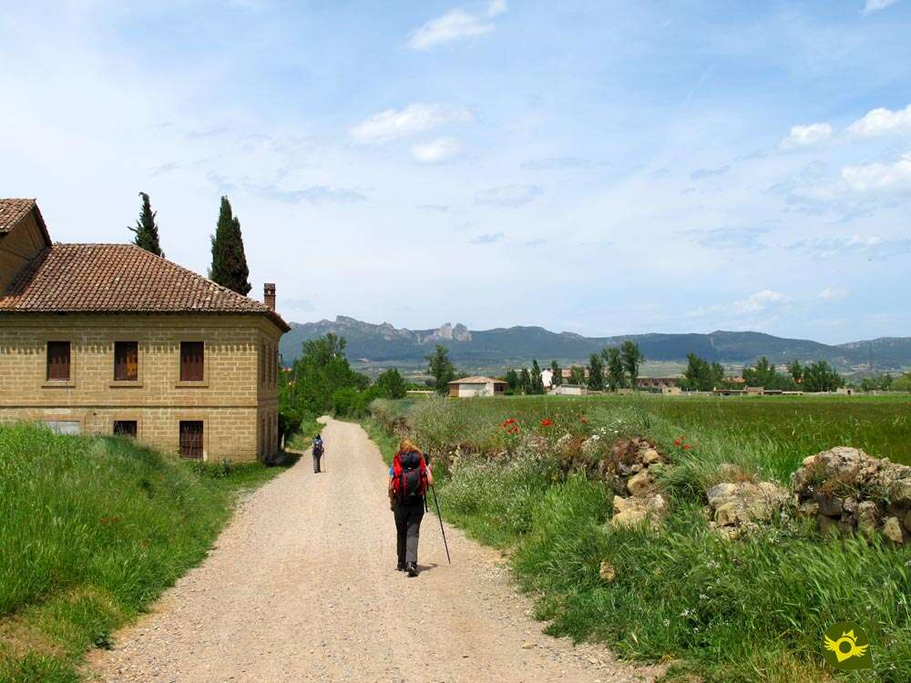
The 13.8 km route starts from Haro, famous for its noble wines and its luminous history, where we will leave behind, not before visiting them, its Torreón Museum, its emblematic squares and palaces, and after the almost obligatory stop at the Virgen de la Vega and its gardens begin the tour next to the Haro Oenological Station building, entering the Vista Alegre Park. This park, flanked by the old railway line, is the official starting point of the route in which we are given the opportunity to take two short routes that join again in just one in just two kilometres. The first one gets us fully into the wide tracks along which a large part of the route passes. The second takes us to the banks of the River Tirón to follow the path that leads to El Viano, a conditioned recreation area very frequented by the inhabitants of the area. The next point that attracts our attention is the Arrauri Dam. The dam as it is known in Haro, inaugurated in June 1915, is especially linked to the history of the locality.

From here a pleasant walk awaits us between fields and poplars to the village of Anguciana, where the route takes us to know the church of San Martín of the sixteenth century, before crossing the river to pass by the imposing Fortress Tower of the Salcedo, Gothic style. After crossing the river Tirón we will continue going up its course towards the next town that will take us to visit this Green Route of the Oja Tirón. Cihuri, or more specifically the old building of its Priory dependent on the Monastery of San Millán, awaits us just before crossing the river Tirón again by the ancient Roman bridge known by the nickname of the Priory Bridge, belonging to it until the disentailment of Mendizábal. Here we have the opportunity to take a small detour that will take us to the Viewpoint of Junta los Ríos, where the Oja flows into the Tirón. After the short detour we take again our route and we continue going up again the course of the Tirón while we border the locality of Cihuri. Section that serves us to say goodbye with calm of the one that was our companion of trip since shortly after passing next to an old mill we will leave the company of the river to march in search of the bank of the Oja.

Behind them are the orchards that surround Cihuri and soon we see ourselves again crossing the margin of the river, this time the one of the Oja. This will be our new travelling companion who will accompany us to Casalarreina, which we will reach after crossing under its unmistakable bridge. In this locality, the final point of the route, emblematic places such as the Dominican Convent of La Piedad or the Palace of the Condestables await us. It is also the starting point of the Greenway of the Oja with which our Green Route of the Oja Tirón connects in two possible ways, either crossing the river and crossing the main street of the locality until arriving at the road of Zarratón, where we will find the starting point of the greenway, or following the conditioned andadero that continues initially going up again the course of the river Oja, for shortly after leaving Casalarreina, to lead us to the encounter of the itinerary of the greenway that runs considerably separated from the river that gives it its name.
La Rioja has a good interurban bus service which, in this case, gives us the opportunity to cover each section and return to the starting point, those who so decide, without having to face a large number of kilometres on foot.
The AP-68 motorway connects Haro with Bilbao, Burgos, Logroño and Zaragoza, as well as the N-124 road and the proximity of the N-232 that connect it with the nearby towns of Briñas, Briones, linking here with the regional 210 towards San Vicente de la Sonsierra, and San Asensio. The LR-111 that connects with the neighbouring Casalarreina and Santo Domingo de la Calzada and the N-120 that runs parallel to the Camino de Santiago, the LR-203 towards Zarratón, the LR-202 towards Anguciana and Cihuri, the LR-401 to Villalba de Rioja. There are several bus companies that stop in Haro and cover the routes of Bilbao, Vitoria, Logroño, Santander and Burgos. Another option is the train, as Haro has stops on different railway lines. Once here the beginning of the route and zones where to be able to park our vehicle, we will find it next to the building of the oenological station of Haro, to the beginning of the road of Anguciana.
Distance and heat in summer are the biggest pitfalls that our friend will have to face, so it is important that he is already used to this type of tours. Attention to the few crossings that we will have to cross, they have more traffic than it might seem. Be careful to let him enter the rivers without knowing where we let him do it, both hide strong currents that can give us a good scare.
As always we can not forget to carry in your backpack water and food, although we pass through several localities where we have water points in the rest of the route will have no choice.
Beyond the mascots that we will surely find to our step by the localities that crosses this route we should not encounter more dwellers than the native fauna of the zone.
The building of the Haro Oenological Station (0h 00min) is the starting point of this Route Green of the Oja Tirón.

From here we enter the park of Vista Alegre heading towards the footbridge that crosses the road that descends towards the Neighborhood of the Wineries.

Walkway that we will leave behind us while we follow the conditioned promenade that borders the hill of Alto de Santo Domingo.

The wooded area of this promenade almost conceals from our view the old railway line that linked Haro with Ezcaray. We continue this pleasant stretch without deviating for the moment from the straight marked course.

Soon we arrive at the fork (0h 05min) where we will have two possible routes.
We cross the old bridge that crosses the railway trench to start the descent to the bank of the river Tirón.

As soon as we cross, we start the path we are going to follow, which will take us to the fountain La Salud.

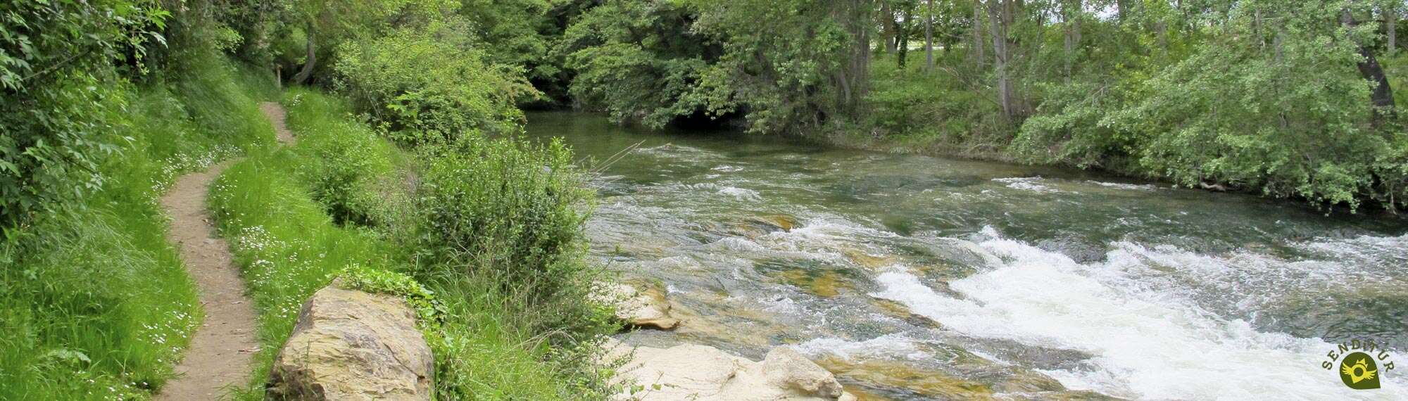
We enter the thick vegetation while we follow the narrow path that leads to the trail that runs by the river.

We go up the whimsical riverbed of the Tirón following the marked footpath that borders it. A footpath that does not pose any great complications, beyond any worn staircase.

The usual passage of people who make this route keeps at bay the vegetation that surrounds this entire stretch of the route.

This riverside footpath alternates quiet areas with others in which it is forced to overcome the unevennesses that the river has been forming.

After an entertaining stretch, we arrive at the El Viano recreational area, which we must cross from side to side following the well marked path that runs through it.

This large area on the river bank is equipped with barbecues, benches and tables that take advantage of the peace and freshness transmitted by the river.

When we reach the end of the area we find the track that goes from the road to it. We will leave this track on our left, a track that if we follow it would quickly join us with the other route that was offered to us in Haro.

Now we see ourselves following a perfect path at the same time that we continue going up the course of the Tirón. Almost without realizing it, we see ourselves at a crossroads next to the motorway bridge, a crossroads where the two routes join again to march together towards Anguciana.

Another alternative to get to this crossroads next to the motorway bridge is to continue along the Vista Alegre park from the fork, leaving the bridge that crosses the old railway track on your right.

This route takes us to the very limits of the park where we will turn off to descend to the tracing of the old railway line. We will follow its course for a few meters approaching until the same road of Anguciana.

Here we will say goodbye to the old route that continues towards El Moro Fountain, to take a well-conditioned dirt track that gradually separates us from the road.

This track goes up a small hill at the same time that makes us leave behind some path. Soon we find an asphalted road that comes from the nearby road and which we must follow.

This asphalted road, which for now serves as a guide, is the access for vehicles to the recreational area of El Viano.

If we follow it in its entirety we would link with the other layout in this place, but we left its comfortable firm to continue on another dirt track that maintains the course that brought us here.

Almost at the moment our track forks and we must follow the option on the right that seems to bring us closer to the bank of the river.

Obliged by the motorway, our track changes direction again, taking us directly to the crossroads next to the motorway bridge, where we join with the other route and where those who have travelled this route in the other direction will come across this fork (0h 30min) in the road.
Already in a single route and after passing under the highway we continue with the direction that marks us the river Tirón.

Quickly we meet again with a new crossing in which without doubt we continue going up again the flow of the water.

The Arrauri Dam invites us to take a little breath at the same time that we enjoy this beautiful place. The thick poplar grove that marks out the track on which we go hides the vision of the nearby river.

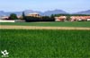
River from which the road seems to take us away at the same time as we walk between fields.

At the moment, a new junction gives us back our lost orientation, the route leads us towards a thick poplar grove, although already definitively separated from the river, or at least for the moment.

In front of us awaits a perfect path that will lead us from poplar to poplar and from field to field. Soon we will begin to observe to our left the district of the wineries of Anguciana.

There are not many paths we come across and the good condition of our track serves as a reference in case of doubt.

Our next goal is with each step closer, and tempts us with alternatives to get to it.

Shortly afterwards, and without any further warning than the houses and old cellars that crowd on the edge of the road that comes from Haro, the first houses of the town come to meet us. Among them is the church of San Martín, which marks the entrance to the town.

We will have to border this church to accede definitively to its square and thus to enter finally in Anguciana (1h 20min).

The route crosses this square heading towards another of the landmarks of this town, the Tower. When we reach its height we will find the road that joins Haro and Anguciana and with some signs of the route that inform us of the possibility of having arrived here following the banks of the river, probably from the last crossing in which we leave behind a solitary bank.

We must cross the bridge that saves the Tirón, until we reach the next crossing that we have to find.

There we leave the company of the road and undertake a monotonous journey through an urbanization. Now our route continues going up the riverbed but this time by its other side.

We finally got out of this urban area, without having to detour at any time.

We follow the straight course of an asphalted track that takes us directly to the very gates of the next town we have to visit.

Once again we can see ourselves going through another urbanization until we almost run into the road, at which point the route turns abruptly and goes in search of the river that we have been following from Haro.

The bridge and the priory welcome us to Cihuri (1h 50min) as we cross the river again.
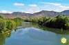
As soon as we cross the bridge, we are given the chance to approach the Viewpoint of Junta los Ríos (1h 55min), a short detour through the winery district to find a narrow footpath that takes us to the mouth of the Oja in the Tirón.

Once we have visited this picturesque place, we will return to the route, returning to travel along the river bank.

An old mill and the bridge that crosses the flow of water that nourishes it, tell us about part of the history that these lands have. Cihuri extends on the other side of the river, a river that we are about to say goodbye to definitively.

Without further notice we will leave the pleasant protection of the riverbank to deviate and move away from it and Cihuri that are finally left behind, as well as a small recreational area to which we can approach if we wish.

This part of the route runs between orchards following the accesses that communicate them. Soon we will come across a new track that comes from the nearby road, a track that we must continue along.

This road heads in search of a new travel companion, the Oja River. We follow the layout of this perfect dirt track without deviating in any case.

Soon we will meet the river and we will begin to travel along its shore, without going into it for the moment.

We move forward between the trees that hide the river and the cereal fields. Once again it seems that we are on our way to cross under a road.

As soon as we cross under it, we will leave on our right the path that follows parallel to the road we have just crossed.

At the moment a new crossroads makes us leave the wide track, to enter under the trees that populate the bank of the river.

In front of us we have a pleasant and sombre walk that will accompany us in this stretch that separates us from Casalarreina.

A hut takes us out of the idyllic walk forcing us to intuit the continuation of our route, which as could not be otherwise remains parallel to the river Oja. The first houses of the town surprise us among the trees just before reaching it.

The bridge that crosses the river cuts our way, here if the pass that is enabled to cross under the bridge is flooded by water, we will have no choice but to go out to the road to cross to the other side.

Once we cross under him or on him we will arrive at a footbridge that will serve us to cross the river and to arrive at Casalarreina (2h 50min), where we can give for finalized the route if this way we wish it.
If our intention is to continue the march, linking with the greenway we have two options.

The first consists of crossing Casalarreina following its main street, the old national road.

This street, once there, will take us without further detours to the crossroads with the road to Zarratón.

We will follow this road for a few metres until we get out of Casalarreina where, next to some pavilions, it crosses the old route of the green way, today an agricultural way.

The other possibility invites us to continue for the moment up the river. This walk takes us past the local sports complex.

In case of doubt the conditioning walkway can serve as a reference to follow.

For the moment the landscape does not vary much compared to the one that accompanied us here.

Without realizing it, we see ourselves walking next to the road, at the same time that we leave Casalarreina.

We follow the marked path that takes us to a junction of roads. When we reach its height, we have to cross a first road, leaving the banks of the Oja river behind us.

As soon as we cross, we will apparently be forced to return to the roundabout we had just passed.

The route takes us to the tunnel that crosses under the road between Haro and Santo Domingo de la Calzada. As soon as we pass through the tunnel, a new roundabout appears in front of us.

The path takes us to a new crossroads where we will have to cross a road again. Already on the other side we find ourselves in front of a new path, if we follow it to our right we would go, parallel to the road, direct and without detours to the greenway.

But the official route forces us to continue on our left, leaving the road also to that hand as if it wanted to make us return to Casalarreina.

This section takes us for the moment next to the road which is above our heads. The path seems to come to an end at the same time as it changes its dirt road for an old asphalted section.

Once again the route turns abruptly to follow another dirt track that makes us leave the road behind us. This dirt road leads us without further detours to the encounter with the Greenway of the Oja.

If we follow this route, when we find the greenway, in comparison with the other option, that joins in this same place, we will have traveled 1 Km more approximately.
 Distance 13.8Km
This figure, although low, will vary depending on the itinerary we choose from the options offered by the route.
 Time. 3:35h
This is the total time that will take us to connect with the greenway, past Casalarreina. This figure can vary considerably depending on where we choose to end the route.
 Time of year
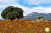
The route runs mostly between fields of cereal along the banks of rivers, this gives a great landscape difference from one season of the year to another. From the yellows in communion with the greens of summer to the explosion of colour in spring, passing through the ochre and reddish tones that characterise this land of wines in autumn.
 Required equipment
Clothes and sports shoes without forgetting to carry in the backpack a raincoat or windbreaker, sun protection, glasses, cap and sunscreen, along with water and some food a priori is all we should need in normal conditions. The walking sticks, although the route does not have great unevennesses, will make it easier for us to better distribute the effort of the kilometres. Consult our list of material and equipment for hiking. Read more.
 Difficulty. Moderate
Physical
The distance is the factor that brings most of the difficulty of this simple route, especially if we have to add the return journey. The heat in summer will undoubtedly harden the route more than it might seem in the first term.
Severity of the environment
The tracks and paths in good condition are the usual tonic in almost all the route, where the Path of the Viano and the short path up to the viewpoint of Junta los Ríos are the sections in which we are going to be most exposed, because of its proximity to the river and its narrowness. Some rivers, the Oja and the Tirón, which hide deep pools and strong currents in their apparently calm flow.
Orientation
The different options of the same route together with the abundant signposting of other hiking routes with which we will coincide can generate some doubts or confusion. There are many crossroads through which we will pass, so we must be aware of the posts or marks that mark them. White and purple markings characteristic of some trails in La Rioja which, together with the typical signposting of the Greenway of the Oja, mark this Green Route of the Oja Tirón.
 |
 |
 |
 |
 |
| 1-Haro | 0:00h | 475m | 0Km | 30T 511870 4713568 |
| 2-Bifurcation | 0:05h | 467m | 0.6Km | 30T 511435 4713623 |
| 3-Bifurcation | 0:30h | 460m | 2.1Km | 30T 510190 4713891 |
| 4-Anguciana | 1:20h | 470m | 4.9Km | 30T 507986 4713657 |
| 5-Cihuri | 1:50h | 485m | 6.9Km | 30T 506617 4712883 |
| 6-Viewpoint Junta los Ríos | 1:55h | 482m | 7.3Km | 30T 506929 4712754 |
| 7-Casalarreina | 2:50h | 495m | 10.9Km | 30T 506997 4710610 |
| 8-Link to the Greenway | 3:35h | 515m | 13.8Km | 30T 507233 4709148 |
Coordinates UTM Datum WGS84

 Slope: 255m
 Slope +: 148m
 Slope -: 107m
 Maximum altitude: 515m
 Minimum altitude: 440m

This sketch of the route is not made to scale nor does it contain all the information relating to the area, it is merely indicative.

![]()
This schematic with the path is approximate and has been created from the derived cartographic base © Instituto Geográfico Nacional "Cuadrante 169-4 y 170-3, 1:25.000"
Senditur has manipulated the tracks to correct the aberrant points that may exist, caused by problems with the reception of the GPS signal. In any case the tracks are always approximate. SENDITUR encourages you to use the new technologies within your reach, using them as support and consultation in your activity, not basing the realization and orientation of the same only and exclusively on them, since they may see their functioning altered by very diverse causes, not functioning correctly and their indications may not be precise.


Una bonita excursión para hacer después de visitar Haro.
An emblematic place where devotion and tradition come together


Romanesque jewel from La Rioja

Avenida Miranda, 1
941312737

¿Did you know that...
From Haro began the railway line that linked this town with Santo Domingo and Ezcaray, a route that today from Casalarreina is known as the Greenway of the Oja and that its stretch between Haro and Casalarreina could not be conditioned, as its itinerary was cut in several places.
Don't miss out...
The rich and important gastronomy of the zone, famous for its wines and for the quality of its products, are many the options that we will have in the localities where the route passes to enjoy it as much as pinchos or artisan products.


From the commitment of SENDITUR with Nature and the respect to the balance of the environment, SENDITUR urges you to travel in a responsible way, with low environmental impact and respecting at all times the Natural, Cultural and Social environment wherever you go.

Besides sharing with all of us your experience on the route we would be grateful if you could write to us to inform us of any erroneous or outdated information you may have found, or simply to let us know what you think at Thank you.
This route has been carried out in the field by SENDITUR on 01-04-2017. The route may vary greatly depending on the time of year, weather conditions and terrain, as well as the actions of third parties and the evolution suffered in the natural environment where it is located. All opinions, advice and/or assessments made by SENDITUR in their descriptions are for guidance only and are subject to and/or refer to the specific conditions of the specific day of the route, referring to that specific day, taken from trained people, with the appropriate experience and with a high level of physical and technical preparation as a reference, as well as correctly equipped.
All the times are approximate and take an orientative character, the stops have not been taken into account, no matter how small they are. All the information related to the route, texts, images, videos, maps, diagrams, tracks, towns, and places of tourist interest are published as a guide, and may not coincide with the current state of each place. Before undertaking any activity, assess your technical knowledge, your physical condition, find out about the weather and the variations that the route may undergo, equip yourself correctly, be prudent and responsible at all times, and do not exceed your capabilities. SENDITUR is not responsible for any misuse or inappropriate use of the comprehensive guides of its routes and/or publications as well as its electronic guides, nor for any variations in their descriptions for the aforementioned reasons, and recommends that everyone be responsible and prudent in carrying out the activity. We also encourage you to read books and specialised guides to complement the information described above.
Continue watching …
 Next: Greenway of the Oja Section 1 Casalarreina-Stº Domingo de la Calzada